Estimated Value: $150,000 - $170,000
--
Bed
--
Bath
1,416
Sq Ft
$113/Sq Ft
Est. Value
About This Home
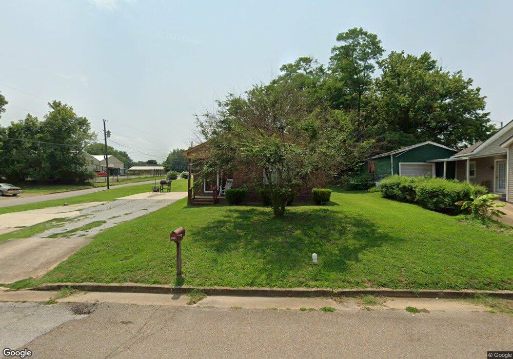
This home is located at 174 N Royal St, Dyer, TN 38330 and is currently estimated at $159,519, approximately $112 per square foot. 174 N Royal St is a home with nearby schools including Dyer Elementary School and Gibson County High School.
Ownership History
Date
Name
Owned For
Owner Type
Purchase Details
Closed on
Sep 25, 2004
Sold by
Simpson Tim
Bought by
Woods Colette
Current Estimated Value
Purchase Details
Closed on
Aug 31, 2004
Sold by
Gibson County Tennessee
Bought by
Simpson Tim
Purchase Details
Closed on
Jan 1, 1982
Purchase Details
Closed on
Jan 4, 1900
Bought by
Jackson Joe Scates Barbara
Purchase Details
Closed on
Jan 3, 1900
Purchase Details
Closed on
Jan 2, 1900
Create a Home Valuation Report for This Property
The Home Valuation Report is an in-depth analysis detailing your home's value as well as a comparison with similar homes in the area
Home Values in the Area
Average Home Value in this Area
Purchase History
| Date | Buyer | Sale Price | Title Company |
|---|---|---|---|
| Woods Colette | $2,500 | -- | |
| Simpson Tim | $800 | -- | |
| -- | $5,300 | -- | |
| Jackson Joe Scates Barbara | -- | -- | |
| -- | -- | -- | |
| -- | -- | -- |
Source: Public Records
Tax History Compared to Growth
Tax History
| Year | Tax Paid | Tax Assessment Tax Assessment Total Assessment is a certain percentage of the fair market value that is determined by local assessors to be the total taxable value of land and additions on the property. | Land | Improvement |
|---|---|---|---|---|
| 2024 | $1,403 | $40,450 | $2,500 | $37,950 |
| 2023 | $740 | $23,800 | $1,050 | $22,750 |
| 2022 | $724 | $23,800 | $1,050 | $22,750 |
| 2021 | $724 | $23,800 | $1,050 | $22,750 |
| 2020 | $1,183 | $23,800 | $1,050 | $22,750 |
| 2019 | $1,183 | $23,800 | $1,050 | $22,750 |
| 2018 | $1,191 | $23,600 | $1,050 | $22,550 |
| 2017 | $1,145 | $23,600 | $1,050 | $22,550 |
| 2016 | $1,145 | $23,600 | $1,050 | $22,550 |
| 2015 | $1,042 | $23,600 | $1,050 | $22,550 |
| 2014 | $1,043 | $23,600 | $1,050 | $22,550 |
Source: Public Records
Map
Nearby Homes
- 0 Royal St
- 208 & 210 Lee St
- 117 Washington St
- 142 S Poplar St
- 205 Division St
- 299 E Walnut St
- 354 E Maple St
- 137 W South St
- 139 Peach St
- 217 Central St
- 288 W Broad St
- 173 Orr Rd
- 246 Thomas St
- 163 Monroe St
- 548 E College St
- 153 New Hope St
- 0 Reed Rd
- 23 Gravettes Crossing Rd W
- 106 Scattered Acres Dr
- 0 Ernest Paschall Rd Unit RRA45339