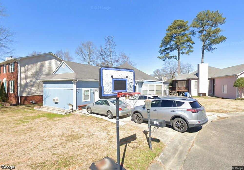
174 S Pointe Dr Birmingham, AL 35209
Estimated Value: $342,000 - $409,000
3
Beds
2
Baths
1,729
Sq Ft
$217/Sq Ft
Est. Value
About This Home
This home is located at 174 S Pointe Dr, Birmingham, AL 35209 and is currently estimated at $375,500, approximately $217 per square foot. 174 S Pointe Dr is a home located in Jefferson County with nearby schools including Hall-Kent Elementary School, Homewood Middle School, and Homewood High School.
Ownership History
Date
Name
Owned For
Owner Type
Purchase Details
Closed on
Mar 6, 2024
Sold by
Ly Trisha
Bought by
Pham Huynh Cong and Pham Ngocthu Thi
Current Estimated Value
Purchase Details
Closed on
Oct 20, 2004
Sold by
Ellis Lee Maxwell
Bought by
Ly Trisha and Pham Ngocthu Thi
Home Financials for this Owner
Home Financials are based on the most recent Mortgage that was taken out on this home.
Original Mortgage
$139,280
Interest Rate
5.73%
Mortgage Type
Purchase Money Mortgage
Create a Home Valuation Report for This Property
The Home Valuation Report is an in-depth analysis detailing your home's value as well as a comparison with similar homes in the area
Home Values in the Area
Average Home Value in this Area
Purchase History
| Date | Buyer | Sale Price | Title Company |
|---|---|---|---|
| Pham Huynh Cong | $121,833 | -- | |
| Ly Trisha | $174,100 | -- |
Source: Public Records
Mortgage History
| Date | Status | Borrower | Loan Amount |
|---|---|---|---|
| Previous Owner | Ly Trisha | $139,280 | |
| Previous Owner | Ly Trisha | $10,000 |
Source: Public Records
Tax History
| Year | Tax Paid | Tax Assessment Tax Assessment Total Assessment is a certain percentage of the fair market value that is determined by local assessors to be the total taxable value of land and additions on the property. | Land | Improvement |
|---|---|---|---|---|
| 2025 | $2,671 | $36,560 | -- | -- |
| 2024 | $2,671 | $36,560 | -- | -- |
| 2022 | $2,479 | $33,990 | $22,080 | $11,910 |
| 2021 | $2,125 | $29,280 | $19,360 | $9,920 |
| 2020 | $1,873 | $25,920 | $16,000 | $9,920 |
| 2019 | $1,873 | $25,920 | $0 | $0 |
| 2018 | $1,605 | $22,340 | $0 | $0 |
| 2017 | $1,790 | $24,820 | $0 | $0 |
| 2016 | $1,605 | $22,340 | $0 | $0 |
| 2015 | $1,468 | $20,520 | $0 | $0 |
| 2014 | $1,359 | $19,720 | $0 | $0 |
| 2013 | $1,359 | $20,540 | $0 | $0 |
Source: Public Records
Map
Nearby Homes
- 100 Edgemont Dr
- 216 Raleigh Ave
- 252 Kent Dr
- 824 Grove St
- 232 Kent Ln
- 1068 Venetian Cir
- 536 Edgeknoll Dr
- 508 Scott St
- 1084 Sherbrooke Dr
- 504 Scott St
- 613 Greenhill Dr
- 408 Woodvale Ln
- 1140 Hardwick Ln
- 1100 Drexel Pkwy
- 1103 Fern St
- 803 Acton Ave
- 328 Redfern St
- 211 Acton Ave
- 8 Eastwood Cir
- 1610 Berry Knoll
- 166 S Pointe Dr
- 182 S Pointe Dr
- 207 S Wood Rd
- 158 S Pointe Dr
- 844 Cobb St
- 190 S Pointe Dr
- 213 S Wood Rd
- 838 Cobb St
- 173 S Pointe Dr
- 189 S Pointe Dr
- 150 S Pointe Dr
- 198 S Pointe Dr
- 805 Southwood Cir
- 219 S Wood Rd
- 197 S Pointe Dr
- 826 Cobb St
- 157 S Pointe Dr
- 801 Southwood Cir
- 220 S Wood Rd
- 225 S Wood Rd
Your Personal Tour Guide
Ask me questions while you tour the home.