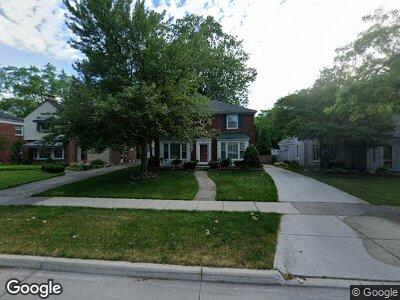
1740 Broadstone Rd Grosse Pointe Woods, MI 48236
Estimated Value: $350,924 - $368,000
3
Beds
2
Baths
1,962
Sq Ft
$185/Sq Ft
Est. Value
About This Home
This home is located at 1740 Broadstone Rd, Grosse Pointe Woods, MI 48236 and is currently estimated at $363,231, approximately $185 per square foot. 1740 Broadstone Rd is a home located in Wayne County with nearby schools including John Monteith Elementary School, Brownell Middle School, and Grosse Pointe North High School.
Ownership History
Date
Name
Owned For
Owner Type
Purchase Details
Closed on
Sep 13, 2006
Sold by
Fannie Mae
Bought by
Ledesma Sedone and Argel Aimee L
Current Estimated Value
Home Financials for this Owner
Home Financials are based on the most recent Mortgage that was taken out on this home.
Original Mortgage
$205,530
Interest Rate
6.58%
Mortgage Type
Unknown
Purchase Details
Closed on
Jul 29, 2005
Sold by
Mortgage Electronic Registration Systems
Bought by
Federal National Mortgage Association
Purchase Details
Closed on
Jul 20, 2005
Sold by
Blachut Timothy J and Beauvais Regina A
Bought by
Mortgage Electronic Registration Systems
Create a Home Valuation Report for This Property
The Home Valuation Report is an in-depth analysis detailing your home's value as well as a comparison with similar homes in the area
Home Values in the Area
Average Home Value in this Area
Purchase History
| Date | Buyer | Sale Price | Title Company |
|---|---|---|---|
| Ledesma Sedone | $221,000 | Greco | |
| Federal National Mortgage Association | -- | None Available | |
| Mortgage Electronic Registration Systems | $258,076 | -- |
Source: Public Records
Mortgage History
| Date | Status | Borrower | Loan Amount |
|---|---|---|---|
| Open | Ledesma Sedone | $177,576 | |
| Closed | Ledesma Sedone | $205,530 |
Source: Public Records
Tax History Compared to Growth
Tax History
| Year | Tax Paid | Tax Assessment Tax Assessment Total Assessment is a certain percentage of the fair market value that is determined by local assessors to be the total taxable value of land and additions on the property. | Land | Improvement |
|---|---|---|---|---|
| 2024 | $3,332 | $163,600 | $0 | $0 |
| 2023 | $3,204 | $151,500 | $0 | $0 |
| 2022 | $5,018 | $135,200 | $0 | $0 |
| 2021 | $4,784 | $128,400 | $0 | $0 |
| 2020 | $4,926 | $135,200 | $0 | $0 |
| 2019 | $2,917 | $119,200 | $0 | $0 |
| 2018 | $2,866 | $107,200 | $0 | $0 |
| 2017 | $3,331 | $103,400 | $0 | $0 |
| 2016 | $4,541 | $101,200 | $0 | $0 |
| 2015 | $7,870 | $89,900 | $0 | $0 |
| 2013 | $7,530 | $79,100 | $0 | $0 |
| 2012 | -- | $73,600 | $19,200 | $54,400 |
Source: Public Records
Map
Nearby Homes
- 1878 Prestwick Rd
- 1855 Prestwick Rd
- 19299 Raymond St
- 1873 Manchester Blvd
- 1898 Manchester Blvd
- 19280 Berden St
- 19218 Eastborne St
- 2071 Stanhope St
- 484 Bournemouth Cir
- 21519 Sloan Dr
- 21327 Prestwick Ave
- 21421 Bournemouth St
- 21306 Brierstone St
- 21719 Moross Rd
- 19950 W Emory Ct
- 21225 Bournemouth St
- 2220 Stanhope St
- 1615 Faircourt St
- 21746 Moross Rd
- 19266 Tyrone St
- 1740 Broadstone Rd
- 1752 Broadstone Rd
- 1728 Broadstone Rd
- 1731 Littlestone Rd
- 1712 Broadstone Rd
- 1760 Broadstone Rd
- 1717 Littlestone Rd
- 1707 Littlestone Rd
- 1747 Littlestone Rd
- 1706 Broadstone Rd
- 1739 Littlestone Rd
- 1699 Littlestone Rd
- 1753 Broadstone Rd
- 1729 Broadstone Rd
- 1737 Broadstone Rd
- 1761 Broadstone Rd
- 1713 Broadstone Rd
- 1780 Broadstone Rd
- 1690 Broadstone Rd
- 1771 Littlestone Rd