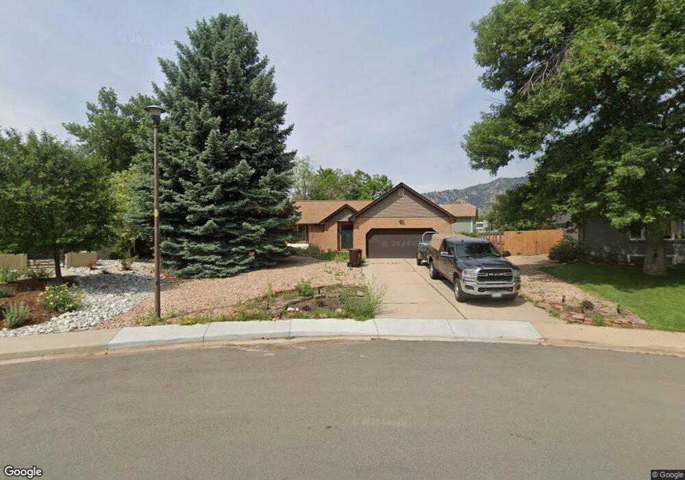
1740 Grape Ave Boulder, CO 80304
Central Boulder NeighborhoodEstimated Value: $1,316,000 - $1,491,000
2
Beds
2
Baths
1,874
Sq Ft
$739/Sq Ft
Est. Value
About This Home
This home is located at 1740 Grape Ave, Boulder, CO 80304 and is currently estimated at $1,384,515, approximately $738 per square foot. 1740 Grape Ave is a home located in Boulder County with nearby schools including Columbine Elementary School, Casey Middle School, and Boulder High School.
Ownership History
Date
Name
Owned For
Owner Type
Purchase Details
Closed on
Nov 4, 1996
Sold by
West Paul H and West Marie L
Bought by
Stewart Frank
Current Estimated Value
Purchase Details
Closed on
May 8, 1991
Bought by
Stewart Frank and Stewart Ann
Purchase Details
Closed on
Nov 24, 1987
Bought by
Stewart Frank and Stewart Ann
Purchase Details
Closed on
Aug 19, 1987
Bought by
Stewart Frank and Stewart Ann
Create a Home Valuation Report for This Property
The Home Valuation Report is an in-depth analysis detailing your home's value as well as a comparison with similar homes in the area
Home Values in the Area
Average Home Value in this Area
Purchase History
| Date | Buyer | Sale Price | Title Company |
|---|---|---|---|
| Stewart Frank | $175,000 | -- | |
| Stewart Frank | $146,400 | -- | |
| Stewart Frank | $134,800 | -- | |
| Stewart Frank | -- | -- |
Source: Public Records
Tax History Compared to Growth
Tax History
| Year | Tax Paid | Tax Assessment Tax Assessment Total Assessment is a certain percentage of the fair market value that is determined by local assessors to be the total taxable value of land and additions on the property. | Land | Improvement |
|---|---|---|---|---|
| 2025 | $8,219 | $87,594 | $68,556 | $19,038 |
| 2024 | $8,219 | $87,594 | $68,556 | $19,038 |
| 2023 | $8,074 | $92,621 | $71,489 | $24,817 |
| 2022 | $7,952 | $84,818 | $54,231 | $30,587 |
| 2021 | $7,511 | $87,258 | $55,791 | $31,467 |
| 2020 | $5,811 | $66,760 | $53,411 | $13,349 |
| 2019 | $5,722 | $66,760 | $53,411 | $13,349 |
| 2018 | $4,885 | $56,347 | $43,488 | $12,859 |
| 2017 | $4,732 | $62,295 | $48,078 | $14,217 |
| 2016 | $4,723 | $54,558 | $35,661 | $18,897 |
| 2015 | $4,472 | $45,213 | $22,925 | $22,288 |
| 2014 | $3,802 | $45,213 | $22,925 | $22,288 |
Source: Public Records
Map
Nearby Homes
- 1930 Grape Ave
- 1707 Grape Ave
- 1717 Iris Ave
- 2006 Joslyn Place
- 3010 14th St
- 3505 19th St
- 1525 Jennine Place
- 2935 19th St
- 2941 21st St
- 3360 Broadway St
- 3315 Broadway St
- 3319 Broadway
- 1400 Kalmia Ave
- 1237 Elder Ave Unit 1
- 3600 Cloverleaf Dr
- 2165 Kincaid Place
- 1172 Juniper Ave
- 2870 18th St
- 1023 Forest Ave
- 3055 23rd St
- 1760 Grape Ave
- 1720 Grape Ave
- 1720 Hawthorn Ave
- 1705 Garland Ln
- 1734 Hawthorn Ave
- 1780 Grape Ave
- 1715 Garland Ln
- 1725 Garland Ln
- 1744 Hawthorn Ave
- 1777 Grape Ave
- 1735 Garland Ln
- 1855 Garland Ln
- 1755 Garland Ln
- 1803 Grape Ave
- 1712 Garland Ln
- 1702 Garland Ln
- 1722 Garland Ln
- 1741 Hawthorn Ave
- 1731 Hawthorn Ave
- 1751 Hawthorn Ave