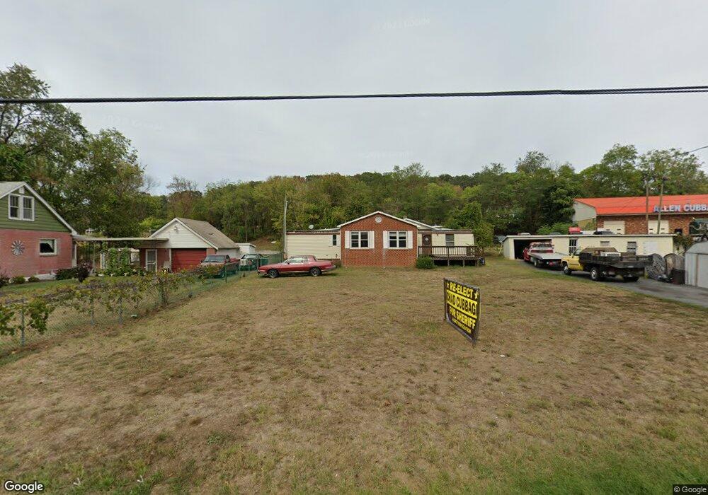
1740 Us Hwy Bsn 340 W Stanley, VA 22851
Estimated Value: $249,993 - $280,000
3
Beds
1
Bath
2,209
Sq Ft
$120/Sq Ft
Est. Value
About This Home
This home is located at 1740 Us Hwy Bsn 340 W, Stanley, VA 22851 and is currently estimated at $264,997, approximately $119 per square foot. 1740 Us Hwy Bsn 340 W is a home located in Page County with nearby schools including Stanley Seventh-day Adventist School.
Ownership History
Date
Name
Owned For
Owner Type
Purchase Details
Closed on
May 27, 2020
Sold by
Rowe Iva M
Bought by
Mcalister Kendall
Current Estimated Value
Home Financials for this Owner
Home Financials are based on the most recent Mortgage that was taken out on this home.
Original Mortgage
$103,600
Outstanding Balance
$92,005
Interest Rate
3.3%
Mortgage Type
Construction
Estimated Equity
$172,992
Create a Home Valuation Report for This Property
The Home Valuation Report is an in-depth analysis detailing your home's value as well as a comparison with similar homes in the area
Home Values in the Area
Average Home Value in this Area
Purchase History
| Date | Buyer | Sale Price | Title Company |
|---|---|---|---|
| Mcalister Kendall | $129,500 | -- |
Source: Public Records
Mortgage History
| Date | Status | Borrower | Loan Amount |
|---|---|---|---|
| Open | Mcalister Kendall | $103,600 |
Source: Public Records
Tax History Compared to Growth
Tax History
| Year | Tax Paid | Tax Assessment Tax Assessment Total Assessment is a certain percentage of the fair market value that is determined by local assessors to be the total taxable value of land and additions on the property. | Land | Improvement |
|---|---|---|---|---|
| 2025 | $947 | $129,700 | $35,000 | $94,700 |
| 2024 | $947 | $129,700 | $35,000 | $94,700 |
| 2023 | $947 | $129,700 | $35,000 | $94,700 |
| 2022 | $947 | $129,700 | $35,000 | $94,700 |
| 2021 | $947 | $129,700 | $35,000 | $94,700 |
| 2020 | $916 | $125,500 | $35,000 | $90,500 |
| 2019 | $916 | $125,500 | $35,000 | $90,500 |
| 2018 | $879 | $125,500 | $35,000 | $90,500 |
| 2017 | $828 | $125,500 | $35,000 | $90,500 |
| 2016 | $828 | $125,500 | $35,000 | $90,500 |
| 2015 | $828 | $129,400 | $35,000 | $94,400 |
| 2014 | $828 | $129,400 | $35,000 | $94,400 |
Source: Public Records
Map
Nearby Homes
- 1999 US Hwy Bsn 340 W
- 490 Leola Loop
- 237 Preston Ln
- 127 Deerfield Estates Dr
- 1903 Honeyville Rd
- 341 Park Rd
- 343 Park Rd
- 650 Honeyville Rd
- 1955 Old Stanley Rd
- 115 Sunset Dr
- 551 Park Rd
- 5672 Mill Creek Rd
- 0 Lucas Hollow Rd Unit VAPA2005076
- 218 Honeyville Rd
- 481 Eldon Yates Dr
- 586 Eldon Yates Dr
- 0 Judy Ln Unit 650150
- 240 Deford Ave
- 206 Masonic Dr
- 23 lots Birchwood Dr
- 1717 Us Hwy Bsn 340 W
- 1733 Us Hwy Business 340
- 1766 Us Hwy Bsn 340 W
- 1702 Us Hwy Bsn 340 W
- 1697 Us Hwy Bsn 340 W
- 1677 Us Hwy Bsn 340 W
- 1682 Us Hwy Bsn 340 W
- 650 Old Stanley Rd
- 1780 Us Hwy Bsn 340 W
- 1795 Us Hwy Bsn 340 W
- 1676 Us Hwy Bsn 340 W
- 1676 Us Hwy Bsn 340 W
- 1659 Us Hwy Bsn 340 W
- 576 Old Stanley Rd
- 0 Tbd Old Stanley Rd
- 570 Old Stanley Rd
- 1812 Us Hwy Bsn 340 W
- 1841 Us Hwy Bsn 340 W
- 710 Old Stanley Rd
- 544 Old Stanley Rd