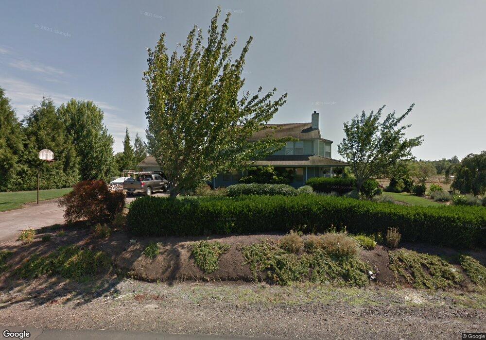
1741 Pheasant Ct Philomath, OR 97370
Estimated Value: $878,174 - $897,000
4
Beds
3
Baths
2,630
Sq Ft
$337/Sq Ft
Est. Value
About This Home
This home is located at 1741 Pheasant Ct, Philomath, OR 97370 and is currently estimated at $886,725, approximately $337 per square foot. 1741 Pheasant Ct is a home located in Benton County with nearby schools including Clemens Primary School, Philomath Elementary School, and Philomath Middle School.
Ownership History
Date
Name
Owned For
Owner Type
Purchase Details
Closed on
May 23, 2001
Sold by
Mock Gerald A and Mock Ruth L
Bought by
Mock Gerald A and Mock Ruth L
Current Estimated Value
Home Financials for this Owner
Home Financials are based on the most recent Mortgage that was taken out on this home.
Original Mortgage
$110,000
Interest Rate
7.06%
Purchase Details
Closed on
Apr 9, 1999
Sold by
Mock Gerald A and Mock Ruth L
Bought by
Mock Gerald A and Mock Ruth L
Purchase Details
Closed on
Mar 12, 1999
Sold by
Mock Gerald A and Mock Ruth L
Bought by
Mock Gerald A and Mock Ruth L
Create a Home Valuation Report for This Property
The Home Valuation Report is an in-depth analysis detailing your home's value as well as a comparison with similar homes in the area
Home Values in the Area
Average Home Value in this Area
Purchase History
| Date | Buyer | Sale Price | Title Company |
|---|---|---|---|
| Mock Gerald A | -- | Key Title Company | |
| Mock Gerald A | -- | Key Title Company | |
| Mock Gerald A | -- | -- | |
| Mock Gerald A | -- | -- |
Source: Public Records
Mortgage History
| Date | Status | Borrower | Loan Amount |
|---|---|---|---|
| Closed | Mock Gerald A | $110,000 |
Source: Public Records
Tax History Compared to Growth
Tax History
| Year | Tax Paid | Tax Assessment Tax Assessment Total Assessment is a certain percentage of the fair market value that is determined by local assessors to be the total taxable value of land and additions on the property. | Land | Improvement |
|---|---|---|---|---|
| 2025 | $8,810 | $586,722 | -- | -- |
| 2024 | $8,810 | $569,633 | -- | -- |
| 2023 | $8,399 | $553,042 | $0 | $0 |
| 2022 | $8,078 | $536,934 | $0 | $0 |
| 2021 | $7,459 | $521,295 | $0 | $0 |
| 2020 | $7,634 | $506,112 | $0 | $0 |
| 2019 | $6,678 | $491,371 | $0 | $0 |
| 2018 | $6,782 | $477,059 | $0 | $0 |
| 2017 | $6,515 | $463,164 | $0 | $0 |
| 2016 | $6,043 | $449,674 | $0 | $0 |
| 2015 | $5,586 | $436,577 | $0 | $0 |
| 2014 | $5,599 | $423,861 | $0 | $0 |
| 2012 | -- | $399,530 | $0 | $0 |
Source: Public Records
Map
Nearby Homes
- 1284 N 19th St Unit 7 St
- 1284 N 19th St
- 1284 N 19th St Unit 4 St
- 688 Wyatt Ln
- 807 N 12th St
- 769 N 9th St
- 852 Marilyn Dr
- 881 Quail Glenn Dr
- 240 N 19th St
- 807 Quail Glenn Dr
- 801 Quail Glenn Dr
- 791 Quail Glenn Dr
- 223 N 14th St
- 990 Pippa Ln
- 345 N 11th (351) St
- 1717 Main St
- 609 Coastal View (Land Next To) Dr
- 135 S 21st St
- 224 S 24th St
- 2820 Newton Place
- 1731 Pheasant Ct
- 0 Wooded Knolls Dr
- 1753 Wooded Knolls Dr
- 1873 Wooded Knolls Dr
- 1726 Pheasant Ct
- 1669 Wooded Knolls Dr
- 1667 Wooded Knolls Dr
- 1834 Unassigned Dr
- 1736 Wooded Knolls Dr
- 1834 Egan Dr
- 2013 W Hills Rd
- 1933 Wooded Knolls Dr
- 1946 Wooded Knolls Dr
- 1877 W Hills Rd
- 2093 West Hills Rd
- 2021 W Hills Rd
- 1911 West Hills Rd
- 1945 West Hills Rd
- 2011 West Hills Rd
- 2009 West Hills Rd