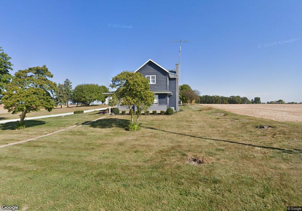
1742 Cox Rd Union City, OH 45390
Estimated Value: $215,000 - $299,000
3
Beds
2
Baths
1,760
Sq Ft
$144/Sq Ft
Est. Value
About This Home
This home is located at 1742 Cox Rd, Union City, OH 45390 and is currently estimated at $253,339, approximately $143 per square foot. 1742 Cox Rd is a home with nearby schools including Mississinawa Valley Elementary School and Mississinawa Valley Junior/Senior High School.
Ownership History
Date
Name
Owned For
Owner Type
Purchase Details
Closed on
Apr 20, 2016
Sold by
Mendenhall Ag Llc
Bought by
Mendenhall Eric L
Current Estimated Value
Home Financials for this Owner
Home Financials are based on the most recent Mortgage that was taken out on this home.
Original Mortgage
$104,000
Outstanding Balance
$82,459
Interest Rate
3.62%
Mortgage Type
Commercial
Estimated Equity
$170,880
Purchase Details
Closed on
Jan 29, 2013
Sold by
Mendenhall Laura Jean and Mendenhall Craig Allan
Bought by
Mendenhall Ag Llc
Create a Home Valuation Report for This Property
The Home Valuation Report is an in-depth analysis detailing your home's value as well as a comparison with similar homes in the area
Home Values in the Area
Average Home Value in this Area
Purchase History
| Date | Buyer | Sale Price | Title Company |
|---|---|---|---|
| Mendenhall Eric L | $130,000 | Attorney | |
| Mendenhall Ag Llc | -- | Attorney |
Source: Public Records
Mortgage History
| Date | Status | Borrower | Loan Amount |
|---|---|---|---|
| Open | Mendenhall Eric L | $104,000 |
Source: Public Records
Tax History Compared to Growth
Tax History
| Year | Tax Paid | Tax Assessment Tax Assessment Total Assessment is a certain percentage of the fair market value that is determined by local assessors to be the total taxable value of land and additions on the property. | Land | Improvement |
|---|---|---|---|---|
| 2024 | $1,767 | $58,440 | $10,650 | $47,790 |
| 2023 | $1,769 | $58,440 | $10,650 | $47,790 |
| 2022 | $1,611 | $44,870 | $9,170 | $35,700 |
| 2021 | $1,636 | $44,870 | $9,170 | $35,700 |
| 2020 | $1,576 | $44,870 | $9,170 | $35,700 |
| 2019 | $1,393 | $42,300 | $9,170 | $33,130 |
| 2018 | $1,390 | $42,300 | $9,170 | $33,130 |
| 2017 | $940 | $42,300 | $9,170 | $33,130 |
| 2016 | $2,587 | $31,580 | $7,780 | $23,800 |
| 2015 | $2,587 | $114,770 | $90,970 | $23,800 |
| 2014 | $2,593 | $114,770 | $90,970 | $23,800 |
| 2013 | $1,573 | $100,280 | $76,480 | $23,800 |
Source: Public Records
Map
Nearby Homes
- 1960 Ohio 571
- 8018 Fisher Dangler Rd
- 1108 Ohio 571
- 1108 State Route 571
- 2149 State Route 571
- 2493 Ohio 571
- 2515 State Route 571
- 0 N Madison-Coletwn Rd Unit 1039727
- 427 State Route 571
- 8892 N State Route 49
- 720 E Main St
- 103 S Wintergreen St
- 3163 State Route 571
- 309 S Market St
- 718 Lynwood Ct
- 807 E Cherry St
- 706 Lynwood Ct
- 230 NW Deerfield Rd
- 227 South St
- 305 E North St
- 1547 Cox Rd
- 1588 Cox Rd
- 1546 Cox Rd
- 1944 Cox Rd
- 8517 Weiss Rd
- 8531 Weiss Rd
- 8643 Weiss Rd
- 8541 Weiss Rd
- 8511 Weiss Rd
- 8523 Weiss Rd
- 8505 Weiss Rd
- 8549 Weiss Rd
- 8559 Weiss Rd
- 8565 Weiss Rd
- 1740 Ohio 571
- 8504 Fisher Dangler Rd
- 8572 Fisher Dangler
- 8532 Fisher Dangler Rd
- 1481 Cox Rd
- 1740 State Route 571