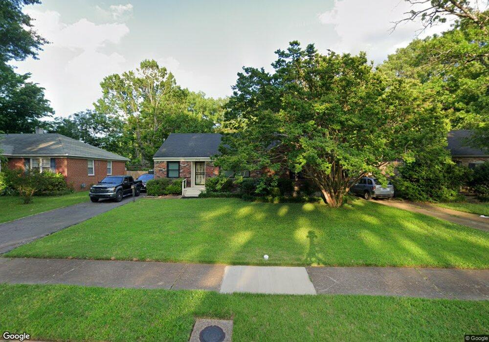
1742 Dorrie Ln Memphis, TN 38117
Colonial Acres NeighborhoodEstimated Value: $160,000 - $200,000
3
Beds
2
Baths
1,820
Sq Ft
$96/Sq Ft
Est. Value
About This Home
This home is located at 1742 Dorrie Ln, Memphis, TN 38117 and is currently estimated at $175,388, approximately $96 per square foot. 1742 Dorrie Ln is a home located in Shelby County with nearby schools including Willow Oaks Elementary School, Colonial Middle, and Overton High.
Ownership History
Date
Name
Owned For
Owner Type
Purchase Details
Closed on
Nov 26, 1997
Sold by
Ray Lee Investment Company Inc
Bought by
Smith Larue
Current Estimated Value
Home Financials for this Owner
Home Financials are based on the most recent Mortgage that was taken out on this home.
Original Mortgage
$64,966
Outstanding Balance
$11,137
Interest Rate
7.38%
Mortgage Type
FHA
Estimated Equity
$164,251
Purchase Details
Closed on
Aug 26, 1997
Sold by
Altegra Credit Company
Bought by
Ray Lee Investment Company Inc
Home Financials for this Owner
Home Financials are based on the most recent Mortgage that was taken out on this home.
Original Mortgage
$34,500
Interest Rate
7.39%
Purchase Details
Closed on
Feb 14, 1997
Sold by
Stone Higgs & Drexler Pc
Bought by
Altegra Credit Company
Create a Home Valuation Report for This Property
The Home Valuation Report is an in-depth analysis detailing your home's value as well as a comparison with similar homes in the area
Home Values in the Area
Average Home Value in this Area
Purchase History
| Date | Buyer | Sale Price | Title Company |
|---|---|---|---|
| Smith Larue | $65,000 | -- | |
| Ray Lee Investment Company Inc | $34,500 | -- | |
| Altegra Credit Company | $50,000 | -- |
Source: Public Records
Mortgage History
| Date | Status | Borrower | Loan Amount |
|---|---|---|---|
| Open | Smith Larue | $64,966 | |
| Previous Owner | Ray Lee Investment Company Inc | $34,500 |
Source: Public Records
Tax History Compared to Growth
Tax History
| Year | Tax Paid | Tax Assessment Tax Assessment Total Assessment is a certain percentage of the fair market value that is determined by local assessors to be the total taxable value of land and additions on the property. | Land | Improvement |
|---|---|---|---|---|
| 2025 | $1,184 | $42,225 | $8,000 | $34,225 |
| 2024 | $1,184 | $34,925 | $4,425 | $30,500 |
| 2023 | $2,128 | $34,925 | $4,425 | $30,500 |
| 2022 | $2,128 | $34,925 | $4,425 | $30,500 |
| 2021 | $2,152 | $34,925 | $4,425 | $30,500 |
| 2020 | $1,205 | $16,625 | $4,425 | $12,200 |
| 2019 | $1,205 | $16,625 | $4,425 | $12,200 |
| 2018 | $1,205 | $16,625 | $4,425 | $12,200 |
| 2017 | $683 | $16,625 | $4,425 | $12,200 |
| 2016 | $698 | $15,975 | $0 | $0 |
| 2014 | $698 | $15,975 | $0 | $0 |
Source: Public Records
Map
Nearby Homes
- 1709 Dorrie Ln
- 1776 Dorrie Ln
- 1771 Tahiti Ln
- 1731 Sea Isle Rd
- 4677 Leatherwood Ave
- 1844 Capri Rd
- 4487 E Dearing Rd
- 1653 Colonial Rd
- 1597 Marcia Rd
- 1886 Danville Rd
- 1917 Tahiti Ln
- 1570 Dearing Rd
- 4420 Helene Rd
- 1628 Cherry Rd
- 4485 Dunn Ave
- 4416 Boyce Rd
- 4471 Jamaica Ave
- 1563 Flamingo Rd
- 4797 Helene Rd
- 1864 Denison St
- 1750 Dorrie Ln
- 1736 Dorrie Ln
- 1743 Cornelia Ln
- 1756 Dorrie Ln
- 1730 Dorrie Ln
- 1735 Cornelia Ln
- 1749 Cornelia Ln
- 1741 Dorrie Ln
- 1755 Cornelia Ln
- 1729 Cornelia Ln
- 1749 Dorrie Ln
- 1735 Dorrie Ln
- 1724 Dorrie Ln
- 1764 Dorrie Ln
- 1729 Dorrie Ln
- 1755 Dorrie Ln
- 1761 Cornelia Ln
- 1723 Cornelia Ln
- 1763 Dorrie Ln
- 1716 Dorrie Ln