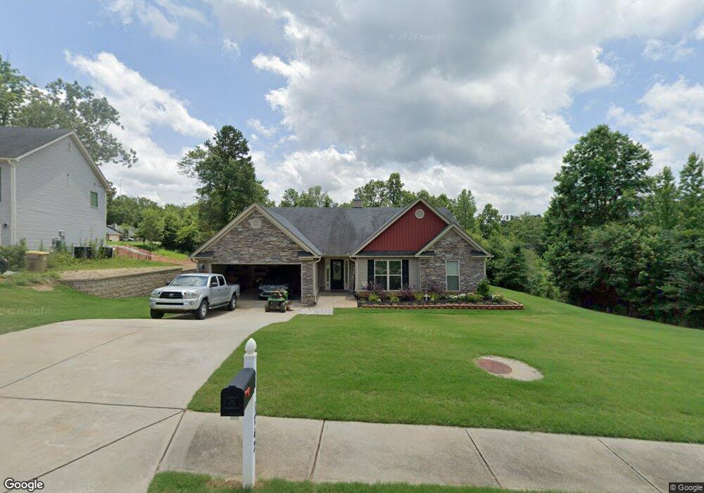
1742 Gresham Place Unit 11 Winder, GA 30680
Estimated Value: $372,104 - $396,000
Studio
3
Baths
2,258
Sq Ft
$171/Sq Ft
Est. Value
About This Home
This home is located at 1742 Gresham Place Unit 11, Winder, GA 30680 and is currently estimated at $386,026, approximately $170 per square foot. 1742 Gresham Place Unit 11 is a home located in Barrow County with nearby schools including Statham Elementary School, Bear Creek Middle School, and Winder-Barrow High School.
Ownership History
Date
Name
Owned For
Owner Type
Purchase Details
Closed on
Dec 28, 2016
Sold by
Southfork Homes Llc
Bought by
Sanders Jerra
Current Estimated Value
Home Financials for this Owner
Home Financials are based on the most recent Mortgage that was taken out on this home.
Original Mortgage
$176,767
Outstanding Balance
$144,430
Interest Rate
4.08%
Mortgage Type
New Conventional
Estimated Equity
$241,596
Purchase Details
Closed on
Aug 12, 2016
Sold by
Sugarloaf East Llc
Bought by
Southfork Homes Llc
Purchase Details
Closed on
Dec 22, 2010
Sold by
State Bank & Trust Co
Bought by
Sugarloaf East Llc
Purchase Details
Closed on
Dec 7, 2009
Sold by
Lcs Llc
Bought by
State Bank & Trust Co
Purchase Details
Closed on
Aug 2, 2006
Sold by
Reece Deborah P
Bought by
Lcs Llc
Create a Home Valuation Report for This Property
The Home Valuation Report is an in-depth analysis detailing your home's value as well as a comparison with similar homes in the area
Home Values in the Area
Average Home Value in this Area
Purchase History
| Date | Buyer | Sale Price | Title Company |
|---|---|---|---|
| Sanders Jerra | $174,900 | -- | |
| Southfork Homes Llc | $73,500 | -- | |
| Sugarloaf East Llc | $3,700 | -- | |
| State Bank & Trust Co | -- | -- | |
| Lcs Llc | -- | -- |
Source: Public Records
Mortgage History
| Date | Status | Borrower | Loan Amount |
|---|---|---|---|
| Open | Sanders Jerra | $176,767 |
Source: Public Records
Tax History
| Year | Tax Paid | Tax Assessment Tax Assessment Total Assessment is a certain percentage of the fair market value that is determined by local assessors to be the total taxable value of land and additions on the property. | Land | Improvement |
|---|---|---|---|---|
| 2025 | $3,048 | $130,654 | $19,200 | $111,454 |
| 2024 | $3,144 | $127,272 | $19,200 | $108,072 |
| 2023 | $2,733 | $127,672 | $19,200 | $108,472 |
| 2022 | $2,940 | $103,425 | $19,200 | $84,225 |
| 2021 | $2,659 | $88,456 | $19,200 | $69,256 |
| 2020 | $2,389 | $79,269 | $16,000 | $63,269 |
| 2019 | $2,430 | $79,269 | $16,000 | $63,269 |
| 2018 | $2,215 | $73,075 | $12,800 | $60,275 |
| 2017 | $2,011 | $69,082 | $16,000 | $53,082 |
| 2016 | $323 | $7,680 | $7,680 | $0 |
| 2015 | $233 | $7,680 | $7,680 | $0 |
| 2014 | $82 | $2,600 | $2,600 | $0 |
| 2013 | -- | $2,600 | $2,600 | $0 |
Source: Public Records
Map
Nearby Homes
- 1295 Double Bridges Rd
- 207 Cedar Grove Church Rd
- 670 Cedar Grove Church Rd
- 113 Platte St
- 0
- 670 Cedar Grove Church Rd
- 1453 Solomon Dr
- 16 Fox Dr
- 1264 Highway 211 NE
- 311 Anchors Way
- 233 Hunter Rd
- 315 Paige Way
- 614 Anns Way
- 3845 S Highway 82
- 144 Briar Rose Blvd
- 123 Briar Rose Blvd
- Tract 3 Ethridge Rd
- Tract Ethridge Rd
- Tract 2 Ethridge Rd
- 142 Defilippe Dr
- 1742 Gresham Place Unit 52
- 1742 Gresham Place
- 1740 Gresham Place Unit 51
- 1740 Gresham Place
- 1873 Keri Ln Unit 49
- 1873 Keri Ln
- 1875 Keri Ln Unit 48
- 1875 Keri Ln
- 1871 Keri Ln Unit 50
- 1871 Keri Ln
- 1741 Gresham Place
- 1741 Gresham Place Unit 56
- 1877 Keri Ln Unit 47
- 1877 Keri Ln
- 1744 Gresham Place Unit 53
- 1744 Gresham Place
- 1745 Gresham Place
- 1745 Gresham Place Unit 55
- 1961 Paynes Point Unit 63
- 1961 Paynes Point
Your Personal Tour Guide
Ask me questions while you tour the home.