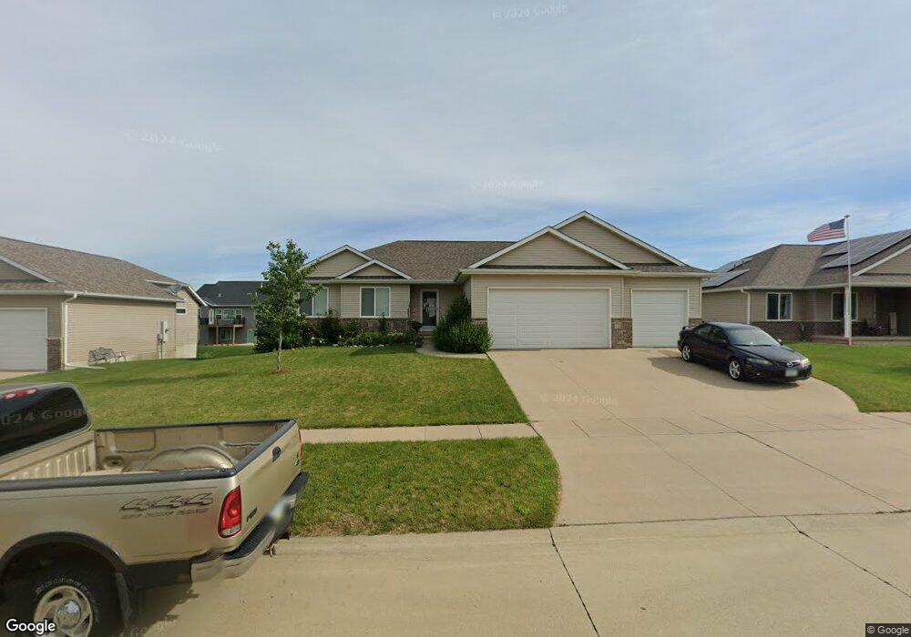
1742 Para Dr Marion, IA 52302
Estimated Value: $373,000 - $429,000
3
Beds
2
Baths
1,639
Sq Ft
$239/Sq Ft
Est. Value
About This Home
This home is located at 1742 Para Dr, Marion, IA 52302 and is currently estimated at $391,476, approximately $238 per square foot. 1742 Para Dr is a home located in Linn County with nearby schools including Indian Creek Elementary School, Excelsior Middle School, and Linn-Mar High School.
Ownership History
Date
Name
Owned For
Owner Type
Purchase Details
Closed on
Jun 16, 2011
Sold by
T2 Homes Llc
Bought by
Setrum Kyle L and Setrum Jennifer
Current Estimated Value
Home Financials for this Owner
Home Financials are based on the most recent Mortgage that was taken out on this home.
Original Mortgage
$203,000
Outstanding Balance
$140,730
Interest Rate
4.75%
Mortgage Type
New Conventional
Estimated Equity
$250,746
Purchase Details
Closed on
Jul 16, 2010
Sold by
Glen Rock Farms Llc
Bought by
T2 Homes Llc
Create a Home Valuation Report for This Property
The Home Valuation Report is an in-depth analysis detailing your home's value as well as a comparison with similar homes in the area
Home Values in the Area
Average Home Value in this Area
Purchase History
| Date | Buyer | Sale Price | Title Company |
|---|---|---|---|
| Setrum Kyle L | $225,500 | None Available | |
| T2 Homes Llc | $43,500 | None Available |
Source: Public Records
Mortgage History
| Date | Status | Borrower | Loan Amount |
|---|---|---|---|
| Open | Setrum Kyle L | $203,000 |
Source: Public Records
Tax History Compared to Growth
Tax History
| Year | Tax Paid | Tax Assessment Tax Assessment Total Assessment is a certain percentage of the fair market value that is determined by local assessors to be the total taxable value of land and additions on the property. | Land | Improvement |
|---|---|---|---|---|
| 2025 | $5,728 | $380,900 | $46,500 | $334,400 |
| 2024 | $5,448 | $315,100 | $46,500 | $268,600 |
| 2023 | $5,448 | $315,100 | $46,500 | $268,600 |
| 2022 | $5,192 | $254,400 | $46,500 | $207,900 |
| 2021 | $5,590 | $254,400 | $46,500 | $207,900 |
| 2020 | $5,590 | $256,700 | $46,500 | $210,200 |
| 2019 | $5,222 | $240,000 | $38,000 | $202,000 |
| 2018 | $5,016 | $240,000 | $38,000 | $202,000 |
| 2017 | $5,246 | $244,700 | $38,000 | $206,700 |
| 2016 | $5,280 | $244,700 | $38,000 | $206,700 |
| 2015 | $5,261 | $244,700 | $38,000 | $206,700 |
| 2014 | $5,074 | $255,600 | $38,000 | $217,600 |
| 2013 | $5,066 | $255,600 | $38,000 | $217,600 |
Source: Public Records
Map
Nearby Homes
- 1789 Glen Rock Cir
- 1823 Glen Rock Cir
- 2239 Royal Oak Ridge Rd
- 2027 Royal Oak Ridge Rd
- 2069 Royal Oak Ridge Rd
- 2155 Royal Oak Ridge Rd
- 1605 Valentine Dr
- 2070 Royal Oak Ridge Rd
- 1845 Hunters Creek Way Unit 1845
- 1727 Hunters Creek Way Unit 1727
- 1562 Hunters Creek Way Unit 1562
- 1600 Hunters Creek Way Unit 1600
- 5510 Hunters Ridge Ct
- 2970 Covey Run Ct
- 2935 Clubhouse Dr
- 2995 Royal Oak Ridge Rd
- 2933 Clubhouse Dr and 2935
- 2933 Clubhouse Dr
- 3096 Duckhorn Cove
- 3098 Duckhorn Cove
- 1772 Para Dr
- 1712 Para Dr
- 1789 Cottage Ridge Dr
- 1802 Para Dr
- 1682 Para Dr
- 1757 Cottage Ridge Dr
- 1747 Para Dr
- 1735 Cottage Ridge Dr
- 1777 Para Dr
- 1821 Cottage Ridge Dr
- 1717 Para Dr
- 1807 Para Dr
- 1703 Cottage Ridge Dr
- 1832 Para Dr
- 1652 Para Dr
- 1845 Cottage Ridge Dr
- 1687 Para Dr
- 1837 Para Dr
- 1756 Cottage Ridge Dr
- 1681 Cottage Ridge Dr