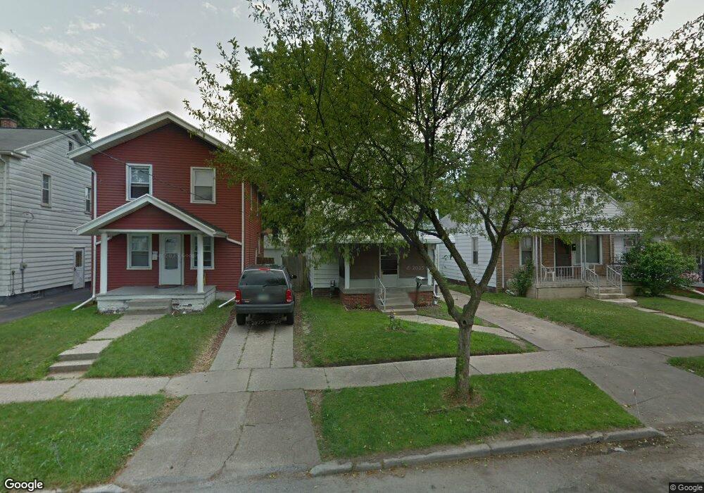
1743 Mansfield Rd Toledo, OH 43613
DeVeaux NeighborhoodEstimated Value: $70,000 - $85,000
3
Beds
1
Bath
1,089
Sq Ft
$72/Sq Ft
Est. Value
About This Home
This home is located at 1743 Mansfield Rd, Toledo, OH 43613 and is currently estimated at $78,220, approximately $71 per square foot. 1743 Mansfield Rd is a home located in Lucas County with nearby schools including McKinley Stemm Academy, Start High School, and Horizon Science Academy - Toledo High School.
Ownership History
Date
Name
Owned For
Owner Type
Purchase Details
Closed on
Sep 17, 2025
Sold by
Midaas Properties Llc
Bought by
Baker April
Current Estimated Value
Purchase Details
Closed on
Feb 7, 2022
Sold by
Midaas Properties Llc
Bought by
Midaas Properties Llc
Purchase Details
Closed on
Aug 25, 2021
Sold by
Bird S Drywell Inc
Bought by
Midaas Properties Llc
Purchase Details
Closed on
Jan 22, 2010
Sold by
Baker Shanon
Bought by
Birds Drywall Inc
Purchase Details
Closed on
Nov 3, 2009
Sold by
Deutsche Bank National Turst Company
Bought by
Baker Shanon
Purchase Details
Closed on
Aug 25, 2009
Sold by
Bryant Claude E and Bryant Jacqueline L
Bought by
Deutsche Bank National Trust Company and Ameriquest Mortgage Securities Trust 200
Purchase Details
Closed on
Dec 5, 1991
Sold by
Erbskorn Zola H
Create a Home Valuation Report for This Property
The Home Valuation Report is an in-depth analysis detailing your home's value as well as a comparison with similar homes in the area
Home Values in the Area
Average Home Value in this Area
Purchase History
| Date | Buyer | Sale Price | Title Company |
|---|---|---|---|
| Baker April | -- | None Listed On Document | |
| Midaas Properties Llc | -- | None Listed On Document | |
| Midaas Properties Llc | $10,000 | None Available | |
| Birds Drywall Inc | -- | None Available | |
| Baker Shanon | $11,400 | None Available | |
| Deutsche Bank National Trust Company | $33,334 | Attorney | |
| -- | $36,000 | -- |
Source: Public Records
Tax History
| Year | Tax Paid | Tax Assessment Tax Assessment Total Assessment is a certain percentage of the fair market value that is determined by local assessors to be the total taxable value of land and additions on the property. | Land | Improvement |
|---|---|---|---|---|
| 2025 | $2,152 | $19,285 | $6,370 | $12,915 |
| 2024 | $1,891 | $19,285 | $6,370 | $12,915 |
| 2023 | $1,073 | $16,170 | $3,955 | $12,215 |
| 2022 | $1,077 | $16,170 | $3,955 | $12,215 |
| 2021 | $1,103 | $16,170 | $3,955 | $12,215 |
| 2020 | $1,187 | $15,470 | $3,745 | $11,725 |
| 2019 | $1,155 | $15,470 | $3,745 | $11,725 |
| 2018 | $1,160 | $15,470 | $3,745 | $11,725 |
| 2017 | $1,683 | $15,120 | $3,675 | $11,445 |
| 2016 | $2,961 | $43,200 | $10,500 | $32,700 |
| 2015 | $1,178 | $43,200 | $10,500 | $32,700 |
| 2014 | $1,467 | $15,130 | $3,680 | $11,450 |
| 2013 | $978 | $15,130 | $3,680 | $11,450 |
Source: Public Records
Map
Nearby Homes
- 1814 Marlow Rd
- 1717 Fairfax Rd
- 1816 Loxley Rd
- 1829 Talbot St
- 1822 Wychwood St
- 1831 Talbot St
- 3430 Upton Ave
- 3433 Upton Ave
- 3628 Wallwerth Dr
- 1730 Balkan Place
- 1752 Marne Ave
- 1929 Marlow Rd
- 1815 Berdan Ave
- 1820 Marne Ave
- 1740 Berdan Ave
- 1750 Berdan Ave
- 1748 Georgia Ave
- 1758 Georgia Ave
- 1952 Fairfax Rd
- 3821 Jackman Rd
- 1745 Mansfield Rd
- 1731 Mansfield Rd
- 1747 Mansfield Rd
- 1729 Mansfield Rd
- 1749 Mansfield Rd
- 1727 Mansfield Rd
- 1736 Marlow Rd
- 1751 Mansfield Rd
- 1744 Marlow Rd
- 1734 Marlow Rd
- 1748 Marlow Rd
- 1753 Mansfield Rd
- 1723 Mansfield Rd
- 1732 Marlow Rd
- 1752 Marlow Rd
- 1740 Mansfield Rd
- 1746 Mansfield Rd
- 1736 Mansfield Rd
- 1759 Mansfield Rd
- 1748 Mansfield Rd
Your Personal Tour Guide
Ask me questions while you tour the home.