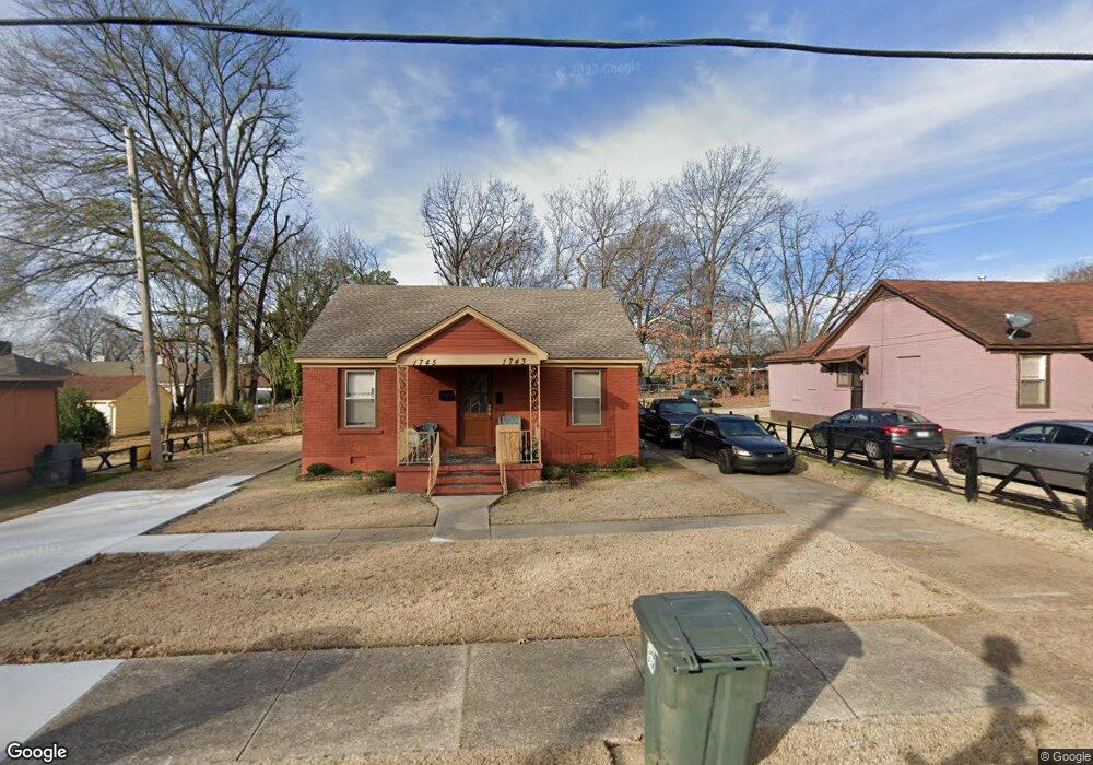
1743 S Trezevant St Memphis, TN 38114
Southeast Memphis NeighborhoodEstimated Value: $93,548 - $163,000
2
Beds
2
Baths
1,320
Sq Ft
$95/Sq Ft
Est. Value
About This Home
This home is located at 1743 S Trezevant St, Memphis, TN 38114 and is currently estimated at $125,637, approximately $95 per square foot. 1743 S Trezevant St is a home located in Shelby County with nearby schools including Bethel Grove Elementary School, Sherwood Middle, and Melrose High School.
Ownership History
Date
Name
Owned For
Owner Type
Purchase Details
Closed on
Jun 9, 2017
Sold by
Williams Rodney and Williams Gregory L
Bought by
Williams Rodney
Current Estimated Value
Purchase Details
Closed on
Jul 6, 2013
Sold by
Edwards Monroe J
Bought by
Williams Rodney
Purchase Details
Closed on
Jun 28, 2013
Sold by
Edwards Monroe J
Bought by
Williams Rodney
Purchase Details
Closed on
Jan 24, 2005
Sold by
Edwards Monroe J
Bought by
Edwards Monroe J and Monroe J Edwards Living Trust
Create a Home Valuation Report for This Property
The Home Valuation Report is an in-depth analysis detailing your home's value as well as a comparison with similar homes in the area
Home Values in the Area
Average Home Value in this Area
Purchase History
| Date | Buyer | Sale Price | Title Company |
|---|---|---|---|
| Williams Rodney | -- | None Available | |
| Williams Rodney | -- | None Available | |
| Williams Rodney | -- | None Available | |
| Edwards Monroe J | -- | -- |
Source: Public Records
Tax History Compared to Growth
Tax History
| Year | Tax Paid | Tax Assessment Tax Assessment Total Assessment is a certain percentage of the fair market value that is determined by local assessors to be the total taxable value of land and additions on the property. | Land | Improvement |
|---|---|---|---|---|
| 2025 | $521 | $31,840 | $3,920 | $27,920 |
| 2024 | $521 | $15,360 | $1,800 | $13,560 |
| 2023 | $936 | $15,360 | $1,800 | $13,560 |
| 2022 | $936 | $15,360 | $1,800 | $13,560 |
| 2021 | $947 | $15,360 | $1,800 | $13,560 |
| 2020 | $988 | $13,640 | $1,800 | $11,840 |
| 2019 | $988 | $13,640 | $1,800 | $11,840 |
| 2018 | $988 | $13,640 | $1,800 | $11,840 |
| 2017 | $561 | $13,640 | $1,800 | $11,840 |
| 2016 | $659 | $15,080 | $0 | $0 |
| 2014 | $659 | $15,080 | $0 | $0 |
Source: Public Records
Map
Nearby Homes
- 2383 Lowell Ave
- 1059 S Willett St S
- 1720 Airways Blvd
- 2400 Kimball Ave
- 2421 Arlington Ave
- 2515 Larose Ave
- 2481 Kimball Ave
- 0 Airways Blvd Unit 10199303
- 2149 Wabash Ave
- 2255 Deadrick Ave
- 2426 Lamar Cir
- 1609 Hugenot St
- 2481 Browning Ave
- 2607 Barron Ave
- 2637 Arlington Ave
- 0 Dublin Ave Unit LOTS 20 & 21 LAST TW
- 2589 Browning Ave
- 1240 Ethel St
- 1239 Ethel St
- 2585 Filmore Ave
- 1737 S Trezevant St
- 2352 Poe Ave
- 2358 Poe Ave
- 2346 Poe Ave
- 2341 Boyle Ave
- 1733 S Trezevant St
- 2342 Poe Ave
- 2365 Boyle Ave
- 2335 Boyle Ave
- 2336 Poe Ave
- 2377 Boyle Ave
- 2331 Boyle Ave
- 1723 S Trezevant St
- 1760 S Trezevant St
- 2381 Boyle Ave
- 2326 Poe Ave
- 2349 Poe Ave
- 1717 S Trezevant St
- 2345 Poe Ave
- 2355 Poe Ave