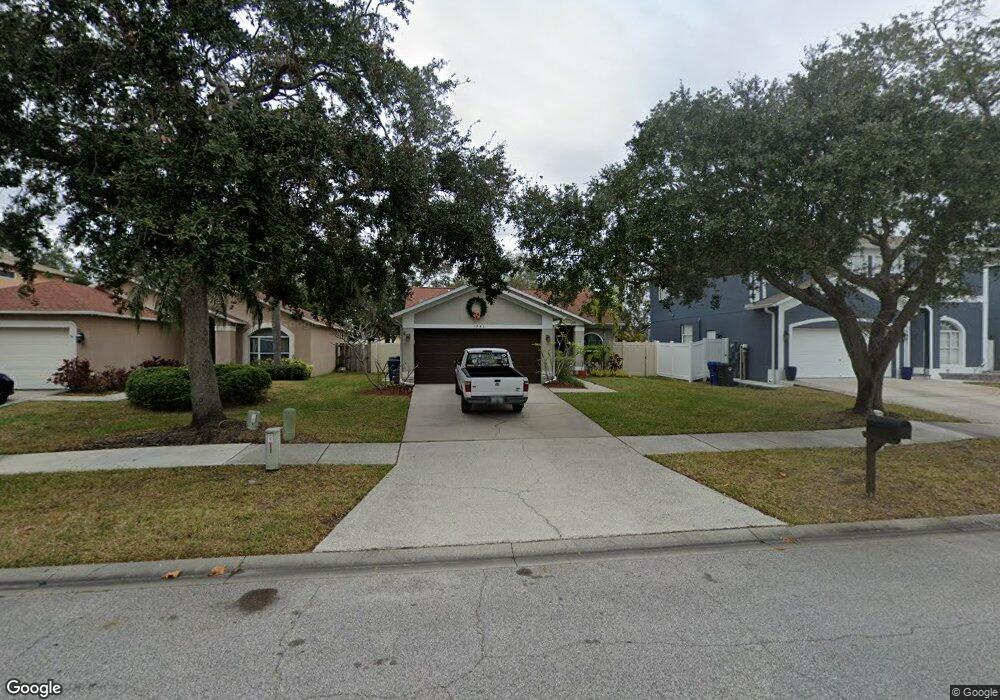
1743 Split Fork Dr Oldsmar, FL 34677
Estimated Value: $362,790 - $498,000
Studio
2
Baths
1,360
Sq Ft
$319/Sq Ft
Est. Value
About This Home
This home is located at 1743 Split Fork Dr, Oldsmar, FL 34677 and is currently estimated at $433,448, approximately $318 per square foot. 1743 Split Fork Dr is a home located in Pinellas County with nearby schools including Oldsmar Elementary School, East Lake High School, and Joseph L. Carwise Middle School.
Ownership History
Date
Name
Owned For
Owner Type
Purchase Details
Closed on
May 5, 2016
Sold by
Saracki Paula J
Bought by
Saracki Trust and Saracki Daniel
Current Estimated Value
Purchase Details
Closed on
Dec 31, 1997
Sold by
U S Home Corp
Bought by
Saracki Paula J
Home Financials for this Owner
Home Financials are based on the most recent Mortgage that was taken out on this home.
Original Mortgage
$86,130
Interest Rate
7.2%
Mortgage Type
New Conventional
Create a Home Valuation Report for This Property
The Home Valuation Report is an in-depth analysis detailing your home's value as well as a comparison with similar homes in the area
Home Values in the Area
Average Home Value in this Area
Purchase History
| Date | Buyer | Sale Price | Title Company |
|---|---|---|---|
| Saracki Trust | -- | None Available | |
| Saracki Trust | -- | None Available | |
| Saracki Paula J | $107,700 | -- |
Source: Public Records
Mortgage History
| Date | Status | Borrower | Loan Amount |
|---|---|---|---|
| Previous Owner | Saracki Paula J | $50,000 | |
| Previous Owner | Saracki Paula J | $86,130 |
Source: Public Records
Tax History
| Year | Tax Paid | Tax Assessment Tax Assessment Total Assessment is a certain percentage of the fair market value that is determined by local assessors to be the total taxable value of land and additions on the property. | Land | Improvement |
|---|---|---|---|---|
| 2025 | $2,772 | $159,515 | -- | -- |
| 2024 | $2,731 | $155,019 | -- | -- |
| 2023 | $2,731 | $150,504 | $0 | $0 |
| 2022 | $2,666 | $146,120 | $0 | $0 |
| 2021 | $2,679 | $141,864 | $0 | $0 |
| 2020 | $2,670 | $139,905 | $0 | $0 |
| 2019 | $2,630 | $136,760 | $0 | $0 |
| 2018 | $2,598 | $134,210 | $0 | $0 |
| 2017 | $2,528 | $131,450 | $0 | $0 |
| 2016 | $2,963 | $128,746 | $0 | $0 |
| 2015 | $2,992 | $127,851 | $0 | $0 |
| 2014 | $2,987 | $126,836 | $0 | $0 |
Source: Public Records
Map
Nearby Homes
- 1732 Split Fork Dr
- 1718 Azalea Ct Unit B
- 1712 Azalea Ct Unit B
- 1712 Azalea Ct Unit A
- 1713 Azalea Ct Unit A
- 30 Aster Place
- 260 Balsam Dr
- 80 Lance Ct
- 1802 Chinaberry Dr
- 1637 Gray Bark Dr
- 1810 Driftwood Cir S
- 1820 Driftwood Cir N
- 1821 Driftwood Cir N
- 433 Tangerine Dr
- 1811 Driftwood Cir S Unit 2
- 1803 Elmwood Dr
- 1730 Oak Pond Ct
- 1802 Forest Dr
- 1806 Forest Dr Unit 3
- 1811 Forest Dr
- 1745 Split Fork Dr
- 1741 Split Fork Dr
- 1747 Split Fork Dr
- 1739 Split Fork Dr
- 1749 Split Fork Dr
- 1737 Split Fork Dr
- 1735 Split Fork Dr
- 1740 Split Fork Dr
- 1738 Split Fork Dr
- 1742 Split Fork Dr
- 1736 Split Fork Dr
- 1744 Split Fork Dr
- 1733 Split Fork Dr
- 1734 Split Fork Dr
- 1746 Split Fork Dr
- 1753 Split Fork Dr
- 1748 Split Fork Dr
- 1731 Split Fork Dr
- 1730 Split Fork Dr
- 1755 Split Fork Dr
Your Personal Tour Guide
Ask me questions while you tour the home.