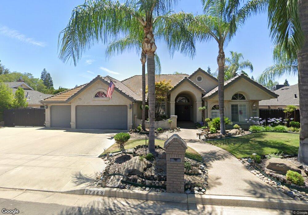
1743 W Spruce Ave Fresno, CA 93711
Bullard NeighborhoodEstimated Value: $575,808 - $655,000
3
Beds
3
Baths
2,249
Sq Ft
$276/Sq Ft
Est. Value
About This Home
This home is located at 1743 W Spruce Ave, Fresno, CA 93711 and is currently estimated at $620,952, approximately $276 per square foot. 1743 W Spruce Ave is a home located in Fresno County with nearby schools including Nelson Elementary School, Kastner Intermediate School, and Clovis West High School.
Ownership History
Date
Name
Owned For
Owner Type
Purchase Details
Closed on
Nov 20, 2023
Sold by
Jue Clifford H and Jue Lynda A
Bought by
Clifford And Lynda Jue Revocable Living Trust and Jue
Current Estimated Value
Purchase Details
Closed on
Sep 19, 2023
Sold by
Jue Clifford H and Jue Lynda A
Bought by
Clifford And Lynda Jue Revocable Living Trust and Jue
Purchase Details
Closed on
Oct 20, 2000
Sold by
Jue Clifford H
Bought by
Jue Clifford H and Jue Lynda A
Purchase Details
Closed on
Apr 21, 2000
Sold by
Jue Clifford H
Bought by
Jue Clifford H and Jue Lynda A
Purchase Details
Closed on
Aug 30, 1999
Sold by
Jue Clifford H
Bought by
Jue Clifford H
Create a Home Valuation Report for This Property
The Home Valuation Report is an in-depth analysis detailing your home's value as well as a comparison with similar homes in the area
Home Values in the Area
Average Home Value in this Area
Purchase History
| Date | Buyer | Sale Price | Title Company |
|---|---|---|---|
| Clifford And Lynda Jue Revocable Living Trust | -- | None Listed On Document | |
| Clifford And Lynda Jue Revocable Living Trust | -- | None Listed On Document | |
| Jue Clifford H | -- | -- | |
| Jue Clifford H | -- | -- | |
| Jue Clifford H | -- | -- |
Source: Public Records
Tax History Compared to Growth
Tax History
| Year | Tax Paid | Tax Assessment Tax Assessment Total Assessment is a certain percentage of the fair market value that is determined by local assessors to be the total taxable value of land and additions on the property. | Land | Improvement |
|---|---|---|---|---|
| 2025 | $4,811 | $401,304 | $137,969 | $263,335 |
| 2023 | $4,715 | $385,722 | $132,612 | $253,110 |
| 2022 | $4,646 | $378,160 | $130,012 | $248,148 |
| 2021 | $4,510 | $370,746 | $127,463 | $243,283 |
| 2020 | $4,604 | $366,946 | $126,157 | $240,789 |
| 2019 | $4,518 | $359,752 | $123,684 | $236,068 |
| 2018 | $4,422 | $352,699 | $121,259 | $231,440 |
| 2017 | $4,194 | $345,784 | $118,882 | $226,902 |
| 2016 | $4,054 | $339,004 | $116,551 | $222,453 |
| 2015 | $3,991 | $333,913 | $114,801 | $219,112 |
| 2014 | $3,914 | $327,373 | $112,553 | $214,820 |
Source: Public Records
Map
Nearby Homes
- 7258 N Channing Way
- 7047 N Teilman Ave Unit 101
- 7047 N Teilman Ave Unit 102
- 7334 N Teilman Ave
- 7355 N Pacific Ave
- 6753 N Durant Ave
- 6743 N Dolores Ave
- 6671 N Channing Way
- 7166 N Fruit Ave Unit 160
- 7166 N Fruit Ave Unit 132
- 7166 N Fruit Ave Unit 133
- 7178 N Fruit Ave Unit 108
- 7166 N Fruit Ave Unit 127
- 2290 W Atlanta Ave
- 6670 N Sequoia Ave
- 6569 N Teilman Ave
- 2246 W Palo Alto Ave
- 6660 N St Catherine Ct
- 2284 W Palo Alto Ave
- 6518 N Dolores Ave
- 1729 W Spruce Ave
- 7190 N Brooks Ave
- 1746 W Locust Ave
- 1734 W Locust Ave
- 1757 W Spruce Ave
- 1758 W Locust Ave
- 1744 W Spruce Ave
- 1722 W Locust Ave
- 1730 W Spruce Ave
- 1715 W Spruce Ave
- 1758 W Spruce Ave
- 1716 W Spruce Ave
- 1710 W Locust Ave
- 1745 W Locust Ave
- 1749 W Birch Ave
- 1733 W Locust Ave
- 1735 W Birch Ave
- 7173 N Brooks Ave
- 1772 W Spruce Ave
- 1701 W Spruce Ave