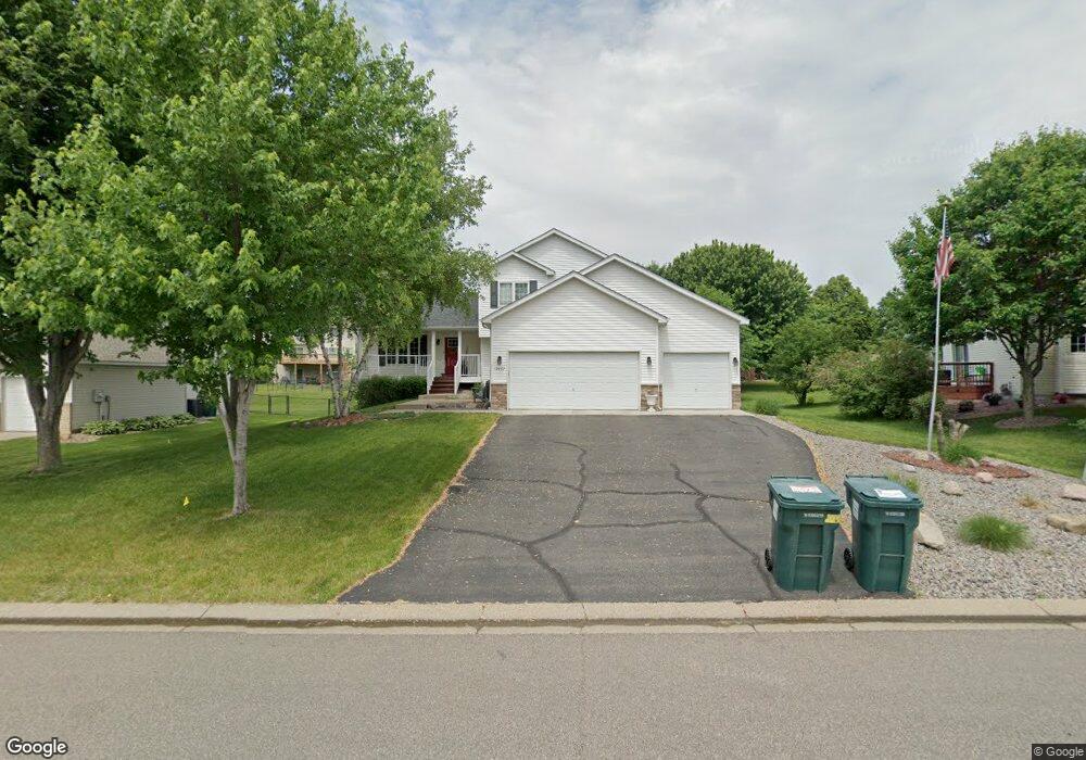
17437 Grove Ave Lakeville, MN 55044
Estimated Value: $446,964 - $523,000
4
Beds
3
Baths
1,929
Sq Ft
$244/Sq Ft
Est. Value
About This Home
This home is located at 17437 Grove Ave, Lakeville, MN 55044 and is currently estimated at $471,241, approximately $244 per square foot. 17437 Grove Ave is a home located in Dakota County with nearby schools including Cherry View Elementary School, Century Middle School, and Lakeville North High School.
Ownership History
Date
Name
Owned For
Owner Type
Purchase Details
Closed on
Dec 29, 2000
Sold by
Druse Todd A and Druse Denise E
Bought by
Muma Jon J and Muma Tovi M R
Current Estimated Value
Purchase Details
Closed on
Oct 27, 1998
Sold by
Anderson Family Homes
Bought by
C & M Home Builders Inc
Purchase Details
Closed on
Jan 23, 1998
Sold by
Cherry View Development Inc
Bought by
Anderson Family Homes
Create a Home Valuation Report for This Property
The Home Valuation Report is an in-depth analysis detailing your home's value as well as a comparison with similar homes in the area
Home Values in the Area
Average Home Value in this Area
Purchase History
| Date | Buyer | Sale Price | Title Company |
|---|---|---|---|
| Muma Jon J | $223,500 | -- | |
| C & M Home Builders Inc | $42,800 | -- | |
| Anderson Family Homes | $147,600 | -- |
Source: Public Records
Tax History Compared to Growth
Tax History
| Year | Tax Paid | Tax Assessment Tax Assessment Total Assessment is a certain percentage of the fair market value that is determined by local assessors to be the total taxable value of land and additions on the property. | Land | Improvement |
|---|---|---|---|---|
| 2024 | $4,248 | $393,300 | $87,100 | $306,200 |
| 2023 | $4,248 | $390,800 | $86,900 | $303,900 |
| 2022 | $3,604 | $375,100 | $86,600 | $288,500 |
| 2021 | $3,734 | $313,200 | $75,300 | $237,900 |
| 2020 | $3,868 | $313,000 | $69,900 | $243,100 |
| 2019 | $3,590 | $307,400 | $66,600 | $240,800 |
| 2018 | $3,423 | $296,100 | $63,400 | $232,700 |
| 2017 | $3,284 | $278,800 | $60,300 | $218,500 |
| 2016 | $3,492 | $265,700 | $57,400 | $208,300 |
| 2015 | $3,281 | $254,989 | $72,093 | $182,896 |
| 2014 | -- | $249,866 | $69,913 | $179,953 |
| 2013 | -- | $225,123 | $63,132 | $161,991 |
Source: Public Records
Map
Nearby Homes
- 17384 Harding Ln
- 17460 Goodland Path
- 8203 174th Ct W
- 17865 Graphite Ln
- 17433 Glacier Way Unit 19
- 17543 Heidelberg Way
- 17908 Greenwich Way
- 17963 Havana Path
- 7605 173rd St W
- 17933 Greeley Place
- 17967 Hawksbill Dr
- Preston I & II Plan at Summers Creek
- Camden Plan at Summers Creek
- Bayport Plan at Summers Creek
- Sheridan & Sheridan C Plan at Summers Creek
- Highlands Plan at Summers Creek
- Parkland Plan at Summers Creek
- Bradford Plan at Summers Creek
- Lincoln II Plan at Summers Creek
- Mackenzie Plan at Summers Creek
- 17433 Grove Ave
- 17441 Grove Ave
- 17430 Halifax Path
- 17440 Halifax Path
- 17445 Grove Ave
- 17429 Grove Ave
- 7998 174th St W
- 8016 174th St W
- 17436 Grove Ave
- 17450 Halifax Path
- 7982 174th St W
- 17428 Grove Ave
- 8032 174th St W
- 17449 Grove Ave
- 17444 Grove Ave
- 17425 Grove Ave
- 7966 174th St W
- 17460 Halifax Path
- 17424 Grove Ave
- 17448 Grove Ave