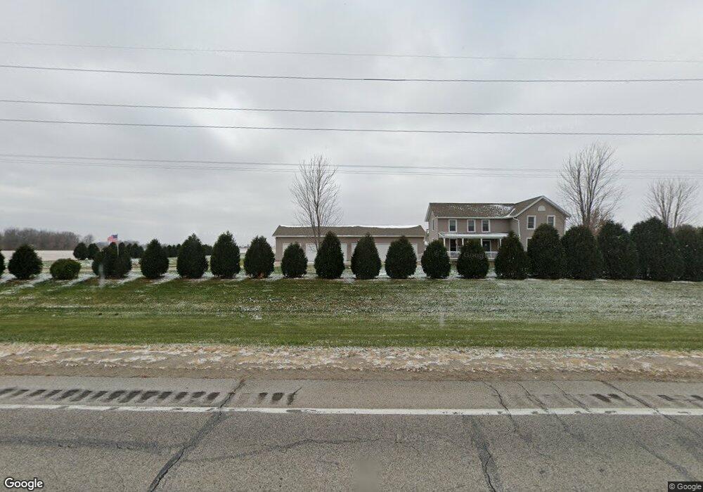
1744 Highway 38 Muscatine, IA 52761
Estimated Value: $375,000 - $520,000
3
Beds
3
Baths
3,062
Sq Ft
$146/Sq Ft
Est. Value
About This Home
This home is located at 1744 Highway 38, Muscatine, IA 52761 and is currently estimated at $446,660, approximately $145 per square foot. 1744 Highway 38 is a home located in Muscatine County with nearby schools including Madison Elementary School, Central Middle School, and Susan Clark Junior High School.
Ownership History
Date
Name
Owned For
Owner Type
Purchase Details
Closed on
Oct 19, 2012
Sold by
Larue Joel and Larue Kendra
Bought by
Battey Gary W and Battey Marcia L
Current Estimated Value
Home Financials for this Owner
Home Financials are based on the most recent Mortgage that was taken out on this home.
Original Mortgage
$188,000
Outstanding Balance
$130,429
Interest Rate
3.55%
Mortgage Type
New Conventional
Estimated Equity
$316,231
Create a Home Valuation Report for This Property
The Home Valuation Report is an in-depth analysis detailing your home's value as well as a comparison with similar homes in the area
Home Values in the Area
Average Home Value in this Area
Purchase History
| Date | Buyer | Sale Price | Title Company |
|---|---|---|---|
| Battey Gary W | $235,000 | None Available |
Source: Public Records
Mortgage History
| Date | Status | Borrower | Loan Amount |
|---|---|---|---|
| Open | Battey Gary W | $188,000 |
Source: Public Records
Tax History Compared to Growth
Tax History
| Year | Tax Paid | Tax Assessment Tax Assessment Total Assessment is a certain percentage of the fair market value that is determined by local assessors to be the total taxable value of land and additions on the property. | Land | Improvement |
|---|---|---|---|---|
| 2025 | $4,646 | $416,170 | $78,440 | $337,730 |
| 2024 | $4,646 | $416,520 | $78,440 | $338,080 |
| 2023 | $4,862 | $419,113 | $78,440 | $340,673 |
| 2022 | $4,368 | $373,590 | $74,000 | $299,590 |
| 2021 | $4,368 | $331,320 | $74,000 | $257,320 |
| 2020 | $3,974 | $318,620 | $64,000 | $254,620 |
| 2019 | $4,054 | $278,370 | $0 | $0 |
| 2018 | $3,932 | $278,370 | $0 | $0 |
| 2017 | $3,932 | $251,310 | $0 | $0 |
| 2016 | $3,706 | $251,310 | $0 | $0 |
| 2015 | $3,706 | $244,420 | $0 | $0 |
| 2014 | $3,632 | $244,420 | $0 | $0 |
Source: Public Records
Map
Nearby Homes
- 2603 Country Ridge
- 2622 Bayfield Rd
- LOT M7 Whispering Pines
- LOT M8 Whispering Pines
- 2688 Becky Thatcher Rd
- 1895 Ashford Ave
- 1899 Ashford Ave
- 4951 Abrams Dr
- 4947 Abrams Dr
- 4911 Abrams Dr
- 2623 Anna Elizabeth
- 2617 Anna Elizabeth
- 2613 Anna Elizabeth
- 2618 Anna Elizabeth
- 32 Coventry Ln
- 2609 Anna Elizabeth
- 2612 Anna Elizabeth
- 2605 Anna Elizabeth
- 2610 Anna Elizabeth
- 2604 Anna Elizabeth
- 1744 Highway 38
- 1747 Highway 38
- 1763 Highway 38
- 1770 Highway 38
- 17 ACRES Highway 38
- 0 Hwy 38 Parcel
- 2696 170th St
- 1785 Highway 38
- 2695 170th St
- 2701 170th St
- HIGHWAY 38 Parcel
- 2701 180th St
- 2698 180th St
- 2702 180th St
- 2720 180th St
- 2732 180th St
- 2741 170th St
- 180TH Street Parcel
- 2707 Oak Dr
- 2701 Oak Dr
