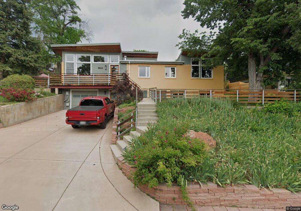
1745 Bluff St Boulder, CO 80304
Whittier NeighborhoodEstimated Value: $1,937,000 - $2,585,273
5
Beds
3
Baths
1,324
Sq Ft
$1,653/Sq Ft
Est. Value
About This Home
This home is located at 1745 Bluff St, Boulder, CO 80304 and is currently estimated at $2,188,758, approximately $1,653 per square foot. 1745 Bluff St is a home located in Boulder County with nearby schools including Whittier Elementary School, Casey Middle School, and Boulder High School.
Ownership History
Date
Name
Owned For
Owner Type
Purchase Details
Closed on
Jan 13, 2005
Sold by
Woolsey Betty J
Bought by
Nuzum Kent A
Current Estimated Value
Home Financials for this Owner
Home Financials are based on the most recent Mortgage that was taken out on this home.
Original Mortgage
$432,000
Outstanding Balance
$197,967
Interest Rate
4.37%
Mortgage Type
Purchase Money Mortgage
Estimated Equity
$1,990,791
Create a Home Valuation Report for This Property
The Home Valuation Report is an in-depth analysis detailing your home's value as well as a comparison with similar homes in the area
Home Values in the Area
Average Home Value in this Area
Purchase History
| Date | Buyer | Sale Price | Title Company |
|---|---|---|---|
| Nuzum Kent A | $540,000 | -- |
Source: Public Records
Mortgage History
| Date | Status | Borrower | Loan Amount |
|---|---|---|---|
| Open | Nuzum Kent A | $432,000 |
Source: Public Records
Tax History
| Year | Tax Paid | Tax Assessment Tax Assessment Total Assessment is a certain percentage of the fair market value that is determined by local assessors to be the total taxable value of land and additions on the property. | Land | Improvement |
|---|---|---|---|---|
| 2025 | $17,012 | $162,369 | $79,863 | $82,506 |
| 2024 | $17,012 | $162,369 | $79,863 | $82,506 |
| 2023 | $16,717 | $193,570 | $83,804 | $113,451 |
| 2022 | $13,497 | $145,345 | $63,613 | $81,732 |
| 2021 | $12,871 | $149,528 | $65,444 | $84,084 |
| 2020 | $10,168 | $116,817 | $56,986 | $59,831 |
| 2019 | $10,013 | $116,817 | $56,986 | $59,831 |
| 2018 | $9,277 | $106,999 | $42,912 | $64,087 |
| 2017 | $8,987 | $118,294 | $47,442 | $70,852 |
| 2016 | $8,629 | $99,683 | $39,880 | $59,803 |
| 2015 | $8,171 | $73,789 | $41,790 | $31,999 |
| 2014 | $6,204 | $73,789 | $41,790 | $31,999 |
Source: Public Records
Map
Nearby Homes
- 1730 Bluff St
- 2324 19th St
- 1749 Alpine Ave Unit 10
- 2236 17th St
- 1895 Alpine Ave Unit G22
- 1895 Alpine Ave Unit G21
- 1895 Alpine Ave Unit E18
- 1526 Sunset Blvd
- 2230 20th St
- 2870 18th St
- 2003 Balsam Dr
- 2895 18th St
- 1938 Spruce St
- 2935 17th St
- 1303 Alpine Ave Unit 29B
- 2940 18th St
- 2085 Balsam Dr
- 2240 Bluff St
- 1707 Walnut St Unit 203
- 1707 Walnut St Unit 307
- 1805 Bluff St
- 1725 Bluff St
- 1740 Sunset Blvd
- 1750 Sunset Blvd
- 1719 Bluff St
- 1720 Sunset Blvd
- 1811 Bluff St
- 1736 Bluff St
- 0 Bluff St Unit 979768
- 0 Bluff St Unit 974373
- 1715 Bluff St
- 1710 Sunset Blvd
- 1720 Bluff St
- 2341 18th St
- 2346 18th St
- 1770 Sunset Blvd
- 2342 18th St
- 1413 Bluff St
- 1718 Bluff St
- 2338 18th St
Your Personal Tour Guide
Ask me questions while you tour the home.