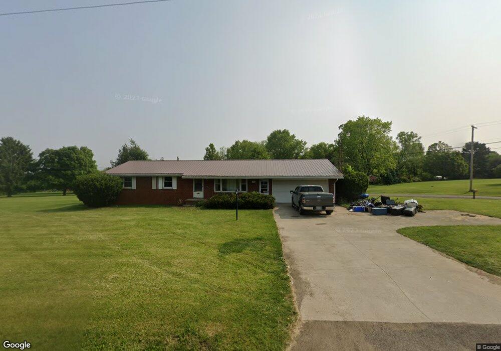
1745 Mansfield Lucas Rd Mansfield, OH 44903
Estimated Value: $217,388 - $227,000
3
Beds
2
Baths
1,305
Sq Ft
$170/Sq Ft
Est. Value
About This Home
This home is located at 1745 Mansfield Lucas Rd, Mansfield, OH 44903 and is currently estimated at $222,097, approximately $170 per square foot. 1745 Mansfield Lucas Rd is a home located in Richland County with nearby schools including St. Peter's Elementary/Montessori School and St. Peter's High School/Junior High.
Ownership History
Date
Name
Owned For
Owner Type
Purchase Details
Closed on
Jul 17, 2023
Sold by
Jones Jacqueline
Bought by
Kegley Jeffrey and Kegley Stephanie A
Current Estimated Value
Home Financials for this Owner
Home Financials are based on the most recent Mortgage that was taken out on this home.
Original Mortgage
$184,398
Outstanding Balance
$179,999
Interest Rate
6.79%
Mortgage Type
FHA
Estimated Equity
$42,098
Create a Home Valuation Report for This Property
The Home Valuation Report is an in-depth analysis detailing your home's value as well as a comparison with similar homes in the area
Home Values in the Area
Average Home Value in this Area
Purchase History
| Date | Buyer | Sale Price | Title Company |
|---|---|---|---|
| Kegley Jeffrey | $187,800 | Chicago Title |
Source: Public Records
Mortgage History
| Date | Status | Borrower | Loan Amount |
|---|---|---|---|
| Open | Kegley Jeffrey | $184,398 |
Source: Public Records
Tax History Compared to Growth
Tax History
| Year | Tax Paid | Tax Assessment Tax Assessment Total Assessment is a certain percentage of the fair market value that is determined by local assessors to be the total taxable value of land and additions on the property. | Land | Improvement |
|---|---|---|---|---|
| 2024 | $1,947 | $44,370 | $5,720 | $38,650 |
| 2023 | $1,947 | $44,370 | $5,720 | $38,650 |
| 2022 | $1,834 | $37,310 | $5,330 | $31,980 |
| 2021 | $1,860 | $37,310 | $5,330 | $31,980 |
| 2020 | $1,753 | $37,310 | $5,330 | $31,980 |
| 2019 | $1,652 | $31,620 | $4,520 | $27,100 |
| 2018 | $1,637 | $31,620 | $4,520 | $27,100 |
| 2017 | $1,605 | $31,620 | $4,520 | $27,100 |
| 2016 | $1,604 | $30,730 | $3,290 | $27,440 |
| 2015 | $1,604 | $30,730 | $3,290 | $27,440 |
| 2014 | $1,509 | $30,730 | $3,290 | $27,440 |
| 2012 | $731 | $31,680 | $3,390 | $28,290 |
Source: Public Records
Map
Nearby Homes
- 1875 Mansfield Lucas Rd
- 929 Antionette Dr
- 0 Woodville Rd Unit Lot 14952, 14953
- 0 Woodville Rd Unit Lot 14954, 14955
- 0 Woodville Rd Unit Lot 14956, 14957,
- 1679 Pulver Rd
- 0 State Route 39 & I-71 Southeast Quadrant
- 0 State Route 39 & I-71 Northeast Quadrant
- 794 Mansfield Washington Rd
- 2061 Washington North Rd
- 716 Mansfield Washington Rd
- 405 Plainview Ave
- 1135 E Hanley Rd
- 369 Davidson St
- 419 Pearl Ave
- 138 Cliffbrook Dr
- 1599 S Main St
- 413 Ruby Ave
- 1680 S Main St
- 65 Logan Rd
- 2834 Scenic View Dr
- 995 Chew Rd
- 960 Chew Rd
- 1744 Mansfield Lucas Rd
- 1768 Mansfield Lucas Rd
- 988 Chew Rd
- 1715 Mansfield Lucas Rd
- 0 Sandy Ln
- 1227 Washington North Rd
- 1714 Mansfield Lucas Rd
- 1017 Chew Rd
- 1701 Mansfield Lucas Rd
- 1014 Chew Rd
- 1244 Washington North Rd
- 1724 Denzler Cir
- 1344 Sandy Ln
- 1021 Chew Rd
- 1801 Mansfield Lucas Rd
- 1694 Mansfield Lucas Rd
- 1029 Chew Rd