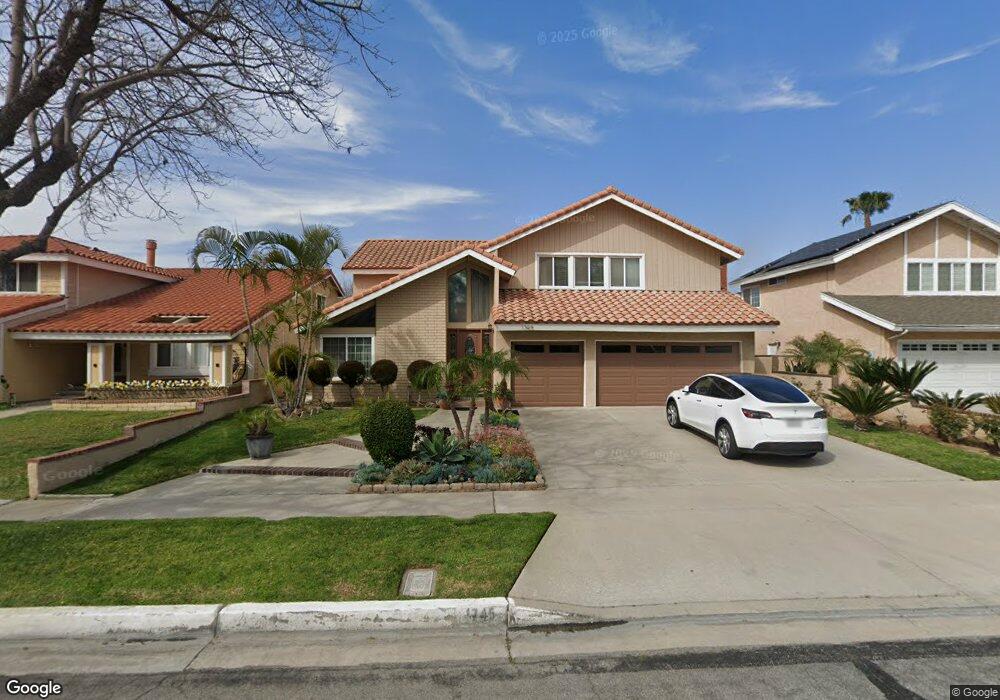
1745 N Pheasant St Unit 132 Anaheim, CA 92806
North Anaheim NeighborhoodEstimated Value: $1,130,000 - $1,390,000
4
Beds
3
Baths
2,919
Sq Ft
$434/Sq Ft
Est. Value
About This Home
This home is located at 1745 N Pheasant St Unit 132, Anaheim, CA 92806 and is currently estimated at $1,267,413, approximately $434 per square foot. 1745 N Pheasant St Unit 132 is a home located in Orange County with nearby schools including Morse Avenue Elementary School, Kraemer Middle School, and Valencia High School.
Ownership History
Date
Name
Owned For
Owner Type
Purchase Details
Closed on
Aug 29, 2018
Sold by
Bhatia Sheena
Bought by
Bhatia Sheena and The Sheena Bhatia Trust
Current Estimated Value
Purchase Details
Closed on
Aug 3, 1998
Sold by
Western Pacific Housing San Simeon Lp
Bought by
Switzer Donald E
Home Financials for this Owner
Home Financials are based on the most recent Mortgage that was taken out on this home.
Original Mortgage
$188,000
Interest Rate
6.82%
Create a Home Valuation Report for This Property
The Home Valuation Report is an in-depth analysis detailing your home's value as well as a comparison with similar homes in the area
Home Values in the Area
Average Home Value in this Area
Purchase History
| Date | Buyer | Sale Price | Title Company |
|---|---|---|---|
| Bhatia Sheena | -- | None Available | |
| Switzer Donald E | $185,000 | First American Title Ins Co |
Source: Public Records
Mortgage History
| Date | Status | Borrower | Loan Amount |
|---|---|---|---|
| Previous Owner | Switzer Donald E | $188,000 |
Source: Public Records
Tax History Compared to Growth
Tax History
| Year | Tax Paid | Tax Assessment Tax Assessment Total Assessment is a certain percentage of the fair market value that is determined by local assessors to be the total taxable value of land and additions on the property. | Land | Improvement |
|---|---|---|---|---|
| 2025 | $4,586 | $411,521 | $147,925 | $263,596 |
| 2024 | $4,586 | $403,452 | $145,024 | $258,428 |
| 2023 | $4,507 | $395,542 | $142,181 | $253,361 |
| 2022 | $4,469 | $387,787 | $139,393 | $248,394 |
| 2021 | $4,394 | $380,184 | $136,660 | $243,524 |
| 2020 | $4,404 | $376,286 | $135,259 | $241,027 |
| 2019 | $4,252 | $368,908 | $132,607 | $236,301 |
| 2018 | $4,199 | $361,675 | $130,007 | $231,668 |
| 2017 | $4,130 | $354,584 | $127,458 | $227,126 |
| 2016 | $4,047 | $347,632 | $124,959 | $222,673 |
| 2015 | $4,002 | $342,411 | $123,082 | $219,329 |
| 2014 | $3,884 | $335,704 | $120,671 | $215,033 |
Source: Public Records
Map
Nearby Homes
- 212 S Kraemer Blvd Unit 2602
- 212 S Kraemer Blvd
- 212 S Kraemer Blvd Unit 709
- 212 S Kraemer Blvd Unit 1106
- 212 S Kraemer Blvd Unit 2208
- 212 S Kraemer Blvd Unit 1205
- 376 Hawaii Way
- 102 Kauai Ln
- 210 Silverlake Dr Unit 103
- 325 E Concord Way
- 161 E Orangethorpe Ave Unit 65
- 125 Alta St
- 410 N Angelina Dr
- 315 W Santa fe Ave
- 549 Fordham Dr
- 201 S Melrose St
- 744 N Angelina Dr
- 747 De Jesus Dr
- 325 W La Jolla St
- 407 Lavender Ln
- 1751 N Pheasant St
- 1741 N Pheasant St
- 1746 N Meadowlark Ln
- 1742 N Meadowlark Ln
- 1755 N Pheasant St
- 1735 N Pheasant St
- 1752 N Meadowlark Ln
- 1736 N Meadowlark Ln
- 1756 N Meadowlark Ln
- 1732 N Meadowlark Ln
- 1742 N Pheasant St
- 1750 N Pheasant St
- 1731 N Pheasant St
- 1761 N Pheasant St
- 1738 N Pheasant St
- 1754 N Pheasant St
- 1762 N Meadowlark Ln
- 1734 N Pheasant St
- 1758 N Pheasant St
- 1726 N Meadowlark Ln