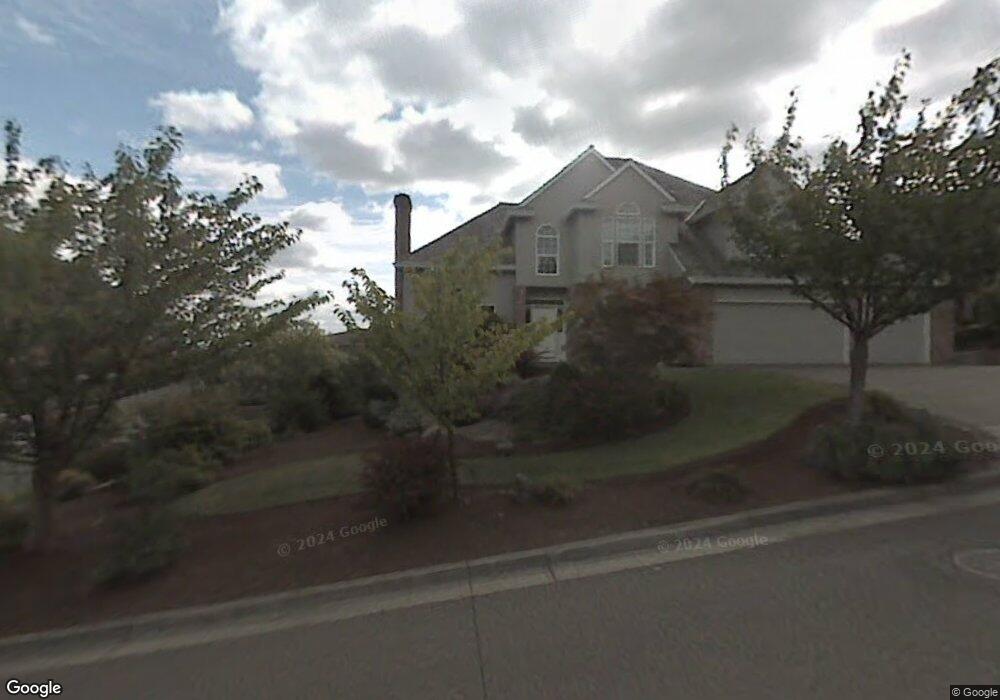
17455 Brookhurst Dr Lake Oswego, OR 97034
Robinwood NeighborhoodEstimated Value: $1,063,246 - $1,148,000
4
Beds
3
Baths
2,884
Sq Ft
$386/Sq Ft
Est. Value
About This Home
This home is located at 17455 Brookhurst Dr, Lake Oswego, OR 97034 and is currently estimated at $1,114,562, approximately $386 per square foot. 17455 Brookhurst Dr is a home located in Clackamas County with nearby schools including Hallinan Elementary School, Lakeridge Middle School, and Lakeridge High School.
Ownership History
Date
Name
Owned For
Owner Type
Purchase Details
Closed on
Apr 25, 2016
Sold by
Mellor Thomas G and Mellor Doris J
Bought by
Howe Scott S and Howe Rachel
Current Estimated Value
Home Financials for this Owner
Home Financials are based on the most recent Mortgage that was taken out on this home.
Original Mortgage
$615,600
Outstanding Balance
$487,730
Interest Rate
3.68%
Mortgage Type
New Conventional
Estimated Equity
$626,832
Purchase Details
Closed on
Sep 24, 1996
Sold by
Apperson Stanley R
Bought by
Wallace Construction Co Inc
Create a Home Valuation Report for This Property
The Home Valuation Report is an in-depth analysis detailing your home's value as well as a comparison with similar homes in the area
Home Values in the Area
Average Home Value in this Area
Purchase History
| Date | Buyer | Sale Price | Title Company |
|---|---|---|---|
| Howe Scott S | $648,000 | Wfg Title | |
| Wallace Construction Co Inc | $114,512 | First American Title Ins Co |
Source: Public Records
Mortgage History
| Date | Status | Borrower | Loan Amount |
|---|---|---|---|
| Open | Howe Scott S | $615,600 |
Source: Public Records
Tax History Compared to Growth
Tax History
| Year | Tax Paid | Tax Assessment Tax Assessment Total Assessment is a certain percentage of the fair market value that is determined by local assessors to be the total taxable value of land and additions on the property. | Land | Improvement |
|---|---|---|---|---|
| 2025 | $13,075 | $682,331 | -- | -- |
| 2024 | $12,726 | $662,458 | -- | -- |
| 2023 | $12,726 | $643,164 | $0 | $0 |
| 2022 | $11,986 | $624,432 | $0 | $0 |
| 2021 | $11,069 | $606,245 | $0 | $0 |
| 2020 | $10,605 | $588,588 | $0 | $0 |
| 2019 | $10,463 | $571,445 | $0 | $0 |
| 2018 | $9,888 | $554,801 | $0 | $0 |
| 2017 | $9,511 | $538,642 | $0 | $0 |
| 2016 | $8,641 | $522,953 | $0 | $0 |
| 2015 | $8,175 | $507,721 | $0 | $0 |
| 2014 | $7,955 | $492,933 | $0 | $0 |
Source: Public Records
Map
Nearby Homes
- 17514 Brookhurst Dr
- 17623 Brookhurst Dr
- 17634 Brookhurst Dr
- 1777 Skyland Dr
- 1354 Skye Pkwy
- 2455 College Hill Place
- 17833 Marylcreek Dr
- 1384 Celtic Ct
- 2147 Glenmorrie Ln
- 17900 Crestline Dr
- 1261 Wells St
- 1397 Skye Pkwy
- 17700 Upper Cherry Ln
- 2167 Marylwood Ct
- 777 Cherry Cir
- 2636 Maria Ct
- 200 Burnham Rd Unit 200
- 1321 Troon Dr
- 1060 Upper Devon Ln
- 2041 Marylhurst Dr
- 17433 Brookhurst Dr
- 2325 Oakhurst Ln
- 2313 Oakhurst Ln
- 17430 Brookhurst Ct
- 17478 Brookhurst Dr
- 17485 Brookhurst Dr
- 2337 Oakhurst Ln
- 2301 Oakhurst Ln
- 1920 Glenmorrie Dr
- 17442 Brookhurst Ct
- 17497 Brookhurst Dr
- 2349 Oakhurst Ln
- 2340 Oakhurst Ln
- 17454 Brookhurst Ct
- 17403 Brookhurst Dr
- 2328 Oakhurst Ln
- 17490 Brookhurst Dr
- 17450 Greenbluff Dr
- 2304 Oakhurst Ln
- 17519 Brookhurst Dr