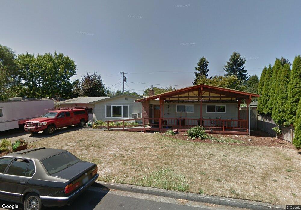
1746 Hemlock St Eugene, OR 97404
River Road NeighborhoodEstimated Value: $455,000 - $496,000
4
Beds
3
Baths
1,926
Sq Ft
$245/Sq Ft
Est. Value
About This Home
This home is located at 1746 Hemlock St, Eugene, OR 97404 and is currently estimated at $471,106, approximately $244 per square foot. 1746 Hemlock St is a home located in Lane County with nearby schools including Howard Elementary School, Kelly Middle School, and North Eugene High School.
Ownership History
Date
Name
Owned For
Owner Type
Purchase Details
Closed on
Nov 17, 2010
Sold by
Swartz Samuel R and Swartz Brenda J
Bought by
Swartz Samuel R and Swartz Brenda J
Current Estimated Value
Purchase Details
Closed on
Jul 8, 2007
Sold by
Kenney Ruth M
Bought by
Swartz Samuel R and Swartz Brenda J
Home Financials for this Owner
Home Financials are based on the most recent Mortgage that was taken out on this home.
Original Mortgage
$194,250
Interest Rate
6.62%
Mortgage Type
Purchase Money Mortgage
Purchase Details
Closed on
May 26, 1999
Sold by
Key Title Company
Bought by
Sayers Ruth M
Create a Home Valuation Report for This Property
The Home Valuation Report is an in-depth analysis detailing your home's value as well as a comparison with similar homes in the area
Home Values in the Area
Average Home Value in this Area
Purchase History
| Date | Buyer | Sale Price | Title Company |
|---|---|---|---|
| Swartz Samuel R | -- | None Available | |
| Swartz Samuel R | $204,500 | Fidelity National Title Insu | |
| Sayers Ruth M | -- | Key Title Company |
Source: Public Records
Mortgage History
| Date | Status | Borrower | Loan Amount |
|---|---|---|---|
| Previous Owner | Swartz Samuel R | $194,250 |
Source: Public Records
Tax History
| Year | Tax Paid | Tax Assessment Tax Assessment Total Assessment is a certain percentage of the fair market value that is determined by local assessors to be the total taxable value of land and additions on the property. | Land | Improvement |
|---|---|---|---|---|
| 2025 | $4,019 | $239,229 | -- | -- |
| 2024 | $3,975 | $232,262 | -- | -- |
| 2023 | $3,975 | $225,498 | $0 | $0 |
| 2022 | $3,739 | $218,931 | $0 | $0 |
| 2021 | $3,477 | $212,555 | $0 | $0 |
| 2020 | $3,502 | $206,365 | $0 | $0 |
| 2019 | $3,378 | $200,355 | $0 | $0 |
| 2018 | $2,715 | $162,711 | $0 | $0 |
| 2017 | $2,537 | $162,711 | $0 | $0 |
| 2016 | $2,398 | $157,972 | $0 | $0 |
| 2015 | $2,341 | $153,371 | $0 | $0 |
| 2014 | $2,352 | $148,904 | $0 | $0 |
Source: Public Records
Map
Nearby Homes
- 1755 Brentwood Ave
- 1682 Hemlock St
- 1566 Maywood Ave
- 1307 Bramblewood Ln
- 389 Maxwell Rd
- 1880 Manihi Dr
- 401 Sterling Dr
- 541 Durham Ave
- 303 Lenore Loop
- 1314 Dalton Dr
- 2439 Quince St
- 2563 York St
- 1487 Barton St
- 1483 Barton St
- 2418 Kalmia St
- 788 Cornwall Ave
- 193 Santa Clara Ave
- 1360 Andersen Ln
- 805 Impala Ave
- 2002 Kintyre St
- 1758 Hemlock St
- 809 Fremont Ave
- 1741 Brentwood Ave
- 835 Fremont Ave
- 1733 Hemlock St
- 1770 Hemlock St
- 1757 Hemlock St
- 795 Fremont Ave
- 1769 Brentwood Ave
- 1769 Hemlock St
- 822 Fremont Ave
- 810 Fremont Ave
- 1782 Hemlock St
- 1742 Brentwood Ave
- 1783 Brentwood Ave
- 798 Fremont Ave
- 775 Fremont Ave
- 855 Fremont Ave
- 1754 Maywood Ave
- 1756 Brentwood Ave
Your Personal Tour Guide
Ask me questions while you tour the home.