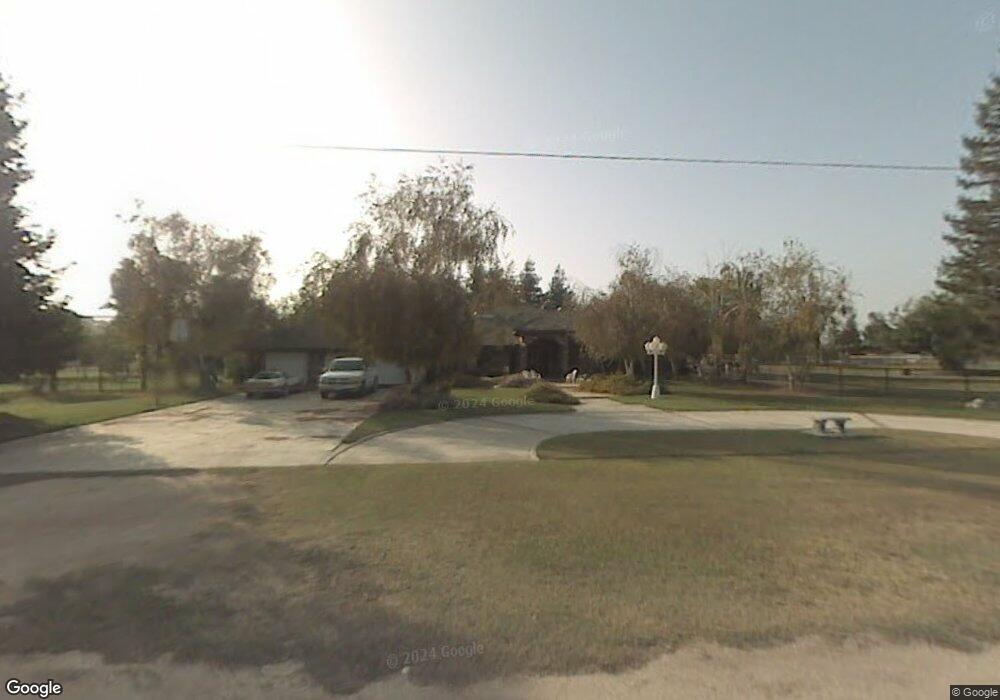
1747 Angie Ct Bakersfield, CA 93314
Estimated Value: $608,000 - $952,000
4
Beds
3
Baths
2,706
Sq Ft
$304/Sq Ft
Est. Value
About This Home
This home is located at 1747 Angie Ct, Bakersfield, CA 93314 and is currently estimated at $821,381, approximately $303 per square foot. 1747 Angie Ct is a home located in Kern County with nearby schools including Rio Bravo-Greeley Elementary School, Rio Bravo Elementary School, and Liberty High School.
Ownership History
Date
Name
Owned For
Owner Type
Purchase Details
Closed on
Aug 14, 2015
Sold by
Tanner Michael A and Tanner Suzanne J
Bought by
The Tanner Family Trust
Current Estimated Value
Purchase Details
Closed on
Mar 21, 2005
Sold by
Gallo Berenice C
Bought by
Gallo Raul E
Purchase Details
Closed on
Nov 1, 1994
Sold by
Byers Charles G and Byers Jennifer
Bought by
Tanner Michael A and Tanner Suzanne J
Create a Home Valuation Report for This Property
The Home Valuation Report is an in-depth analysis detailing your home's value as well as a comparison with similar homes in the area
Home Values in the Area
Average Home Value in this Area
Purchase History
| Date | Buyer | Sale Price | Title Company |
|---|---|---|---|
| The Tanner Family Trust | -- | None Available | |
| Gallo Raul E | -- | -- | |
| Tanner Michael A | -- | -- |
Source: Public Records
Tax History Compared to Growth
Tax History
| Year | Tax Paid | Tax Assessment Tax Assessment Total Assessment is a certain percentage of the fair market value that is determined by local assessors to be the total taxable value of land and additions on the property. | Land | Improvement |
|---|---|---|---|---|
| 2025 | $5,133 | $388,391 | $82,550 | $305,841 |
| 2024 | $5,032 | $380,777 | $80,932 | $299,845 |
| 2023 | $5,032 | $373,312 | $79,346 | $293,966 |
| 2022 | $5,036 | $365,993 | $77,791 | $288,202 |
| 2021 | $4,911 | $358,817 | $76,266 | $282,551 |
| 2020 | $4,755 | $355,138 | $75,484 | $279,654 |
| 2019 | $4,651 | $355,138 | $75,484 | $279,654 |
| 2018 | $4,461 | $341,349 | $72,553 | $268,796 |
| 2017 | $4,400 | $334,657 | $71,131 | $263,526 |
| 2016 | $4,116 | $328,096 | $69,737 | $258,359 |
| 2015 | $3,982 | $323,169 | $68,690 | $254,479 |
| 2014 | $3,914 | $316,840 | $67,345 | $249,495 |
Source: Public Records
Map
Nearby Homes
- 16451 Barton Ln
- 16725 Weatherly Ct
- 16719 Keystone Place
- 16711 Keystone Place
- 17343 Havenridge Dr
- 17340 Legend Oaks Ln
- 15918 Clos du Val Ave
- 15803 Screaming Eagle Ave
- 15733 Joseph Phelps Ave
- 15708 Joseph Phelps Ave
- 17633 Legend Oaks Ln
- 921 Christian Ave
- 8317 Littleton St
- 15626 Sammie Ave
- 1933 Kellie Marie St
- 15427 Chateau Montelena Dr
- 2539 Marva Marie Ct
- 15357 Chateau Montelena Dr
- 15321 Lake Berryessa Ct
- 836 Nord Ave