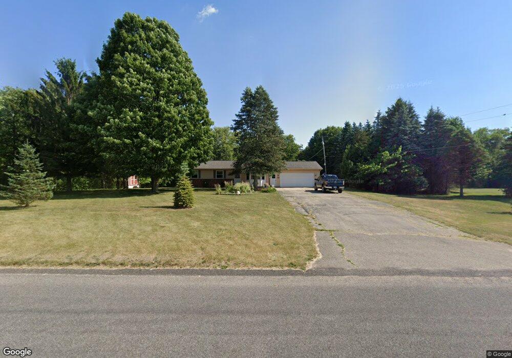
1748 18 Mile Rd NE Cedar Springs, MI 49319
Estimated Value: $330,056 - $410,000
2
Beds
2
Baths
1,101
Sq Ft
$331/Sq Ft
Est. Value
About This Home
This home is located at 1748 18 Mile Rd NE, Cedar Springs, MI 49319 and is currently estimated at $364,019, approximately $330 per square foot. 1748 18 Mile Rd NE is a home located in Kent County with nearby schools including Kent City Elementary School, Kent City Middle School, and Kent City High School.
Ownership History
Date
Name
Owned For
Owner Type
Purchase Details
Closed on
Dec 21, 2023
Sold by
Forrest Michael D and Forrest Mary C
Bought by
Forrest Family Trust and Forrest
Current Estimated Value
Purchase Details
Closed on
Jul 18, 2008
Sold by
Goemaat Janet R
Bought by
Forrest Mary C and Forrest Michael D
Home Financials for this Owner
Home Financials are based on the most recent Mortgage that was taken out on this home.
Original Mortgage
$161,500
Interest Rate
6.36%
Mortgage Type
Purchase Money Mortgage
Purchase Details
Closed on
Aug 22, 2007
Sold by
Goodell Richard B and Goodell Betty K
Bought by
Goemaat Janet R
Create a Home Valuation Report for This Property
The Home Valuation Report is an in-depth analysis detailing your home's value as well as a comparison with similar homes in the area
Home Values in the Area
Average Home Value in this Area
Purchase History
| Date | Buyer | Sale Price | Title Company |
|---|---|---|---|
| Forrest Family Trust | -- | None Listed On Document | |
| Forrest Mary C | $170,000 | Ppr Title Agency | |
| Goemaat Janet R | -- | None Available |
Source: Public Records
Mortgage History
| Date | Status | Borrower | Loan Amount |
|---|---|---|---|
| Previous Owner | Forrest Mary C | $161,500 |
Source: Public Records
Tax History Compared to Growth
Tax History
| Year | Tax Paid | Tax Assessment Tax Assessment Total Assessment is a certain percentage of the fair market value that is determined by local assessors to be the total taxable value of land and additions on the property. | Land | Improvement |
|---|---|---|---|---|
| 2025 | $1,591 | $137,900 | $0 | $0 |
| 2024 | $1,591 | $121,800 | $0 | $0 |
| 2023 | $1,521 | $107,100 | $0 | $0 |
| 2022 | $1,966 | $101,000 | $0 | $0 |
| 2021 | $1,915 | $93,200 | $0 | $0 |
| 2020 | $1,400 | $88,900 | $0 | $0 |
| 2019 | $1,831 | $84,000 | $0 | $0 |
| 2018 | $1,831 | $77,100 | $0 | $0 |
| 2017 | $1,782 | $69,200 | $0 | $0 |
| 2016 | $1,716 | $66,200 | $0 | $0 |
| 2015 | -- | $66,200 | $0 | $0 |
| 2013 | -- | $56,200 | $0 | $0 |
Source: Public Records
Map
Nearby Homes
- 2169 Quarter Horse Dr NE
- 2070 Solon St NE
- 2217 Quarter Horse Dr NE Unit 27
- 2358 Quarter Horse Dr Unit 3
- The Taylor Plan at Saddlebrook
- The Stockton Plan at Saddlebrook
- The Stafford Plan at Saddlebrook
- The Rowen Plan at Saddlebrook
- The Mayfair Plan at Saddlebrook
- The Brinley Plan at Saddlebrook
- The Amber Plan at Saddlebrook
- The Maxwell Plan at Saddlebrook
- The Wisteria Plan at Saddlebrook
- The Georgetown Plan at Saddlebrook
- The Balsam Plan at Saddlebrook
- The Grayson Plan at Saddlebrook
- 2329 Quarter Horse Dr NE Unit 35
- 2347 Quarter Horse Dr NE Unit 36
- 14551 Algoma Ave NE
- 15175 Hanna Ave NE
- 1822 18 Mile Rd NE
- 1822 18 Mile Rd NE Unit G
- 1880 18 Mile Rd NE
- 1880 18 Mile Rd NE Unit F
- 1605 18 Mile Rd NE
- 1745 18 Mile Rd NE
- 1920 18 Mile Rd NE
- 1570 18 Mile Rd NE
- 1551 18 Mile Rd NE
- 1960 18 Mile Rd NE
- 1990 18 Mile Rd NE
- 1550 18 Mile Rd NE
- 1976 18 Mile Rd NE
- 1525 18 Mile Rd NE
- 1560 18 Mile Rd NE
- 1564 18 Mile Rd NE
- 2012 18 Mile Rd NE
- 1675 18 Mile Rd NE
- 2050 18 Mile Rd NE
- 2059 18 Mile Rd NE