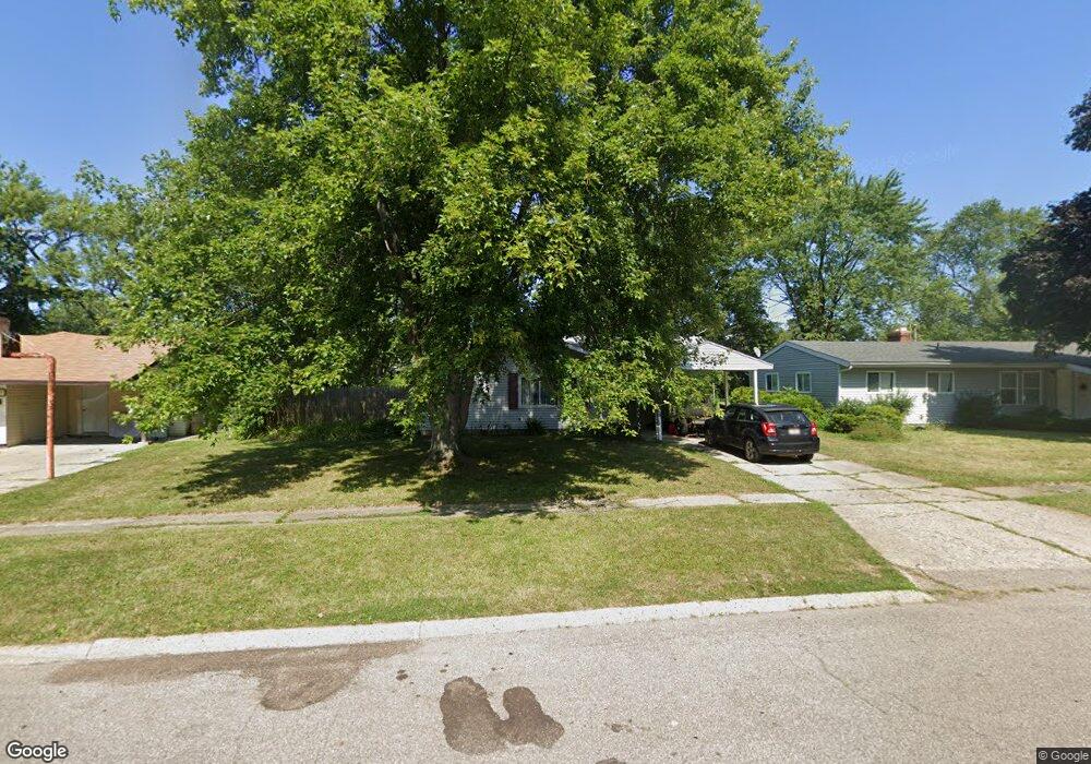
1748 Carmanbrook Pkwy Flint, MI 48507
South Side NeighborhoodEstimated Value: $97,461 - $109,000
3
Beds
1
Bath
1,203
Sq Ft
$86/Sq Ft
Est. Value
About This Home
This home is located at 1748 Carmanbrook Pkwy, Flint, MI 48507 and is currently estimated at $103,115, approximately $85 per square foot. 1748 Carmanbrook Pkwy is a home located in Genesee County with nearby schools including Neithercut Elementary School, Flint Southwestern Classical Academy, and International Academy of Flint (K-12).
Ownership History
Date
Name
Owned For
Owner Type
Purchase Details
Closed on
Feb 16, 2010
Sold by
Hixon Richard M and Hixon Peggy H
Bought by
Lollar David C and Lollar Mary J
Current Estimated Value
Purchase Details
Closed on
Oct 18, 2007
Sold by
Ryan Gregory C
Bought by
Hixon Richard M
Purchase Details
Closed on
Sep 24, 2007
Sold by
Ryan Linda
Bought by
Ryan Gregory C
Purchase Details
Closed on
Sep 12, 2007
Sold by
Ryan Linda
Bought by
Ryan Gregory C
Create a Home Valuation Report for This Property
The Home Valuation Report is an in-depth analysis detailing your home's value as well as a comparison with similar homes in the area
Home Values in the Area
Average Home Value in this Area
Purchase History
| Date | Buyer | Sale Price | Title Company |
|---|---|---|---|
| Lollar David C | $34,500 | First American Title Ins Co | |
| Hixon Richard M | $44,000 | None Available | |
| Ryan Gregory C | -- | None Available | |
| Ryan Gregory C | -- | None Available |
Source: Public Records
Tax History
| Year | Tax Paid | Tax Assessment Tax Assessment Total Assessment is a certain percentage of the fair market value that is determined by local assessors to be the total taxable value of land and additions on the property. | Land | Improvement |
|---|---|---|---|---|
| 2025 | $1,395 | $43,400 | $0 | $0 |
| 2024 | $1,250 | $39,300 | $0 | $0 |
| 2023 | $1,219 | $33,500 | $0 | $0 |
| 2022 | $0 | $28,200 | $0 | $0 |
| 2021 | $1,277 | $21,300 | $0 | $0 |
| 2020 | $1,137 | $19,900 | $0 | $0 |
| 2019 | $1,236 | $18,200 | $0 | $0 |
| 2018 | $1,130 | $17,600 | $0 | $0 |
| 2017 | $1,097 | $0 | $0 | $0 |
| 2016 | $1,089 | $0 | $0 | $0 |
| 2015 | -- | $0 | $0 | $0 |
| 2014 | -- | $0 | $0 | $0 |
| 2012 | -- | $20,900 | $0 | $0 |
Source: Public Records
Map
Nearby Homes
- 1741 Carmanbrook Pkwy
- 1814 Carmanbrook Pkwy
- 1727 Briarwood Dr
- 1506 Pettibone Ave
- 1514 W Atherton Rd
- 1836 Willowbrook Cir
- 1814 Penbrook Ln
- 1413 Lincoln Ave
- 4101 Greenbrook Ln
- 1410 Berrywood Ln
- 1826 Greenbrook Ln
- 4302 Huckleberry Ln
- 1902 Rockcreek Ln
- 1130 W Atherton Rd
- 1310 Alvord Ave
- 1933 Greenbriar Ln
- 1310 Huron St
- 4202 Park Forest Dr
- 4502 Huckleberry Ln
- 1234 Huron St
- 1802 Carmanbrook Pkwy
- 1744 Carmanbrook Pkwy
- 1713 Bayberry Ln
- 1709 Bayberry Ln
- 1806 Carmanbrook Pkwy
- 1717 Bayberry Ln
- 1701 Bayberry Ln
- 1810 Carmanbrook Pkwy
- 1721 Bayberry Ln
- 3602 Briarwood Dr
- 1736 Camanbrook Pkwy
- 1736 Carmanbrook Pkwy
- 3514 Briarwood Dr
- 1807 Carmanbrook Pkwy Unit Bldg-Unit
- 1807 Carmanbrook Pkwy
- 1801 Bayberry Ln
- 3608 Briarwood Dr
- 1730 Carmanbrook Pkwy
- 1702 Bayberry Ln
- 1718 Bayberry Ln
Your Personal Tour Guide
Ask me questions while you tour the home.