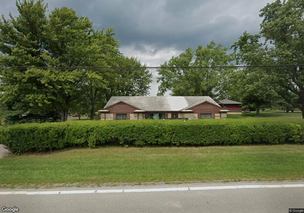
17481 State Route 67 Kenton, OH 43326
Estimated Value: $237,000 - $317,000
2
Beds
3
Baths
2,624
Sq Ft
$109/Sq Ft
Est. Value
About This Home
This home is located at 17481 State Route 67, Kenton, OH 43326 and is currently estimated at $287,102, approximately $109 per square foot. 17481 State Route 67 is a home located in Hardin County with nearby schools including Kenton Elementary School, Kenton Middle School, and Kenton High School.
Ownership History
Date
Name
Owned For
Owner Type
Purchase Details
Closed on
Apr 14, 2023
Sold by
H & P Rentals Llc
Bought by
Kinney Megan Nicole
Current Estimated Value
Home Financials for this Owner
Home Financials are based on the most recent Mortgage that was taken out on this home.
Original Mortgage
$253,326
Outstanding Balance
$246,050
Interest Rate
6.42%
Mortgage Type
FHA
Estimated Equity
$41,052
Purchase Details
Closed on
Aug 17, 2015
Sold by
Us Bank Na
Bought by
H & P Rentals Llc
Purchase Details
Closed on
Jan 27, 2015
Sold by
Brown Jeremy W and Brown Debra L
Bought by
U S Bank Na
Purchase Details
Closed on
Jul 31, 2003
Bought by
Fisher Frank H
Purchase Details
Closed on
Feb 2, 1990
Create a Home Valuation Report for This Property
The Home Valuation Report is an in-depth analysis detailing your home's value as well as a comparison with similar homes in the area
Home Values in the Area
Average Home Value in this Area
Purchase History
| Date | Buyer | Sale Price | Title Company |
|---|---|---|---|
| Kinney Megan Nicole | $258,000 | None Listed On Document | |
| H & P Rentals Llc | $35,000 | None Available | |
| U S Bank Na | $77,333 | None Available | |
| Fisher Frank H | -- | -- | |
| -- | $65,000 | -- |
Source: Public Records
Mortgage History
| Date | Status | Borrower | Loan Amount |
|---|---|---|---|
| Open | Kinney Megan Nicole | $253,326 |
Source: Public Records
Tax History Compared to Growth
Tax History
| Year | Tax Paid | Tax Assessment Tax Assessment Total Assessment is a certain percentage of the fair market value that is determined by local assessors to be the total taxable value of land and additions on the property. | Land | Improvement |
|---|---|---|---|---|
| 2024 | $2,928 | $70,010 | $5,670 | $64,340 |
| 2023 | $2,928 | $70,010 | $5,670 | $64,340 |
| 2022 | $2,797 | $60,650 | $4,420 | $56,230 |
| 2021 | $2,808 | $60,650 | $4,420 | $56,230 |
| 2020 | $2,434 | $60,650 | $4,420 | $56,230 |
| 2019 | $1,900 | $49,130 | $4,210 | $44,920 |
| 2018 | $1,902 | $49,130 | $4,210 | $44,920 |
| 2017 | $1,685 | $49,130 | $4,210 | $44,920 |
| 2016 | $1,499 | $41,360 | $3,690 | $37,670 |
| 2015 | $1,481 | $41,360 | $3,690 | $37,670 |
| 2014 | $856 | $41,360 | $3,690 | $37,670 |
| 2013 | -- | $43,400 | $3,690 | $39,710 |
Source: Public Records
Map
Nearby Homes
- 18322 State Route 67
- 12126 Pamela Dr
- 12535 Barbara Dr
- 12160 Pamela Dr
- 125 Hester St
- 777 Maydoll Dr
- 460 Oriental St
- 79 Broadway St
- 115 Scioto St
- 618 N High St
- 530 E Franklin St
- 513 E Franklin St
- 416 N Cherry St
- 602 N Wayne St
- 215 Henry St
- 506 E Franklin St
- 324 E North St
- 121 S High St
- 510 Decatur St
- 233 N Main St
- 10307 Tr 189
- 10307 Township Road 189
- 17513 Ohio 67
- 17513 State Route 67
- 17451 State Route 67
- 10283 Township Road 189
- 17451 Ohio 67
- 10261 Township Road 189
- 10241 Township Road 189
- 17369 State Route 67
- 17253 State Route 67
- 17326 State Route 67
- 17686 State Route 67
- 17217 State Route 67
- 9970 Township Road 189
- 17037 State Route 67
- 17037 State Route 67
- 10527 County Road 195