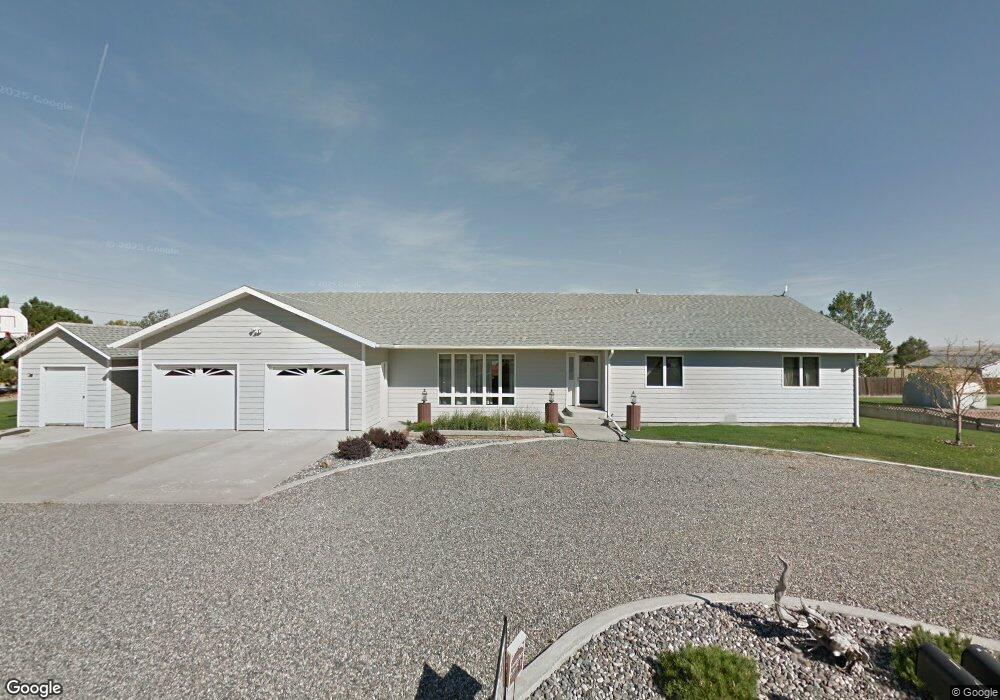
1749 Groshelle Blvd Laurel, MT 59044
Estimated Value: $420,000 - $475,000
3
Beds
3
Baths
2,016
Sq Ft
$221/Sq Ft
Est. Value
About This Home
This home is located at 1749 Groshelle Blvd, Laurel, MT 59044 and is currently estimated at $445,498, approximately $220 per square foot. 1749 Groshelle Blvd is a home located in Yellowstone County with nearby schools including Fred W. Graff School, West School, and Laurel Middle School.
Ownership History
Date
Name
Owned For
Owner Type
Purchase Details
Closed on
May 25, 2012
Sold by
Gustafson Bette M
Bought by
Vandersloot Perry J and Vandersloot Janet L
Current Estimated Value
Home Financials for this Owner
Home Financials are based on the most recent Mortgage that was taken out on this home.
Original Mortgage
$176,800
Outstanding Balance
$122,208
Interest Rate
3.85%
Mortgage Type
New Conventional
Estimated Equity
$323,290
Create a Home Valuation Report for This Property
The Home Valuation Report is an in-depth analysis detailing your home's value as well as a comparison with similar homes in the area
Home Values in the Area
Average Home Value in this Area
Purchase History
| Date | Buyer | Sale Price | Title Company |
|---|---|---|---|
| Vandersloot Perry J | -- | None Available |
Source: Public Records
Mortgage History
| Date | Status | Borrower | Loan Amount |
|---|---|---|---|
| Open | Vandersloot Perry J | $176,800 |
Source: Public Records
Tax History
| Year | Tax Paid | Tax Assessment Tax Assessment Total Assessment is a certain percentage of the fair market value that is determined by local assessors to be the total taxable value of land and additions on the property. | Land | Improvement |
|---|---|---|---|---|
| 2025 | $2,626 | $478,800 | $80,181 | $398,619 |
| 2024 | $2,626 | $382,300 | $52,144 | $330,156 |
| 2023 | $2,588 | $382,300 | $52,144 | $330,156 |
| 2022 | $2,182 | $314,800 | $0 | $0 |
| 2021 | $2,187 | $314,800 | $0 | $0 |
| 2020 | $2,144 | $303,200 | $0 | $0 |
| 2019 | $2,055 | $303,200 | $0 | $0 |
| 2018 | $2,240 | $287,000 | $0 | $0 |
| 2017 | $1,880 | $287,000 | $0 | $0 |
| 2016 | $2,046 | $293,500 | $0 | $0 |
| 2015 | $2,011 | $293,500 | $0 | $0 |
| 2014 | $1,606 | $126,617 | $0 | $0 |
Source: Public Records
Map
Nearby Homes
- 1631 Valley Dr
- 1735 Lobo Dr
- 1319 Valley Dr
- 1960 Coyote Ridge Rd N
- 1254 W Beartooth Dr
- 1216 W 12th Street Cir
- 1013 W 12th St
- 1109 10th Ave
- 809 Pennsylvania Ave
- 1031 Fir Ave
- 1014 Rochelle Ln
- 603 5th Ave
- TBD Block 3 Lot 6
- 516 Pennsylvania Ave
- 110 E 5th St
- 1104 E 8th St
- 601 E 5th St
- 1108 E 8th St
- 414 Wyoming Ave
- 717 E 5th, 506 Alder Ave
- 120 Perso Place
- 1754 Groshelle Blvd
- 1737 Groshelle Blvd
- 1736 1st Ave
- 1756 Cove Ln
- 0 Buffalo Trail Rd
- 1725 Groshelle Blvd
- 1726 Groshelle Blvd
- 1724 Buffalo Trail Rd
- 1755 Cove Ln
- 1746 Cove Ln
- 1718 Groshelle Blvd
- 1706 1st Ave
- 1710 Groshelle Blvd
- 1707 Valley Dr
- 1638 Cove Ln
- 1702 Groshelle Blvd
- 1702 1st Ave
- 1711 Valley Dr
- 1713 Valley Dr
Your Personal Tour Guide
Ask me questions while you tour the home.