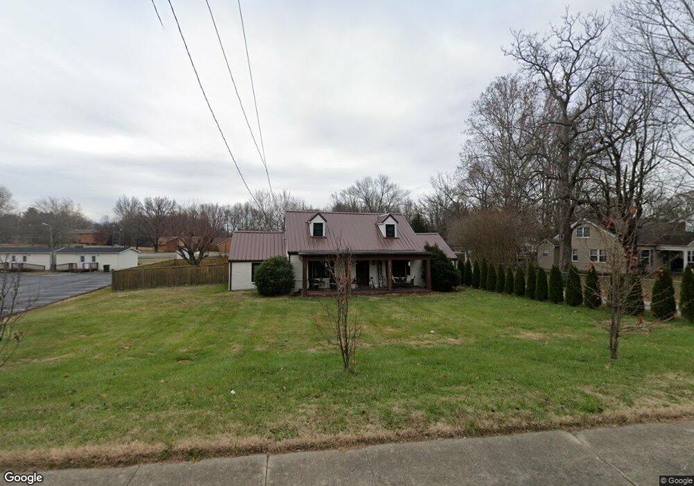
1749 Highway 41 S Ridgetop, TN 37152
Estimated Value: $397,760 - $420,000
--
Bed
2
Baths
2,146
Sq Ft
$190/Sq Ft
Est. Value
About This Home
This home is located at 1749 Highway 41 S, Ridgetop, TN 37152 and is currently estimated at $408,690, approximately $190 per square foot. 1749 Highway 41 S is a home located in Robertson County with nearby schools including Watauga Elementary School, Greenbrier Middle School, and Greenbrier High School.
Ownership History
Date
Name
Owned For
Owner Type
Purchase Details
Closed on
Dec 4, 2020
Sold by
Palmer Joshua M and Palmer Jessica N
Bought by
Hampsey Shawn R and Hampsey Tammy J
Current Estimated Value
Home Financials for this Owner
Home Financials are based on the most recent Mortgage that was taken out on this home.
Original Mortgage
$238,500
Outstanding Balance
$212,715
Interest Rate
2.8%
Mortgage Type
New Conventional
Estimated Equity
$195,975
Purchase Details
Closed on
Jun 29, 2018
Sold by
Webb Jennifer F
Bought by
Palmer Joshua M and Palmer Jesscia N
Home Financials for this Owner
Home Financials are based on the most recent Mortgage that was taken out on this home.
Original Mortgage
$176,767
Interest Rate
4.6%
Mortgage Type
New Conventional
Purchase Details
Closed on
Jul 7, 2017
Sold by
Callis Forde L
Bought by
Webb Jennifer F
Purchase Details
Closed on
May 9, 1953
Bought by
Callis Forde L and Callis Daisy L
Create a Home Valuation Report for This Property
The Home Valuation Report is an in-depth analysis detailing your home's value as well as a comparison with similar homes in the area
Home Values in the Area
Average Home Value in this Area
Purchase History
| Date | Buyer | Sale Price | Title Company |
|---|---|---|---|
| Hampsey Shawn R | $265,000 | Property Title Services Llc | |
| Palmer Joshua M | $175,000 | Grissm Title & Escrow Llc | |
| Webb Jennifer F | $130,000 | Warranty Title Insurance Co | |
| Callis Forde L | -- | -- |
Source: Public Records
Mortgage History
| Date | Status | Borrower | Loan Amount |
|---|---|---|---|
| Open | Hampsey Shawn R | $238,500 | |
| Previous Owner | Palmer Joshua M | $176,767 |
Source: Public Records
Tax History Compared to Growth
Tax History
| Year | Tax Paid | Tax Assessment Tax Assessment Total Assessment is a certain percentage of the fair market value that is determined by local assessors to be the total taxable value of land and additions on the property. | Land | Improvement |
|---|---|---|---|---|
| 2024 | -- | $88,075 | $22,500 | $65,575 |
| 2023 | $1,917 | $88,075 | $22,500 | $65,575 |
| 2022 | $2,017 | $62,850 | $9,375 | $53,475 |
| 2021 | $1,186 | $62,850 | $9,375 | $53,475 |
| 2020 | $1,186 | $36,975 | $9,375 | $27,600 |
| 2019 | $1,146 | $35,700 | $9,375 | $26,325 |
| 2018 | $1,146 | $35,700 | $9,375 | $26,325 |
| 2017 | $1,060 | $27,300 | $7,550 | $19,750 |
| 2016 | $1,060 | $27,300 | $7,550 | $19,750 |
| 2015 | $1,026 | $27,300 | $7,550 | $19,750 |
| 2014 | $1,026 | $27,300 | $7,550 | $19,750 |
Source: Public Records
Map
Nearby Homes
- 1831 Woodruff Ave
- 3035 Gracie Ann Dr
- 3006 Gracie Ann Dr
- 3047 Gracie Ann Dr
- 2425 Barwood Dr
- 532 Strudwick Dr
- 6483 Dogwood Dr
- 4191 Wildflower Way
- 1015 Red Oak Dr
- 1017 Red Oak Dr
- 2661 Tinnin Rd
- 1967 Liebengood Rd
- 119 Oliphant St
- 204 Allen Dr
- 1161 Station Dr
- 248 Allen Dr
- 3045 Tacoma Ln
- 2044 Liebengood Rd
- 100 Billy Robb St Unit C
- 100 Billy Robb St Unit B
- 1749 U S 41
- 1749 U S 41
- 107 King St
- 1741 Highway 41 S
- 109 A & B King St
- 1756 Highway 41 S
- 108 King St
- 1756 Highway 41 S
- 1773 Highway 41s S
- 1749 Highway 41 S
- 112 King St
- 112A King St
- 0 Old Springfield Hwy
- 1868 Old Springfield Hwy
- 1725 Highway 41s S
- 1864 Old Springfield Hwy
- 1870 Old Springfield Hwy
- 1781 Highway 41s S
- 1791 Highway 41 S
- 1791 Highway 41 S