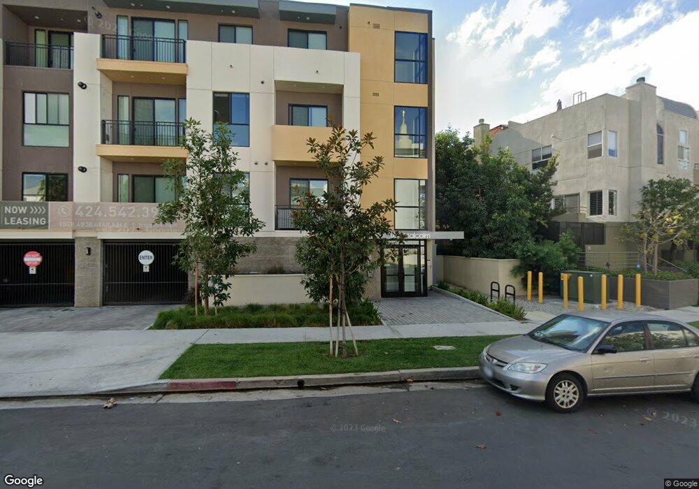
1749 Malcolm Ave Los Angeles, CA 90024
Westwood NeighborhoodEstimated Value: $1,854,877 - $2,227,000
3
Beds
2
Baths
1,541
Sq Ft
$1,349/Sq Ft
Est. Value
About This Home
This home is located at 1749 Malcolm Ave, Los Angeles, CA 90024 and is currently estimated at $2,078,219, approximately $1,348 per square foot. 1749 Malcolm Ave is a home located in Los Angeles County with nearby schools including Fairburn Avenue Elementary School, Westwood Charter School, and Ralph Waldo Emerson Community Charter Middle School.
Ownership History
Date
Name
Owned For
Owner Type
Purchase Details
Closed on
Oct 3, 2018
Sold by
Harkham Family Enterprises Lp
Bought by
Hs Westside Properties Llc
Current Estimated Value
Purchase Details
Closed on
Jan 3, 2003
Sold by
Harkham Uri and Uri Harkham Trust
Bought by
Harkham Family Enterprises Lp
Purchase Details
Closed on
Dec 24, 2001
Sold by
Moulthrop Andrew Alfred and Moulthrop Ok Lae
Bought by
Harkham Uri and The Uri Harkham Trust
Home Financials for this Owner
Home Financials are based on the most recent Mortgage that was taken out on this home.
Original Mortgage
$423,500
Interest Rate
7%
Purchase Details
Closed on
Nov 11, 1997
Sold by
Marshall Douglas and Marshall Lawrence
Bought by
Mouthrop Andrew A and Mouthrop Ok Lae
Home Financials for this Owner
Home Financials are based on the most recent Mortgage that was taken out on this home.
Original Mortgage
$305,600
Interest Rate
7.23%
Create a Home Valuation Report for This Property
The Home Valuation Report is an in-depth analysis detailing your home's value as well as a comparison with similar homes in the area
Home Values in the Area
Average Home Value in this Area
Purchase History
| Date | Buyer | Sale Price | Title Company |
|---|---|---|---|
| Hs Westside Properties Llc | -- | None Available | |
| Harkham Family Enterprises Lp | -- | -- | |
| Harkham Uri | $605,000 | Chicago Title | |
| Mouthrop Andrew A | $382,000 | United Title Company |
Source: Public Records
Mortgage History
| Date | Status | Borrower | Loan Amount |
|---|---|---|---|
| Previous Owner | Harkham Uri | $423,500 | |
| Previous Owner | Mouthrop Andrew A | $305,600 |
Source: Public Records
Tax History
| Year | Tax Paid | Tax Assessment Tax Assessment Total Assessment is a certain percentage of the fair market value that is determined by local assessors to be the total taxable value of land and additions on the property. | Land | Improvement |
|---|---|---|---|---|
| 2025 | $9,417 | $785,652 | $782,962 | $2,690 |
| 2024 | $9,417 | $770,248 | $767,610 | $2,638 |
| 2023 | $9,238 | $755,146 | $752,559 | $2,587 |
| 2022 | $8,810 | $740,340 | $737,803 | $2,537 |
| 2021 | $8,708 | $725,825 | $723,337 | $2,488 |
| 2019 | $9,689 | $801,199 | $701,884 | $99,315 |
| 2018 | $9,630 | $785,490 | $688,122 | $97,368 |
| 2016 | $9,210 | $754,990 | $661,402 | $93,588 |
| 2015 | $9,076 | $743,651 | $651,468 | $92,183 |
| 2014 | $9,111 | $729,085 | $638,707 | $90,378 |
Source: Public Records
Map
Nearby Homes
- 1722 Malcolm Ave Unit 304
- 1748 Malcolm Ave
- 1754 Malcolm Ave
- 1645 Malcolm Ave Unit 302
- 1818 Kelton Ave Unit 101
- 1830 Kelton Ave Unit 5
- 1909 Glendon Ave Unit 304
- 1915 Malcolm Ave Unit 301
- 1621 Manning Ave
- 1927 Glendon Ave Unit 202
- 1935 Malcolm Ave Unit 102
- 1944 Glendon Ave Unit 209
- 1647 Veteran Ave Unit E
- 1811 Manning Ave Unit 302
- 1951 Malcolm Ave Unit 206
- 1880 Veteran Ave Unit 107
- 1948 Malcolm Ave Unit 305
- 1909 Pelham Ave Unit 111
- 1545 Kelton Ave
- 1818 Greenfield Ave Unit 101-302
- 1751 Malcolm Ave
- 1735 Malcolm Ave Unit H
- 1735 Malcolm Ave Unit I
- 1735 Malcolm Ave Unit G
- 1735 Malcolm Ave Unit F
- 1735 Malcolm Ave Unit E
- 1735 Malcolm Ave Unit D
- 1735 Malcolm Ave Unit C
- 1735 Malcolm Ave Unit B
- 1735 Malcolm Ave Unit A
- 1755 Malcolm Ave
- 1756 Malcolm Ave Unit 3
- 1733 Malcolm Ave
- 1733 Malcolm Ave Unit 8
- 1733 Malcolm Ave Unit 7
- 1733 Malcolm Ave Unit 6
- 1733 Malcolm Ave Unit 5
- 1733 Malcolm Ave Unit 4
- 1733 Malcolm Ave Unit 3
- 1733 Malcolm Ave Unit 2
Your Personal Tour Guide
Ask me questions while you tour the home.