Estimated Value: $733,000 - $1,012,000
3
Beds
3
Baths
5,000
Sq Ft
$173/Sq Ft
Est. Value
About This Home
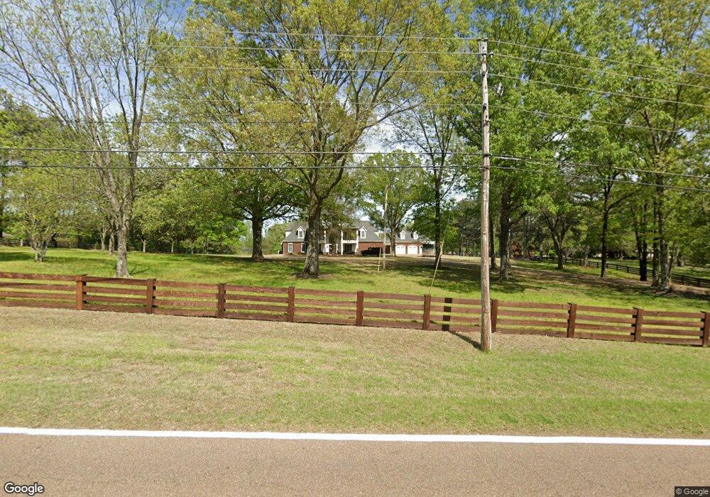
This home is located at 17490 Highway 196, Eads, TN 38028 and is currently estimated at $863,858, approximately $172 per square foot. 17490 Highway 196 is a home located in Fayette County with nearby schools including Oakland Elementary School, West Junior High School, and Fayette Ware Comprehensive High School.
Ownership History
Date
Name
Owned For
Owner Type
Purchase Details
Closed on
May 6, 2016
Sold by
Pittman Robert L
Bought by
Furr Donald E and Furr Karen L
Current Estimated Value
Purchase Details
Closed on
May 5, 2004
Sold by
Proctor Glenn M
Bought by
Pittman Robert L
Home Financials for this Owner
Home Financials are based on the most recent Mortgage that was taken out on this home.
Original Mortgage
$310,000
Interest Rate
5.49%
Purchase Details
Closed on
Nov 3, 2000
Sold by
Phillips Michael D
Bought by
Proctor Glenn M
Purchase Details
Closed on
Jun 18, 1993
Bought by
Phillips Michael D and Kelly Janet O
Purchase Details
Closed on
Oct 10, 1978
Bought by
Lipford Thomas E and Joyce Lee
Purchase Details
Closed on
Jan 1, 1978
Create a Home Valuation Report for This Property
The Home Valuation Report is an in-depth analysis detailing your home's value as well as a comparison with similar homes in the area
Home Values in the Area
Average Home Value in this Area
Purchase History
| Date | Buyer | Sale Price | Title Company |
|---|---|---|---|
| Furr Donald E | $115,000 | -- | |
| Pittman Robert L | $310,000 | -- | |
| Proctor Glenn M | $335,000 | -- | |
| Phillips Michael D | $190,300 | -- | |
| Lipford Thomas E | -- | -- | |
| -- | $15,000 | -- |
Source: Public Records
Mortgage History
| Date | Status | Borrower | Loan Amount |
|---|---|---|---|
| Previous Owner | Not Available | $310,000 |
Source: Public Records
Tax History Compared to Growth
Tax History
| Year | Tax Paid | Tax Assessment Tax Assessment Total Assessment is a certain percentage of the fair market value that is determined by local assessors to be the total taxable value of land and additions on the property. | Land | Improvement |
|---|---|---|---|---|
| 2024 | $2,724 | $210,925 | $19,675 | $191,250 |
| 2023 | $2,724 | $210,925 | $0 | $0 |
| 2022 | $2,724 | $210,925 | $19,675 | $191,250 |
| 2021 | $2,724 | $210,925 | $19,675 | $191,250 |
| 2020 | $2,759 | $210,925 | $19,675 | $191,250 |
| 2019 | $2,759 | $183,000 | $19,675 | $163,325 |
| 2018 | $2,759 | $183,000 | $19,675 | $163,325 |
| 2017 | $1,718 | $177,300 | $19,675 | $157,625 |
| 2016 | $332 | $20,650 | $19,675 | $975 |
| 2015 | $1,013 | $63,075 | $19,675 | $43,400 |
| 2014 | $1,013 | $63,075 | $19,675 | $43,400 |
Source: Public Records
Map
Nearby Homes
- 320 Forest Glade Cove
- 35 Meadow Springs Cove
- 2625 U S 64
- 2625 Highway 64
- 18160 Tennessee 196
- 630 Hickory Lake Rd
- 20 Fair Meadows Ln
- 15 Fair Meadows Ln
- 00 Donelson Dr
- 18670 Tennessee 196
- Laurel Plan at Eads - The Village of Cypress Creek
- Baker Plan at Eads - The Village of Cypress Creek
- Mae Plan at Eads - The Village of Cypress Creek
- Nash Plan at Eads - The Village of Cypress Creek
- Leland Plan at Eads - The Village of Cypress Creek
- Clarksdale Plan at Eads - The Village of Cypress Creek
- Dean Plan at Eads - The Village of Cypress Creek
- Collins Plan at Eads - The Village of Cypress Creek
- Jasper Plan at Eads - The Village of Cypress Creek
- Adalyn Plan at Eads - The Village of Cypress Creek
- 17430 Highway 196
- 17550 Highway 196
- 17430 Tennessee 196
- 17505 Highway 196
- 17555 Highway 196
- 315 Shady Oaks Dr
- 520 Shady Oaks Dr
- 295 Shady Oaks Dr
- 17405 Highway 196
- 17600 Highway 196
- 275 Shady Oaks Dr
- 490 Shady Oaks Dr
- 17555 Tennessee 196
- 255 Shady Oaks Dr
- 140 Forest Glade Cove
- 300 Shady Oaks Dr
- 160 Forest Glade Cove
- 480 Shady Oaks Dr
- 280 Shady Oaks Dr
- 235 Shady Oaks Dr