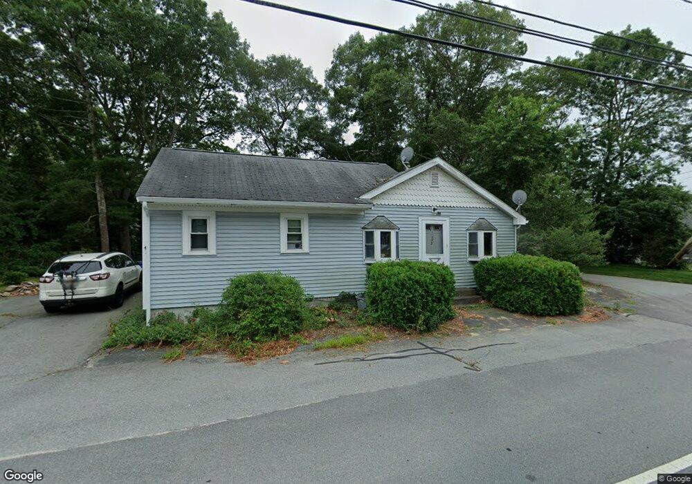
175 Barlows Landing Rd Pocasset, MA 02559
Pocasset NeighborhoodEstimated Value: $430,232 - $633,000
2
Beds
1
Bath
1,001
Sq Ft
$531/Sq Ft
Est. Value
About This Home
This home is located at 175 Barlows Landing Rd, Pocasset, MA 02559 and is currently estimated at $531,558, approximately $531 per square foot. 175 Barlows Landing Rd is a home located in Barnstable County with nearby schools including Bourne High School, Cadence Academy Preschool - Bourne, and St Margaret Regional School.
Ownership History
Date
Name
Owned For
Owner Type
Purchase Details
Closed on
Feb 27, 1995
Sold by
Emc T Two
Bought by
Matthews Deborah L
Current Estimated Value
Home Financials for this Owner
Home Financials are based on the most recent Mortgage that was taken out on this home.
Original Mortgage
$33,750
Interest Rate
9.17%
Mortgage Type
Purchase Money Mortgage
Purchase Details
Closed on
Apr 22, 1994
Sold by
Emc T and Patterson Shawn T
Bought by
Emc T Two and State St Bk & Tr
Create a Home Valuation Report for This Property
The Home Valuation Report is an in-depth analysis detailing your home's value as well as a comparison with similar homes in the area
Home Values in the Area
Average Home Value in this Area
Purchase History
| Date | Buyer | Sale Price | Title Company |
|---|---|---|---|
| Matthews Deborah L | $48,275 | -- | |
| Matthews Deborah L | $48,275 | -- | |
| Emc T Two | $50,000 | -- | |
| Emc T Two | $50,000 | -- |
Source: Public Records
Mortgage History
| Date | Status | Borrower | Loan Amount |
|---|---|---|---|
| Open | Emc T Two | $40,000 | |
| Closed | Emc T Two | $33,750 |
Source: Public Records
Tax History Compared to Growth
Tax History
| Year | Tax Paid | Tax Assessment Tax Assessment Total Assessment is a certain percentage of the fair market value that is determined by local assessors to be the total taxable value of land and additions on the property. | Land | Improvement |
|---|---|---|---|---|
| 2025 | $2,482 | $317,800 | $177,100 | $140,700 |
| 2024 | $2,495 | $311,100 | $177,100 | $134,000 |
| 2023 | $2,425 | $275,300 | $156,700 | $118,600 |
| 2022 | $2,349 | $232,800 | $138,700 | $94,100 |
| 2021 | $2,282 | $211,900 | $126,200 | $85,700 |
| 2020 | $2,219 | $206,600 | $125,000 | $81,600 |
| 2019 | $2,123 | $202,000 | $125,000 | $77,000 |
| 2018 | $1,986 | $188,400 | $119,100 | $69,300 |
| 2017 | $2,005 | $194,700 | $118,000 | $76,700 |
| 2016 | $1,758 | $173,000 | $112,400 | $60,600 |
| 2015 | $1,572 | $156,100 | $95,500 | $60,600 |
Source: Public Records
Map
Nearby Homes
- 15 1st St
- 709 County Rd
- 940 County Rd
- 7 4th Ave
- 254 Barlows Landing Rd
- 39 Bennets Neck Dr
- 41 Portside Dr
- 515 County Rd
- 940 County Rd
- 14 Navajo Rd
- 171 Bellavista Dr
- 566 Shore Rd
- 70 Wings Neck Rd
- 34 Kenwood Rd
- 93 Valley Bars Rd
- 30 Howard Ave
- 45 Kenwood Rd
- 22 Nairn Rd
- 3 Red Brook Pond Dr
- 105 Clay Pond Rd
- 171 Barlows Landing Rd
- 181 Barlows Landing Rd
- 169 Barlows Landing Rd
- 170 Barlows Landing Rd
- 174 Barlows Landing Rd
- 183 Barlows Landing Rd
- 164 Barlows Landing Rd
- 3 Mcalister St
- 180 Barlows Landing Rd
- 161 Barlows Landing Rd
- 20 Observatory Ln
- 12 Observatory Ln
- 160 Barlows Landing Rd
- 3 Mcalister St
- 22 Observatory Ln
- 189 Barlows Landing Rd
- 184 Barlows Landing Rd
- 154 Barlows Landing Rd
- 17 Observatory Ln
- 21 Observatory Ln