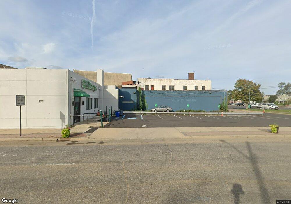
175 Broadway Long Branch, NJ 07740
Estimated Value: $1,834,988
--
Bed
--
Bath
8,000
Sq Ft
$229/Sq Ft
Est. Value
About This Home
This home is located at 175 Broadway, Long Branch, NJ 07740 and is currently estimated at $1,834,988, approximately $229 per square foot. 175 Broadway is a home located in Monmouth County with nearby schools including Long Branch High School and Holy Trinity School.
Ownership History
Date
Name
Owned For
Owner Type
Purchase Details
Closed on
May 28, 2024
Sold by
Widdis Audrey and Widdis Harry J
Bought by
Ben Hur Lb Ii Llc
Current Estimated Value
Purchase Details
Closed on
Jan 2, 1992
Bought by
Widdis Charles and Widdis Audrey
Create a Home Valuation Report for This Property
The Home Valuation Report is an in-depth analysis detailing your home's value as well as a comparison with similar homes in the area
Home Values in the Area
Average Home Value in this Area
Purchase History
| Date | Buyer | Sale Price | Title Company |
|---|---|---|---|
| Ben Hur Lb Ii Llc | $1,800,000 | Trident Abstract Title | |
| Ben Hur Lb Ii Llc | $1,800,000 | Trident Abstract Title | |
| Widdis Charles | $195,000 | -- |
Source: Public Records
Tax History Compared to Growth
Tax History
| Year | Tax Paid | Tax Assessment Tax Assessment Total Assessment is a certain percentage of the fair market value that is determined by local assessors to be the total taxable value of land and additions on the property. | Land | Improvement |
|---|---|---|---|---|
| 2025 | $11,214 | $903,100 | $295,000 | $608,100 |
| 2024 | $9,998 | $729,600 | $285,000 | $444,600 |
| 2023 | $9,998 | $643,800 | $280,000 | $363,800 |
| 2022 | $10,303 | $543,200 | $265,000 | $278,200 |
| 2021 | $10,303 | $515,000 | $260,000 | $255,000 |
| 2020 | $10,325 | $494,000 | $244,000 | $250,000 |
| 2019 | $10,174 | $484,000 | $234,000 | $250,000 |
| 2018 | $10,126 | $479,000 | $229,000 | $250,000 |
| 2017 | $9,852 | $478,000 | $228,000 | $250,000 |
| 2016 | $9,701 | $480,000 | $230,000 | $250,000 |
| 2015 | $8,768 | $393,700 | $252,000 | $141,700 |
| 2014 | $10,347 | $489,700 | $348,000 | $141,700 |
Source: Public Records
Map
Nearby Homes
- 143 Stokes Place
- 145 Stokes Place
- 167 Chelsea Ave
- 40 N 5th Ave
- 14 Slocum Place
- 40 University Dr
- 166 Franklin Ave Unit 8
- 103 Franklin Ave
- 150 Franklin Ave Unit 5
- 152 Franklin Ave
- 158 Franklin Ave
- 170 Franklin Ave
- 144 Westwood Ave
- 22 Cooper Ave Unit 113
- 22 Cooper Ave Unit 309
- 22 Cooper Ave Unit 110
- 151 N 5th Ave
- 55 Melrose Terrace Unit 209
- 55 Melrose Terrace Unit 112
- 33 Cooper Ave Unit 213
- 188-190 Broadway
- 200 Broadway
- 152 Union Ave
- 177 Union Ave
- 177 Union Ave Unit 4
- 181 Union Ave
- 148 Broadway
- 185 Union Ave
- 146 Union Ave
- 189 Union Ave
- 40 Lewis Alley
- 42 Liberty St
- 147 Belmont Ave
- 193 Union Ave
- 193 Union Ave Unit 2
- 197 Union Ave
- 10 N 3rd Ave
- 180 Belmont Ave
- 138 Union Ave
- 182 Belmont Ave