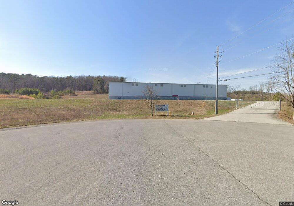
175 Enterprise Dr SW Cleveland, TN 37311
--
Bed
--
Bath
50,000
Sq Ft
11.1
Acres
About This Home
This home is located at 175 Enterprise Dr SW, Cleveland, TN 37311. 175 Enterprise Dr SW is a home located in Bradley County with nearby schools including Blythe-Bower Elementary School, Cleveland Christian School, and Landmark Christian Day School.
Ownership History
Date
Name
Owned For
Owner Type
Purchase Details
Closed on
Apr 27, 2016
Sold by
Dillard Partnership
Bought by
Industrial Dev Board Of County Of Bradle
Home Financials for this Owner
Home Financials are based on the most recent Mortgage that was taken out on this home.
Original Mortgage
$1,600,000
Interest Rate
3.71%
Mortgage Type
Commercial
Purchase Details
Closed on
Aug 5, 2011
Sold by
Industrial Development Boa
Bought by
Dillard Partnership
Purchase Details
Closed on
Jun 4, 2004
Sold by
Palmer Elizabeth May Brezi
Bought by
Logan David M
Create a Home Valuation Report for This Property
The Home Valuation Report is an in-depth analysis detailing your home's value as well as a comparison with similar homes in the area
Home Values in the Area
Average Home Value in this Area
Purchase History
| Date | Buyer | Sale Price | Title Company |
|---|---|---|---|
| Industrial Dev Board Of County Of Bradle | -- | -- | |
| Dillard Partnership | $362,000 | -- | |
| Logan David M | $79,000 | -- |
Source: Public Records
Mortgage History
| Date | Status | Borrower | Loan Amount |
|---|---|---|---|
| Closed | Industrial Dev Board Of County Of Bradle | $1,600,000 |
Source: Public Records
Tax History Compared to Growth
Tax History
| Year | Tax Paid | Tax Assessment Tax Assessment Total Assessment is a certain percentage of the fair market value that is determined by local assessors to be the total taxable value of land and additions on the property. | Land | Improvement |
|---|---|---|---|---|
| 2025 | $6,170 | $591,000 | $244,200 | $346,800 |
| 2024 | $6,170 | $428,720 | $177,600 | $251,120 |
| 2023 | $13,514 | $428,720 | $177,600 | $251,120 |
| 2022 | $13,514 | $428,720 | $177,600 | $251,120 |
| 2021 | $6,170 | $428,720 | $0 | $0 |
| 2020 | $6,275 | $428,720 | $0 | $0 |
| 2019 | $13,529 | $352,120 | $0 | $0 |
| 2018 | $14,508 | $0 | $0 | $0 |
| 2017 | $7,254 | $0 | $0 | $0 |
| 2016 | $12,399 | $0 | $0 | $0 |
| 2015 | $2,928 | $0 | $0 | $0 |
| 2014 | $2,928 | $0 | $0 | $0 |
Source: Public Records
Map
Nearby Homes
- 34153339 Lead Mine Valley Rd SW
- 3415/3339 Lead Mine Valley Rd SW
- 2841 Varnell Rd SW
- 287 Lead Mine Valley Rd SW
- The Pierce Plan at Appalachia Park
- The Greenbrier II Plan at Appalachia Park
- The Manchester II Plan at Appalachia Park
- The Buford II Plan at Appalachia Park
- The Suwanee Plan at Appalachia Park
- The Trenton Plan at Appalachia Park
- The Braselton II Plan at Appalachia Park
- The Rutledge Plan at Appalachia Park
- 275 Lead Mine Valley Rd SW
- 128 Fox Hill Ln SW
- Lot 15 Cobblestone Ridge SW
- 2793 Varnell Rd SW
- Lot 18 Cobblestone Ridge SW
- Lot 17 Cobblestone Ridge SW
- Lot 19 Cobblestone Ridge SW
- Lot 20 Cobblestone Ridge SW
- 315 Industrial Way SW
- 315 Industrial Way SW Unit B
- 175 Corporate Dr SW
- 241 Industrial Way SW
- Lot 8 Industrial Dr SW
- 1320 Old Chattanooga Pike SW
- 0 Industrial Dr SW Unit 20192921
- 12131415 Industrial Way SW
- 014 Industrial Way SW
- 012 Industrial Way SW
- 013 Industrial Way SW
- 015 Industrial Way SW
- 14 Industrial Way SW
- 12 Industrial Way SW
- 014 Industrial Way SW Unit 14
- 012 Industrial Way SW Unit 12
- 165 Industrial Way SW
- 1110 Old Chattanooga Pike SW
- 221 Varnell Dr SW
- 1326 Old Chattanooga Pike SW