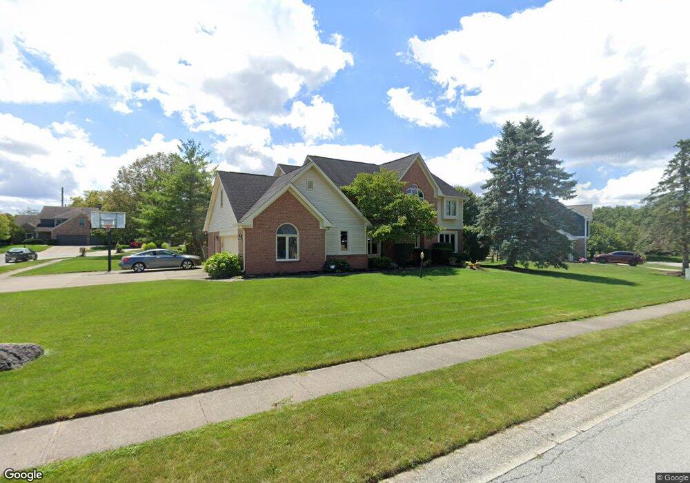
175 Lansdowne Dr Noblesville, IN 46060
Estimated Value: $480,000 - $578,499
4
Beds
3
Baths
4,052
Sq Ft
$133/Sq Ft
Est. Value
About This Home
This home is located at 175 Lansdowne Dr, Noblesville, IN 46060 and is currently estimated at $538,875, approximately $132 per square foot. 175 Lansdowne Dr is a home located in Hamilton County with nearby schools including Stony Creek Elementary School, Noblesville East Middle School, and Noblesville High School.
Ownership History
Date
Name
Owned For
Owner Type
Purchase Details
Closed on
Sep 19, 2003
Sold by
Mattox William M and Mattox Roxanne L
Bought by
Cook S Matthew and Cook Lynn G
Current Estimated Value
Home Financials for this Owner
Home Financials are based on the most recent Mortgage that was taken out on this home.
Original Mortgage
$220,000
Outstanding Balance
$103,460
Interest Rate
6.44%
Mortgage Type
Purchase Money Mortgage
Estimated Equity
$435,415
Create a Home Valuation Report for This Property
The Home Valuation Report is an in-depth analysis detailing your home's value as well as a comparison with similar homes in the area
Home Values in the Area
Average Home Value in this Area
Purchase History
| Date | Buyer | Sale Price | Title Company |
|---|---|---|---|
| Cook S Matthew | -- | -- |
Source: Public Records
Mortgage History
| Date | Status | Borrower | Loan Amount |
|---|---|---|---|
| Open | Cook S Matthew | $220,000 |
Source: Public Records
Tax History Compared to Growth
Tax History
| Year | Tax Paid | Tax Assessment Tax Assessment Total Assessment is a certain percentage of the fair market value that is determined by local assessors to be the total taxable value of land and additions on the property. | Land | Improvement |
|---|---|---|---|---|
| 2024 | $5,993 | $499,700 | $88,600 | $411,100 |
| 2023 | $5,993 | $478,800 | $88,600 | $390,200 |
| 2022 | $5,400 | $416,500 | $88,600 | $327,900 |
| 2021 | $4,837 | $374,900 | $88,600 | $286,300 |
| 2020 | $4,566 | $344,400 | $88,600 | $255,800 |
| 2019 | $4,390 | $347,900 | $47,500 | $300,400 |
| 2018 | $4,126 | $319,700 | $47,500 | $272,200 |
| 2017 | $3,856 | $312,700 | $47,500 | $265,200 |
| 2016 | $3,689 | $303,100 | $47,500 | $255,600 |
| 2014 | $3,576 | $292,800 | $46,000 | $246,800 |
| 2013 | $3,576 | $276,000 | $46,000 | $230,000 |
Source: Public Records
Map
Nearby Homes
- 102 Glasgow Ln
- 208 Andover Ln
- 1536 Rolling Ridge Dr
- 165 Monticello Ct
- 327 Fox Cir
- 12853 S Rim Dr
- 12901 S Rim Dr
- 12872 Mystic Pines Dr
- 12804 S Rim Dr
- 12858 Mystic Pines Dr
- 12781 S Rim Dr
- 10077 Gemstone Dr
- 10174 Gemstone Dr
- 16089 Concert Way
- 15858 Concert Way
- 1419 S 9th St
- 15503 Harmon Place
- 16485 Grand Cypress Dr
- 10115 Cumberland Pointe Blvd
- 10305 Alto Ct
- 145 Lansdowne Dr
- 181 Crowndale Ct
- 213 Crowndale Ct
- 188 Lansdowne Dr
- 170 Lansdowne Dr
- 187 Crowndale Ct
- 137 Lansdowne Dr
- 210 Lansdowne Dr
- 150 Lansdowne Dr
- 140 Lansdowne Dr
- 197 Crowndale Ct
- 205 Crowndale Ct
- 225 Lansdowne Dr
- 125 Lansdowne Dr
- 220 Lansdowne Dr
- 193 Crowndale Ct
- 161 Stony Creek Overlook
- 138 Parliament Ct
- 610 Wordsworth Ct