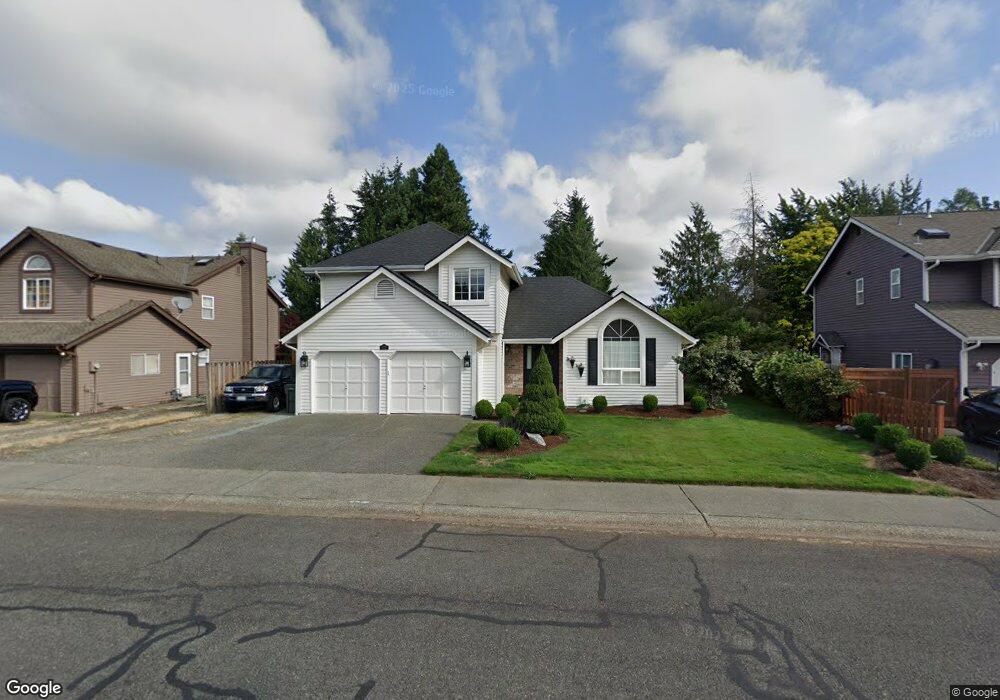
175 Michael Ave Enumclaw, WA 98022
Estimated Value: $571,945 - $613,000
3
Beds
3
Baths
1,660
Sq Ft
$353/Sq Ft
Est. Value
About This Home
This home is located at 175 Michael Ave, Enumclaw, WA 98022 and is currently estimated at $586,486, approximately $353 per square foot. 175 Michael Ave is a home located in King County with nearby schools including Byron Kibler Elementary School, Enumclaw Middle School, and Enumclaw Senior High School.
Ownership History
Date
Name
Owned For
Owner Type
Purchase Details
Closed on
Jul 14, 1997
Sold by
Hobart Jean C and Richardson Jean
Bought by
Hughes Michael A and Hughes Kimberlee K
Current Estimated Value
Home Financials for this Owner
Home Financials are based on the most recent Mortgage that was taken out on this home.
Original Mortgage
$102,000
Outstanding Balance
$15,046
Interest Rate
7.83%
Estimated Equity
$571,440
Purchase Details
Closed on
Jan 26, 1994
Sold by
Richardson Chad A
Bought by
Richardson Jean
Purchase Details
Closed on
Mar 18, 1992
Sold by
Capstone Homes Inc
Bought by
Richardson Chad A and Richardson Jean C
Create a Home Valuation Report for This Property
The Home Valuation Report is an in-depth analysis detailing your home's value as well as a comparison with similar homes in the area
Home Values in the Area
Average Home Value in this Area
Purchase History
| Date | Buyer | Sale Price | Title Company |
|---|---|---|---|
| Hughes Michael A | $141,000 | -- | |
| Richardson Jean | -- | Chicago Title | |
| Richardson Chad A | $124,000 | -- |
Source: Public Records
Mortgage History
| Date | Status | Borrower | Loan Amount |
|---|---|---|---|
| Open | Hughes Michael A | $102,000 |
Source: Public Records
Tax History
| Year | Tax Paid | Tax Assessment Tax Assessment Total Assessment is a certain percentage of the fair market value that is determined by local assessors to be the total taxable value of land and additions on the property. | Land | Improvement |
|---|---|---|---|---|
| 2024 | $4,982 | $519,000 | $200,000 | $319,000 |
| 2023 | $4,648 | $445,000 | $172,000 | $273,000 |
| 2022 | $4,164 | $508,000 | $197,000 | $311,000 |
| 2021 | $3,841 | $412,000 | $170,000 | $242,000 |
| 2020 | $3,294 | $346,000 | $115,000 | $231,000 |
| 2018 | $3,343 | $299,000 | $105,000 | $194,000 |
| 2017 | $2,966 | $271,000 | $96,000 | $175,000 |
| 2016 | $2,915 | $248,000 | $89,000 | $159,000 |
| 2015 | $3,031 | $240,000 | $85,000 | $155,000 |
| 2014 | -- | $239,000 | $86,000 | $153,000 |
| 2013 | -- | $184,000 | $69,000 | $115,000 |
Source: Public Records
Map
Nearby Homes
- 111 Chinook Ave
- 27008 SE & 27012 432nd St
- 1355 Mchugh Ave
- 0 xx 266th Ave SE
- 2921 Frederickson St
- 42801 264th Ave SE
- 1730 Hillcrest Ave
- 1966 Wilson Ave
- 1975 Wilson Ave
- 1705 Marshall Ave
- 1107 Griffin Ave
- 42102 264th Ave SE
- 431 Rainier Ave
- 1624 Lockridge Loop E
- 1595 Lockridge Loop E
- 1573 Lockridge Loop E
- 1722 Harding St
- 1632 Lockridge Loop E
- 1318 Lafromboise St
- 1617 Lockridge Loop E
- 155 Michael Ave
- 199 Michael Ave
- 145 Michael Ave
- 213 Michael Ave
- 174 Michael Ave
- 204 Michael Ave
- 255 Michael Ave
- 135 Michael Ave
- 114 Chinook Ave
- 133 Chinook Ave
- 123 Chinook Ave
- 210 Michael Ave
- 117 Chinook Ave
- 275 Michael Ave
- 113 Chinook Ave
- 27025 SE 432nd St
- 27113 SE 432nd St
- 102 Chinook Ave
- 250 Michael Ave
- 280 Michael Ave
Your Personal Tour Guide
Ask me questions while you tour the home.