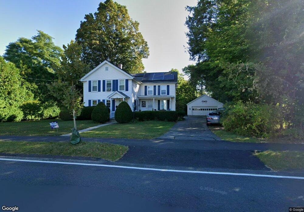
175 N Elm St Northampton, MA 01060
Estimated Value: $429,000 - $654,000
3
Beds
2
Baths
2,024
Sq Ft
$281/Sq Ft
Est. Value
About This Home
This home is located at 175 N Elm St, Northampton, MA 01060 and is currently estimated at $568,358, approximately $280 per square foot. 175 N Elm St is a home located in Hampshire County with nearby schools including Northampton High School, The Montessori School of Northampton, and Lander Grinspoon Academy.
Ownership History
Date
Name
Owned For
Owner Type
Purchase Details
Closed on
Jun 26, 2008
Sold by
Connor Francis P and Connor Mark F
Bought by
Giarusso Joseph M and Lafontaine Sheryl
Current Estimated Value
Home Financials for this Owner
Home Financials are based on the most recent Mortgage that was taken out on this home.
Original Mortgage
$297,000
Outstanding Balance
$191,603
Interest Rate
6.07%
Mortgage Type
Purchase Money Mortgage
Estimated Equity
$376,755
Create a Home Valuation Report for This Property
The Home Valuation Report is an in-depth analysis detailing your home's value as well as a comparison with similar homes in the area
Home Values in the Area
Average Home Value in this Area
Purchase History
| Date | Buyer | Sale Price | Title Company |
|---|---|---|---|
| Giarusso Joseph M | $330,000 | -- |
Source: Public Records
Mortgage History
| Date | Status | Borrower | Loan Amount |
|---|---|---|---|
| Open | Giarusso Joseph M | $297,000 |
Source: Public Records
Tax History Compared to Growth
Tax History
| Year | Tax Paid | Tax Assessment Tax Assessment Total Assessment is a certain percentage of the fair market value that is determined by local assessors to be the total taxable value of land and additions on the property. | Land | Improvement |
|---|---|---|---|---|
| 2025 | $6,101 | $438,000 | $249,600 | $188,400 |
| 2024 | $6,548 | $431,100 | $227,400 | $203,700 |
| 2023 | $6,307 | $398,200 | $206,500 | $191,700 |
| 2022 | $6,022 | $336,600 | $193,300 | $143,300 |
| 2021 | $6,003 | $345,600 | $184,300 | $161,300 |
| 2020 | $5,806 | $345,600 | $184,300 | $161,300 |
| 2019 | $5,789 | $333,300 | $184,300 | $149,000 |
| 2018 | $5,567 | $326,700 | $184,300 | $142,400 |
| 2017 | $5,453 | $326,700 | $184,300 | $142,400 |
| 2016 | $5,279 | $326,700 | $184,300 | $142,400 |
| 2015 | $4,914 | $311,000 | $164,300 | $146,700 |
| 2014 | $4,786 | $311,000 | $164,300 | $146,700 |
Source: Public Records
Map
Nearby Homes
- 0 Terrace Ln
- 61 Woodlawn Ave
- 63 Riverside Dr
- 14 Arlington St
- 74 Barrett St Unit 105
- 152 S Main St Unit 8
- 152 S Main St Unit 4
- 76 Cooke Ave
- 11 Norwood Ave
- 218 Elm St
- 49 Kensington Ave
- 5 Prospect Ct
- 36 Landy Ave
- 37 Landy Ave
- 37 Finn St
- 325 Riverside Dr
- 321 Riverside Dr
- 215 State St
- 76 Maple St
- 225 Nonotuck St Unit C
- 17 Dickinson St
- 15 Dickinson St
- 15 Dickinson St Unit 1
- 169 N Elm St
- 21 Dickinson St
- 185 N Elm St
- 27 Dickinson St
- 15 Locust St
- 425 Prospect St
- 21 Locust St Unit 1A
- 18 Dickinson St
- 12 Dickinson St
- 22 Dickinson St
- 178 N Elm St
- 10 Dickinson St
- 415 Prospect St
- 26 Dickinson St
- 28 Prospect Ave
- 187 N Elm St
- 30 Dickinson St