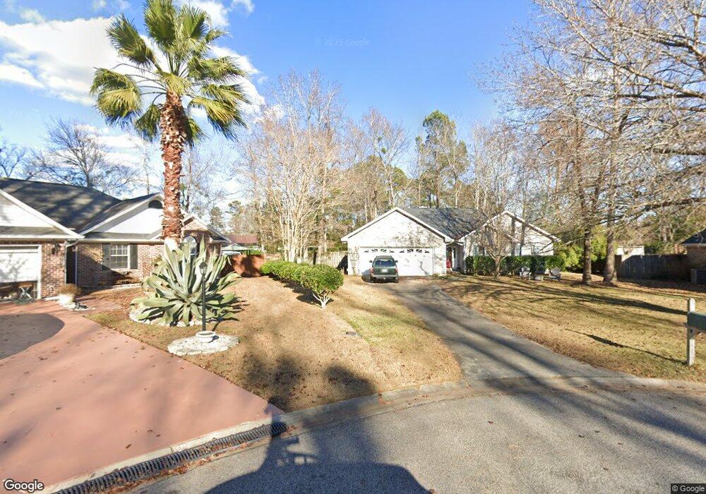
175 Ooneecan Ct Myrtle Beach, SC 29579
Estimated Value: $277,000 - $340,000
3
Beds
2
Baths
1,856
Sq Ft
$171/Sq Ft
Est. Value
About This Home
This home is located at 175 Ooneecan Ct, Myrtle Beach, SC 29579 and is currently estimated at $316,816, approximately $170 per square foot. 175 Ooneecan Ct is a home located in Horry County with nearby schools including Forestbrook Elementary School, Forestbrook Middle School, and Socastee High School.
Ownership History
Date
Name
Owned For
Owner Type
Purchase Details
Closed on
Jun 28, 2005
Sold by
Tanda Michael D and Tanda Shawna L
Bought by
Hutchens John J and Hutchens Robin D
Current Estimated Value
Home Financials for this Owner
Home Financials are based on the most recent Mortgage that was taken out on this home.
Original Mortgage
$167,400
Outstanding Balance
$83,909
Interest Rate
5.54%
Mortgage Type
Fannie Mae Freddie Mac
Estimated Equity
$232,907
Purchase Details
Closed on
Nov 7, 2000
Sold by
Marcum Jerry L and Lynn Marcella Lynn
Bought by
Tanda Michael D and Tanda Shawna L
Create a Home Valuation Report for This Property
The Home Valuation Report is an in-depth analysis detailing your home's value as well as a comparison with similar homes in the area
Home Values in the Area
Average Home Value in this Area
Purchase History
| Date | Buyer | Sale Price | Title Company |
|---|---|---|---|
| Hutchens John J | $179,900 | -- | |
| Tanda Michael D | $129,900 | -- |
Source: Public Records
Mortgage History
| Date | Status | Borrower | Loan Amount |
|---|---|---|---|
| Open | Hutchens John J | $167,400 |
Source: Public Records
Tax History
| Year | Tax Paid | Tax Assessment Tax Assessment Total Assessment is a certain percentage of the fair market value that is determined by local assessors to be the total taxable value of land and additions on the property. | Land | Improvement |
|---|---|---|---|---|
| 2025 | $828 | $0 | $0 | $0 |
| 2024 | $828 | $11,907 | $3,652 | $8,255 |
| 2023 | $828 | $6,990 | $1,470 | $5,520 |
| 2021 | $751 | $6,990 | $1,470 | $5,520 |
| 2020 | $653 | $6,990 | $1,470 | $5,520 |
| 2019 | $653 | $6,990 | $1,470 | $5,520 |
| 2018 | $595 | $6,148 | $1,576 | $4,572 |
| 2017 | $580 | $6,148 | $1,576 | $4,572 |
| 2016 | -- | $6,148 | $1,576 | $4,572 |
| 2015 | $580 | $6,148 | $1,576 | $4,572 |
| 2014 | $536 | $6,148 | $1,576 | $4,572 |
Source: Public Records
Map
Nearby Homes
- 191 Carlisle Way
- TBD Chickasaw Ln Unit Lot 27 (to be subdiv
- 203 Chickasaw Ln Unit Lots 27 & 28 combine
- 203 Chickasaw Ln Unit Lot 28 only
- 152 Brookgate Dr
- 1169 Bethpage Dr
- 1225 Forestbrook Rd
- 875 Brookline Dr
- 615 Burcale Road Cir
- 728 Gazania Ln
- 720 Gazania Ln
- 147 Quail Hollow Rd
- 3648 Eagle Trace Dr
- 3606 Eagle Trace Dr
- 3670 Farmington Place
- 8 Ryan Ln
- 746 Gumbo Limbo Ln
- 801 Burcale Rd Unit F6
- 801 Burcale Rd Unit G-5
- 755 Burcale Rd Unit C3
- 173 Ooneecan Ct
- 177 Ooneecan Ct
- 171 Carlisle Way
- 173 Carlisle Way
- 459 Pawpaw Ln
- 195 Chickasaw Ln
- 197 Chickasaw Ln Unit MB
- 172 Oconee Ct
- 193 Chickasaw Ln Unit MB
- 457 Pawpaw Ln Unit MB
- 457 Paw Ln
- 461 Paw
- 178 Ooneecan Ct
- 199 Chickasaw Ln
- 461 Pawpaw Ln Unit MB
- 191 Brookgate Dr Unit II
- 174 Ooneecan Ct
- 176 Ooneecan Ct
- 176 Oconee Ct
- 1540 Chickasaw Ln Unit 18 Cadiz