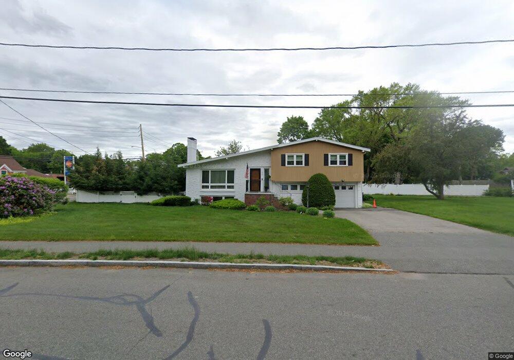
175 Sumner St Milton, MA 02186
Brush Hill NeighborhoodEstimated Value: $895,000 - $1,172,000
3
Beds
3
Baths
2,023
Sq Ft
$501/Sq Ft
Est. Value
About This Home
This home is located at 175 Sumner St, Milton, MA 02186 and is currently estimated at $1,014,377, approximately $501 per square foot. 175 Sumner St is a home located in Norfolk County with nearby schools including Milton High School, Delphi Academy, and St. Mary of the Hills School.
Ownership History
Date
Name
Owned For
Owner Type
Purchase Details
Closed on
Sep 5, 2003
Sold by
Sumner Street Rt
Bought by
Wornum Phillip B and Wornum Carmen C
Current Estimated Value
Home Financials for this Owner
Home Financials are based on the most recent Mortgage that was taken out on this home.
Original Mortgage
$322,700
Outstanding Balance
$147,432
Interest Rate
6.02%
Mortgage Type
Purchase Money Mortgage
Estimated Equity
$866,945
Create a Home Valuation Report for This Property
The Home Valuation Report is an in-depth analysis detailing your home's value as well as a comparison with similar homes in the area
Home Values in the Area
Average Home Value in this Area
Purchase History
| Date | Buyer | Sale Price | Title Company |
|---|---|---|---|
| Wornum Phillip B | $432,000 | -- |
Source: Public Records
Mortgage History
| Date | Status | Borrower | Loan Amount |
|---|---|---|---|
| Open | Wornum Phillip B | $322,700 |
Source: Public Records
Tax History
| Year | Tax Paid | Tax Assessment Tax Assessment Total Assessment is a certain percentage of the fair market value that is determined by local assessors to be the total taxable value of land and additions on the property. | Land | Improvement |
|---|---|---|---|---|
| 2025 | $8,402 | $757,600 | $435,900 | $321,700 |
| 2024 | $8,117 | $743,300 | $415,100 | $328,200 |
| 2023 | $7,543 | $661,700 | $395,500 | $266,200 |
| 2022 | $7,498 | $601,300 | $395,500 | $205,800 |
| 2021 | $7,273 | $553,900 | $357,900 | $196,000 |
| 2020 | $7,123 | $542,900 | $320,100 | $222,800 |
| 2019 | $6,947 | $527,100 | $310,800 | $216,300 |
| 2018 | $6,618 | $479,200 | $249,200 | $230,000 |
| 2017 | $6,193 | $456,700 | $237,300 | $219,400 |
| 2016 | $5,846 | $433,000 | $222,500 | $210,500 |
| 2015 | $5,590 | $401,000 | $204,700 | $196,300 |
Source: Public Records
Map
Nearby Homes
- 4 Farmer Rd
- 7 Preacher Rd
- 17 Quisset Brook Rd
- 485 Blue Hills Pkwy Unit 10
- 485 Blue Hills Pkwy Unit 12
- 485 Blue Hills Pkwy Unit 33
- 485 Blue Hills Pkwy Unit 13
- 485 Blue Hills Pkwy Unit 2
- 485 Blue Hills Pkwy Unit 49
- 485 Blue Hills Pkwy Unit 6
- 58 Adanac Rd
- 350 Blue Hill Ave
- 200 Robbins St
- 7 Parkway Crescent
- 73 Hudson St
- 5 Kinsale Ln
- 6 Kinsale Ln
- 46 Audubon Rd
- 49 Summit St
- 137 Thacher St Unit 137
- 939 Canton Ave
- 67 Trout Brook Ave
- 949 Canton Ave
- 631 Blue Hills Pkwy
- 57 Trout Brook Ave
- 954 Canton Ave
- 959 Canton Ave
- 0000 Canton Ave
- 68 Trout Brook Ave
- 942 Canton Ave
- 4 Harland St
- 3 Harland St
- 623 Blue Hills Pkwy
- 9 Myers Ln
- 8 Harland St
- 967 Canton Ave
- 970 Canton Ave
- 47 Trout Brook Ave
- 52 Trout Brook Ave
- 137 Sumner St
Your Personal Tour Guide
Ask me questions while you tour the home.