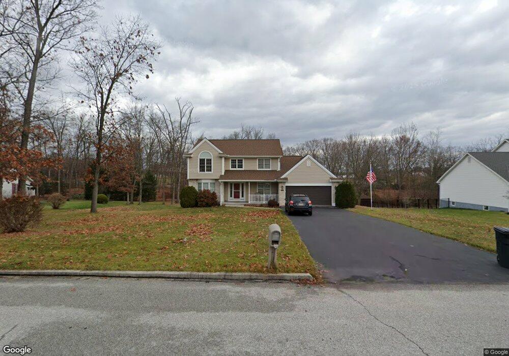
175 White Rd Unit 7 Gettysburg, PA 17325
Estimated Value: $448,000 - $486,000
4
Beds
3
Baths
2,319
Sq Ft
$200/Sq Ft
Est. Value
About This Home
This home is located at 175 White Rd Unit 7, Gettysburg, PA 17325 and is currently estimated at $464,340, approximately $200 per square foot. 175 White Rd Unit 7 is a home located in Adams County with nearby schools including Gettysburg Area High School, Vida Charter School, and Childrens Montessori School of Gettysburg.
Ownership History
Date
Name
Owned For
Owner Type
Purchase Details
Closed on
Apr 20, 2022
Sold by
Burdge Marlyn E
Bought by
Snell Matthew A
Current Estimated Value
Home Financials for this Owner
Home Financials are based on the most recent Mortgage that was taken out on this home.
Original Mortgage
$207,500
Outstanding Balance
$194,069
Interest Rate
3.85%
Mortgage Type
New Conventional
Estimated Equity
$270,272
Purchase Details
Closed on
Jul 27, 1993
Bought by
Burdge Richard G and Burdge Marlyn E
Create a Home Valuation Report for This Property
The Home Valuation Report is an in-depth analysis detailing your home's value as well as a comparison with similar homes in the area
Home Values in the Area
Average Home Value in this Area
Purchase History
| Date | Buyer | Sale Price | Title Company |
|---|---|---|---|
| Snell Matthew A | $250,000 | None Listed On Document | |
| Burdge Richard G | $183,900 | -- |
Source: Public Records
Mortgage History
| Date | Status | Borrower | Loan Amount |
|---|---|---|---|
| Open | Snell Matthew A | $207,500 |
Source: Public Records
Tax History
| Year | Tax Paid | Tax Assessment Tax Assessment Total Assessment is a certain percentage of the fair market value that is determined by local assessors to be the total taxable value of land and additions on the property. | Land | Improvement |
|---|---|---|---|---|
| 2025 | $4,715 | $285,600 | $66,600 | $219,000 |
| 2024 | $4,483 | $285,600 | $66,600 | $219,000 |
| 2023 | $4,483 | $285,600 | $66,600 | $219,000 |
| 2022 | $4,440 | $285,600 | $66,600 | $219,000 |
| 2021 | $4,386 | $285,600 | $66,600 | $219,000 |
| 2020 | $4,751 | $285,600 | $66,600 | $219,000 |
| 2019 | $4,648 | $285,600 | $66,600 | $219,000 |
| 2018 | $4,329 | $285,600 | $66,600 | $219,000 |
| 2017 | $4,176 | $285,600 | $66,600 | $219,000 |
| 2016 | -- | $285,600 | $66,600 | $219,000 |
| 2015 | -- | $285,600 | $66,600 | $219,000 |
| 2014 | -- | $285,600 | $66,600 | $219,000 |
Source: Public Records
Map
Nearby Homes
- 1751 Baltimore Pike
- 944 Heritage Dr Unit 944
- 198 Longstreet Dr Unit 198
- 171 Longstreet Dr Unit 171
- 742 Harrison Dr
- 837 Hancock Dr Unit 837
- 871 Sherman Dr Unit 871
- 371 Heritage Dr Unit 371
- 857 Hancock Dr Unit 857
- 279 Longstreet Dr Unit 279
- 627 Heritage Dr Unit 627
- 2975 Baltimore Pike
- 1685 LOT #3 Baltimore Pike
- 65 W Crest View Ln
- 542 Hillcrest Place
- 533 Hillcrest Place
- 5 Solomon Rd
- 4 Solomon Rd
- 395 Quiet Creek Dr
- 460 Baltimore St
- 155 White Rd Unit 6
- 185 White Rd Unit 8
- 143 White Rd Unit 5
- 180 White Rd Unit 10
- 160 White Rd Unit 11
- 190 White Rd Unit 9
- 140 White Rd Unit 12
- 137 White Rd
- 137 White Rd Unit 4
- 120 White Rd Unit 13
- 125 White Rd Unit 3
- 105 White Rd Unit 2
- 58 Heritage Dr Unit 58
- 1 Heritage Dr Unit 1
- 59 Heritage Dr Unit 59
- 2 Heritage Dr Unit 2
- 98 White Rd
- 60 Heritage Dr Unit 60
- 5 Jackson Rd Unit 5
- 3 Heritage Dr Unit 3
Your Personal Tour Guide
Ask me questions while you tour the home.