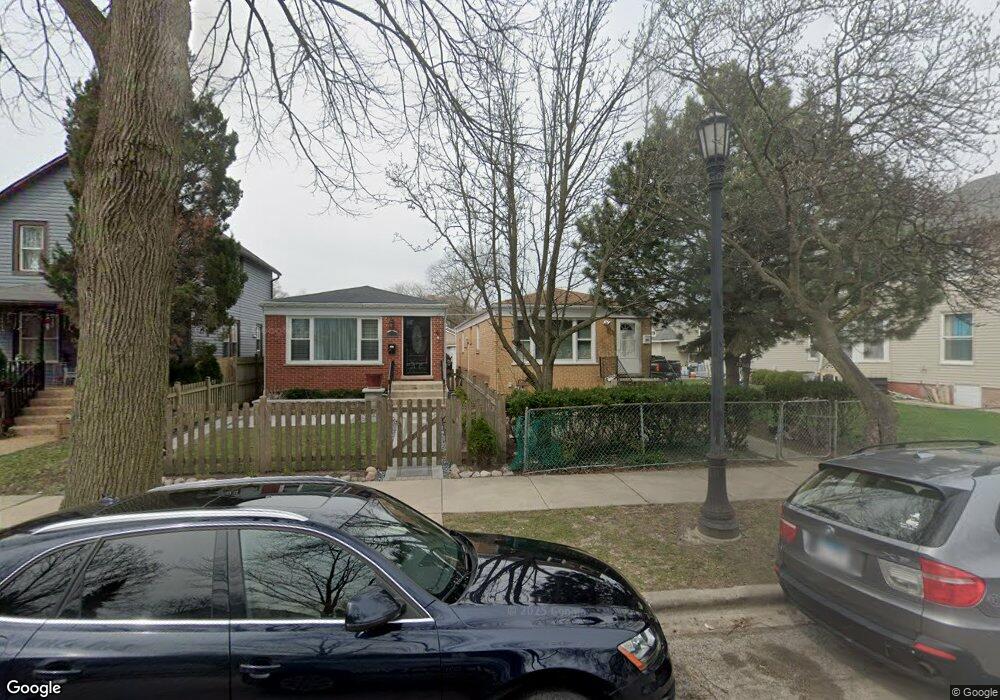
1750 Brown Ave Evanston, IL 60201
West Evanston NeighborhoodEstimated Value: $270,000 - $360,229
2
Beds
1
Bath
1,045
Sq Ft
$303/Sq Ft
Est. Value
About This Home
This home is located at 1750 Brown Ave, Evanston, IL 60201 and is currently estimated at $316,807, approximately $303 per square foot. 1750 Brown Ave is a home located in Cook County with nearby schools including Willard Elementary School, Haven Middle School, and Evanston Township High School.
Ownership History
Date
Name
Owned For
Owner Type
Purchase Details
Closed on
Sep 28, 1998
Sold by
Jean Jacques Louis R and Luzincourt Fernande
Bought by
Gallimore Lobbin Norma Lee
Current Estimated Value
Home Financials for this Owner
Home Financials are based on the most recent Mortgage that was taken out on this home.
Original Mortgage
$95,200
Outstanding Balance
$18,336
Interest Rate
6.62%
Estimated Equity
$298,471
Create a Home Valuation Report for This Property
The Home Valuation Report is an in-depth analysis detailing your home's value as well as a comparison with similar homes in the area
Home Values in the Area
Average Home Value in this Area
Purchase History
| Date | Buyer | Sale Price | Title Company |
|---|---|---|---|
| Gallimore Lobbin Norma Lee | $119,000 | -- |
Source: Public Records
Mortgage History
| Date | Status | Borrower | Loan Amount |
|---|---|---|---|
| Open | Gallimore Lobbin Norma Lee | $95,200 |
Source: Public Records
Tax History
| Year | Tax Paid | Tax Assessment Tax Assessment Total Assessment is a certain percentage of the fair market value that is determined by local assessors to be the total taxable value of land and additions on the property. | Land | Improvement |
|---|---|---|---|---|
| 2025 | $5,568 | $33,000 | $4,350 | $28,650 |
| 2024 | $5,568 | $23,000 | $3,600 | $19,400 |
| 2023 | $5,343 | $23,000 | $3,600 | $19,400 |
| 2022 | $5,343 | $23,000 | $3,600 | $19,400 |
| 2021 | $4,435 | $16,711 | $3,300 | $13,411 |
| 2020 | $4,376 | $16,711 | $3,300 | $13,411 |
| 2019 | $4,390 | $18,735 | $3,300 | $15,435 |
| 2018 | $4,084 | $14,908 | $2,700 | $12,208 |
| 2017 | $3,978 | $14,908 | $2,700 | $12,208 |
| 2016 | $3,773 | $14,908 | $2,700 | $12,208 |
| 2015 | $3,415 | $12,738 | $2,325 | $10,413 |
| 2014 | $3,383 | $12,738 | $2,325 | $10,413 |
| 2013 | $3,305 | $12,738 | $2,325 | $10,413 |
Source: Public Records
Map
Nearby Homes
- 1813 Dodge Ave
- 1811 Hartrey Ave
- 2115 Emerson St
- 1653 Church St
- 2208 Foster St
- 2211 Foster St
- 1460 Dewey Ave
- 1578 Wesley Ave
- 1521 Lake St
- 1735 Asbury Ave
- 1321 Pitner Ave Unit A
- 1834 Ridge Ave Unit 102
- 1228 Emerson St Unit 304
- 2017 Jackson Ave
- 1585 Ridge Ave Unit 506
- 1585 Ridge Ave Unit 509
- 1585 Ridge Ave Unit 404
- 1585 Ridge Ave Unit 608
- 1585 Ridge Ave Unit 611
- 1585 Ridge Ave Unit 301
- 1748 Brown Ave
- 1746 Brown Ave
- 1802 Brown Ave
- 1744 Brown Ave
- 1742 Brown Ave
- 1808 Brown Ave
- 1740 Brown Ave
- 1801 Hovland Ct
- 1749 Brown Ave
- 1803 Hovland Ct
- 1747 Hovland Ct
- 1805 Hovland Ct
- 1738 Brown Ave
- 1745 Hovland Ct
- 1745 Hovland Ct
- 1745 Brown Ave
- 1807 Hovland Ct Unit S
- 1809 Hovland Ct
- 1805 Brown Ave
- 1814 Brown Ave
Your Personal Tour Guide
Ask me questions while you tour the home.