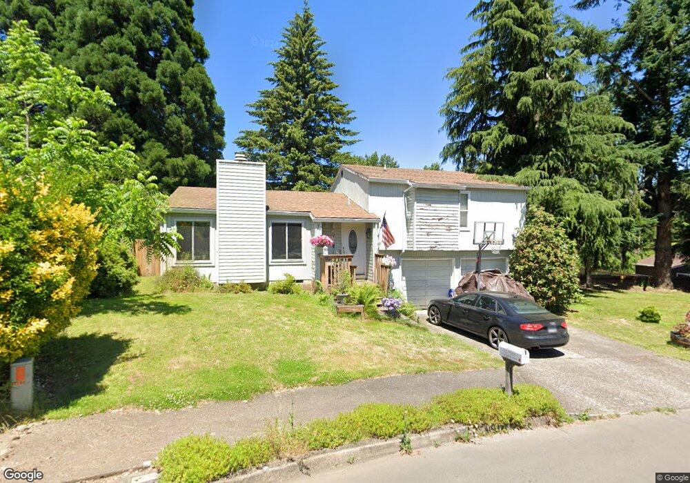
1750 Jamie Cir West Linn, OR 97068
Willamette NeighborhoodEstimated Value: $504,990 - $554,000
3
Beds
2
Baths
1,350
Sq Ft
$387/Sq Ft
Est. Value
About This Home
This home is located at 1750 Jamie Cir, West Linn, OR 97068 and is currently estimated at $522,998, approximately $387 per square foot. 1750 Jamie Cir is a home located in Clackamas County with nearby schools including Willamette Primary School, Athey Creek Middle School, and West Linn High School.
Ownership History
Date
Name
Owned For
Owner Type
Purchase Details
Closed on
Aug 29, 2007
Sold by
Vorobey Olga A and Vorobey Stella F
Bought by
Hopkins David and Hopkins Joanne
Current Estimated Value
Home Financials for this Owner
Home Financials are based on the most recent Mortgage that was taken out on this home.
Original Mortgage
$242,900
Outstanding Balance
$153,713
Interest Rate
6.74%
Mortgage Type
Purchase Money Mortgage
Estimated Equity
$369,285
Purchase Details
Closed on
Feb 19, 2002
Sold by
Allard William E and Allard Robin L
Bought by
Vorobey Olga A and Vorobey Stella F
Home Financials for this Owner
Home Financials are based on the most recent Mortgage that was taken out on this home.
Original Mortgage
$85,000
Interest Rate
7.04%
Create a Home Valuation Report for This Property
The Home Valuation Report is an in-depth analysis detailing your home's value as well as a comparison with similar homes in the area
Home Values in the Area
Average Home Value in this Area
Purchase History
| Date | Buyer | Sale Price | Title Company |
|---|---|---|---|
| Hopkins David | $269,900 | Transnation Title Agency Or | |
| Vorobey Olga A | $149,000 | Transnation Title Insurance |
Source: Public Records
Mortgage History
| Date | Status | Borrower | Loan Amount |
|---|---|---|---|
| Open | Hopkins David | $242,900 | |
| Previous Owner | Vorobey Olga A | $85,000 |
Source: Public Records
Tax History Compared to Growth
Tax History
| Year | Tax Paid | Tax Assessment Tax Assessment Total Assessment is a certain percentage of the fair market value that is determined by local assessors to be the total taxable value of land and additions on the property. | Land | Improvement |
|---|---|---|---|---|
| 2025 | $4,524 | $234,767 | -- | -- |
| 2024 | $4,355 | $227,930 | -- | -- |
| 2023 | $4,355 | $221,292 | $0 | $0 |
| 2022 | $4,111 | $214,847 | $0 | $0 |
| 2021 | $3,902 | $208,590 | $0 | $0 |
| 2020 | $3,929 | $202,515 | $0 | $0 |
| 2019 | $3,746 | $196,617 | $0 | $0 |
| 2018 | $3,579 | $190,890 | $0 | $0 |
| 2017 | $3,440 | $185,330 | $0 | $0 |
| 2016 | $3,351 | $179,932 | $0 | $0 |
| 2015 | $3,167 | $174,691 | $0 | $0 |
| 2014 | $3,019 | $169,603 | $0 | $0 |
Source: Public Records
Map
Nearby Homes
- 1733 Jamie Cir
- 1931 13th St
- 1721 Dollar St Unit 1721
- 975 Springtree Ln
- 850 Springtree Ln Unit 850
- 880 Springtree Ln Unit 880
- 1694 16th St
- 1690 16th St
- 640 Springtree Ln
- 4650 Summerlinn Way
- 3850 Summerlinn Dr Unit 58
- 3565 Summerlinn Dr Unit 64
- 3395 Summerlinn Dr Unit 24
- 1160 Blankenship Rd
- 6505 Summerlinn Way Unit 79
- 3135 Summerlinn Dr Unit 40
- 2077 5th Ave
- 6840 Summerlinn Way Unit 93
- 6735 Summerlinn Way Unit 87
- 1765 Ostman Rd