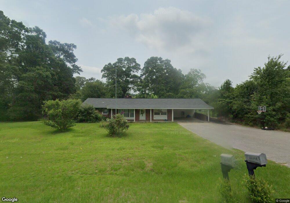
1751 Highway 184 Laurel, MS 39443
Estimated Value: $147,870 - $197,000
3
Beds
2
Baths
1,790
Sq Ft
$94/Sq Ft
Est. Value
About This Home
This home is located at 1751 Highway 184, Laurel, MS 39443 and is currently estimated at $168,718, approximately $94 per square foot. 1751 Highway 184 is a home located in Jones County with nearby schools including St. John's Day School, Immaculate Conception School, and Laurel Christian High School.
Ownership History
Date
Name
Owned For
Owner Type
Purchase Details
Closed on
Sep 5, 2017
Bought by
Sherman Timathy Lee and Sherman Holly
Current Estimated Value
Home Financials for this Owner
Home Financials are based on the most recent Mortgage that was taken out on this home.
Original Mortgage
$103,098
Outstanding Balance
$85,535
Interest Rate
3.75%
Mortgage Type
FHA
Estimated Equity
$83,183
Purchase Details
Closed on
Nov 19, 2012
Sold by
Barry Roy and Russell Betty
Bought by
Boutwell Emily B
Purchase Details
Closed on
Aug 23, 2010
Sold by
Bryant Veronica L
Bought by
Barry Roy and Russell Betty
Create a Home Valuation Report for This Property
The Home Valuation Report is an in-depth analysis detailing your home's value as well as a comparison with similar homes in the area
Home Values in the Area
Average Home Value in this Area
Purchase History
| Date | Buyer | Sale Price | Title Company |
|---|---|---|---|
| Sherman Timathy Lee | $105,000 | -- | |
| Boutwell Emily B | -- | -- | |
| Barry Roy | -- | -- |
Source: Public Records
Mortgage History
| Date | Status | Borrower | Loan Amount |
|---|---|---|---|
| Open | Sherman Timathy Lee | $103,098 |
Source: Public Records
Tax History Compared to Growth
Tax History
| Year | Tax Paid | Tax Assessment Tax Assessment Total Assessment is a certain percentage of the fair market value that is determined by local assessors to be the total taxable value of land and additions on the property. | Land | Improvement |
|---|---|---|---|---|
| 2025 | $664 | $7,753 | $0 | $0 |
| 2024 | $664 | $7,619 | $0 | $0 |
| 2023 | $664 | $7,619 | $0 | $0 |
| 2022 | $686 | $7,621 | $0 | $0 |
| 2021 | $690 | $7,621 | $0 | $0 |
| 2020 | $723 | $7,737 | $0 | $0 |
| 2019 | $730 | $7,760 | $0 | $0 |
| 2018 | $729 | $7,760 | $0 | $0 |
| 2017 | $729 | $7,759 | $0 | $0 |
| 2016 | $632 | $7,102 | $0 | $0 |
| 2015 | $590 | $7,099 | $0 | $0 |
| 2014 | $590 | $7,094 | $0 | $0 |
Source: Public Records
Map
Nearby Homes
- 17 Stone Cut Off Rd
- 17 Eastview Dr
- 217 Victory Rd
- 17 Myrtle Wood Ln
- 0 Wansley-Clark Dirt Pit Rd
- 224 Buckley Rd
- 17.74 Acre Lower Myrick Rd
- 1236 Martin Luther King Ave
- 145 Northeast Dr
- 10 Shadow Ridge Dr
- 703 Cross St
- 17 Shadow Ridge Dr
- 16 Shadow Ridge Dr
- 19 Shadow Ridge Dr
- 30 Shadow Ridge Dr
- 22 Shadow Ridge Dr
- 18 Shadow Ridge Dr
- 744 Front St
- 313 N Pine St
- 73 Pine Dr
- 00 Highway 184
- 0 Highway 184
- 2.25 AC Highway 184
- 1739 Highway 184
- 1746 Highway 184
- 1743 Highway 184
- 1727 Highway 184
- 9 Manning Dr
- 17 Manning Dr
- 1941 Highway 184
- 1718 Highway 84 W
- 49 Stone Cutoff Rd
- 1763 Highway 184
- 19 Manning Dr
- 29 Manning Dr
- 1712 Highway 184
- 31 Manning Dr
- 1750 Highway 184
- 30 Stone Cutoff Rd
- 39 Stone Cutoff Rd