Estimated Value: $568,741 - $731,000
5
Beds
4
Baths
4,161
Sq Ft
$164/Sq Ft
Est. Value
About This Home
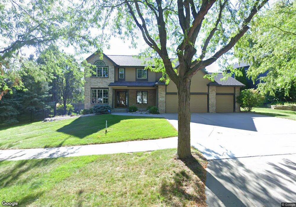
This home is located at 17511 Jones St, Omaha, NE 68118 and is currently estimated at $681,435, approximately $163 per square foot. 17511 Jones St is a home located in Douglas County with nearby schools including Spring Ridge Elementary School, Elkhorn Ridge Middle School, and Elkhorn South High School.
Ownership History
Date
Name
Owned For
Owner Type
Purchase Details
Closed on
Dec 6, 2022
Sold by
Sayyed Samer H and Sayyed Salwa G
Bought by
Samer H Sayyed And Salwa G Sayyed Trust and Sayyed
Current Estimated Value
Purchase Details
Closed on
Mar 8, 2011
Sold by
Boyens Mark A and Boyens Stephanie A
Bought by
Sayyed Samer H
Home Financials for this Owner
Home Financials are based on the most recent Mortgage that was taken out on this home.
Original Mortgage
$297,500
Interest Rate
4.78%
Mortgage Type
New Conventional
Purchase Details
Closed on
Feb 27, 2002
Sold by
Villines Larry D and Villines Opal L
Bought by
Boyens Mark A and Boyens Stephanie A
Home Financials for this Owner
Home Financials are based on the most recent Mortgage that was taken out on this home.
Original Mortgage
$220,800
Interest Rate
7.01%
Mortgage Type
Purchase Money Mortgage
Create a Home Valuation Report for This Property
The Home Valuation Report is an in-depth analysis detailing your home's value as well as a comparison with similar homes in the area
Home Values in the Area
Average Home Value in this Area
Purchase History
| Date | Buyer | Sale Price | Title Company |
|---|---|---|---|
| Samer H Sayyed And Salwa G Sayyed Trust | -- | None Listed On Document | |
| Sayyed Samer H | $350,000 | None Available | |
| Boyens Mark A | $276,000 | -- |
Source: Public Records
Mortgage History
| Date | Status | Borrower | Loan Amount |
|---|---|---|---|
| Previous Owner | Sayyed Samer H | $297,500 | |
| Previous Owner | Boyens Mark A | $220,800 |
Source: Public Records
Tax History
| Year | Tax Paid | Tax Assessment Tax Assessment Total Assessment is a certain percentage of the fair market value that is determined by local assessors to be the total taxable value of land and additions on the property. | Land | Improvement |
|---|---|---|---|---|
| 2025 | $7,818 | $550,700 | $59,500 | $491,200 |
| 2024 | $10,533 | $501,000 | $59,500 | $441,500 |
| 2023 | $10,533 | $501,000 | $59,500 | $441,500 |
| 2022 | $8,703 | $380,600 | $59,500 | $321,100 |
| 2021 | $8,759 | $380,600 | $59,500 | $321,100 |
| 2020 | $8,842 | $380,600 | $59,500 | $321,100 |
| 2019 | $7,371 | $318,300 | $59,500 | $258,800 |
| 2018 | $7,306 | $318,300 | $59,500 | $258,800 |
| 2017 | $7,277 | $321,500 | $59,500 | $262,000 |
| 2016 | $7,040 | $312,800 | $34,200 | $278,600 |
| 2015 | $6,531 | $292,400 | $32,000 | $260,400 |
| 2014 | $6,531 | $292,400 | $32,000 | $260,400 |
Source: Public Records
Map
Nearby Homes
- 1405 S 172nd St
- 17265 Pine St
- 17202 Hickory Plaza
- 613 S 180 Ave
- 17202 Walnut Plaza
- 17102 Harney St
- 18010 Dewey Cir
- 1611 S 168th Ave
- 559 S 182nd St
- 1446 S 167th Ave
- 17511 Marinda Plaza
- 17523 Marinda Plaza
- 16611 Jones St
- 17503 Marinda Plaza
- 17531 Marinda Plaza
- 2221 S 176th Ct
- 1514 S 182nd Cir
- 18301 Dewey Ave
- 16512 Pierce St
- 1274 S 165th Ave
- 17527 Jones St
- 17514 Leavenworth St
- 17506 Leavenworth St
- 17522 Leavenworth St
- 17510 Jones St
- 17535 Jones St
- 17502 Jones St
- 17518 Jones St
- 17530 Leavenworth St
- 809 S 174th St
- 17526 Jones St
- 17749 Mason St
- 17534 Jones St
- 17543 Jones St
- 17538 Leavenworth St
- 817 S 174th St
- 17542 Jones St
- 17602 Leavenworth St
- 17605 Jones St
- 825 S 174th St
Your Personal Tour Guide
Ask me questions while you tour the home.