Estimated Value: $168,000 - $315,000
3
Beds
2
Baths
2,373
Sq Ft
$114/Sq Ft
Est. Value
About This Home
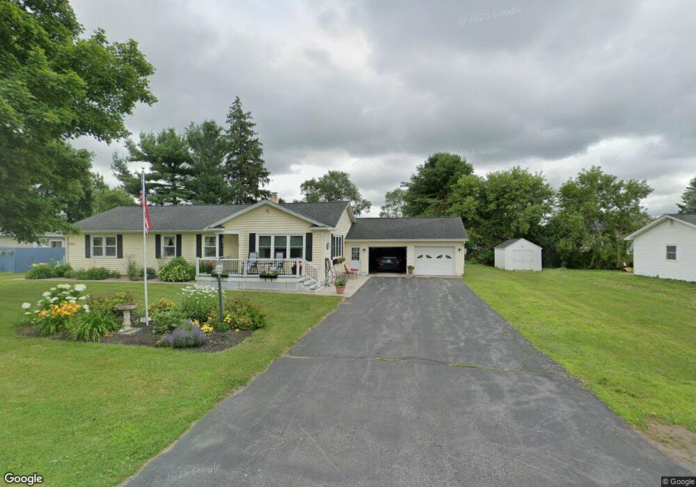
This home is located at 17526 Maxon Ln Unit 28, Adams, NY 13605 and is currently estimated at $269,940, approximately $113 per square foot. 17526 Maxon Ln Unit 28 is a home located in Jefferson County with nearby schools including South Jefferson High School.
Ownership History
Date
Name
Owned For
Owner Type
Purchase Details
Closed on
Sep 25, 2014
Sold by
Nevills Karen C
Bought by
Hamilton Stanton
Current Estimated Value
Home Financials for this Owner
Home Financials are based on the most recent Mortgage that was taken out on this home.
Original Mortgage
$140,000
Outstanding Balance
$103,869
Interest Rate
4.12%
Mortgage Type
Unknown
Estimated Equity
$166,071
Purchase Details
Closed on
Jun 30, 2014
Sold by
Brown Estate Of Dorothy C.
Bought by
Nevills Karen
Create a Home Valuation Report for This Property
The Home Valuation Report is an in-depth analysis detailing your home's value as well as a comparison with similar homes in the area
Home Values in the Area
Average Home Value in this Area
Purchase History
| Date | Buyer | Sale Price | Title Company |
|---|---|---|---|
| Hamilton Stanton | $209,000 | -- | |
| Nevills Karen | -- | Catherine Burns Quencer |
Source: Public Records
Mortgage History
| Date | Status | Borrower | Loan Amount |
|---|---|---|---|
| Open | Hamilton Stanton | $140,000 |
Source: Public Records
Tax History Compared to Growth
Tax History
| Year | Tax Paid | Tax Assessment Tax Assessment Total Assessment is a certain percentage of the fair market value that is determined by local assessors to be the total taxable value of land and additions on the property. | Land | Improvement |
|---|---|---|---|---|
| 2024 | $4,509 | $210,000 | $16,800 | $193,200 |
| 2023 | $4,596 | $210,000 | $16,800 | $193,200 |
| 2022 | $4,611 | $210,000 | $16,800 | $193,200 |
| 2021 | $4,593 | $210,000 | $16,800 | $193,200 |
| 2020 | $4,594 | $210,000 | $16,800 | $193,200 |
| 2019 | -- | $210,000 | $16,800 | $193,200 |
| 2018 | $4,437 | $209,000 | $16,800 | $192,200 |
| 2017 | $4,394 | $209,000 | $16,800 | $192,200 |
| 2016 | $4,353 | $209,000 | $16,800 | $192,200 |
| 2015 | -- | $209,000 | $16,800 | $192,200 |
Source: Public Records
Map
Nearby Homes
- 10384 US Route 11 Unit 386
- 0 N Adams Unit S1306940
- 0 N Adams Unit S1306938
- 0 N Adams Unit S1306936
- 0 N Adams Unit S1306918
- 0 N Adams Unit S1306912
- 0 N Adams Unit S1306904
- 0 N Adams Unit S1571495
- 32 Prospect St
- 37 Wardwell St
- 1 Carol Dr
- 11190 Us Route 11
- 7 Roberts St
- 00 W Us Rt 11 St
- 0 Grange Ave
- 97 E Church St
- 11 Grove St
- 63 Spring St
- 17825 Spook Hill Rd
- 35 Grove St
- 17556 Maxon Ln
- 17502 Maxon Ln
- 17521 Maxon Ln
- 17535 Becky Ln
- 17497 Becky Ln Unit 99
- 17533 Maxon Ln
- 17558 Maxon Ln
- 17497 Maxon Ln
- 17555 Becky Ln
- 17549 Maxon Ln
- 17504 Becky Ln
- 17481 Maxon Ln
- 17538 Becky Ln
- 10604 Us Route 11
- 17576 Maxon Ln
- 17575 Becky Ln
- 17485 Becky Ln
- 17577 Maxon Ln
- 17578 Becky Ln
- 10480 Us Route 11