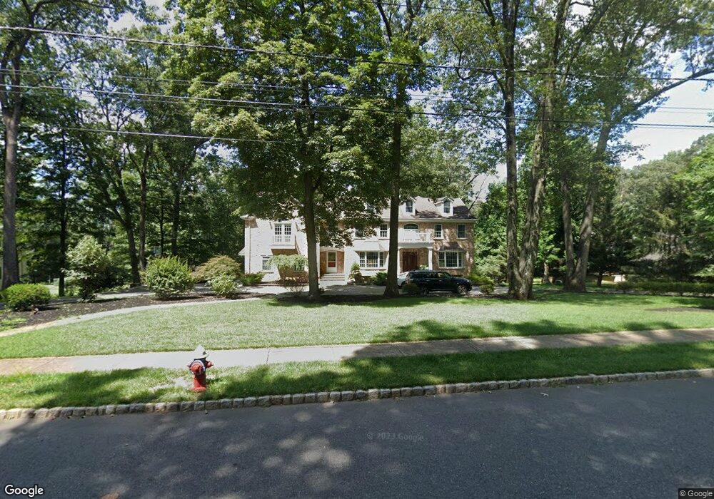
1753 Merriam Dr Martinsville, NJ 08836
Estimated Value: $1,070,451 - $1,354,000
--
Bed
--
Bath
4,011
Sq Ft
$295/Sq Ft
Est. Value
About This Home
This home is located at 1753 Merriam Dr, Martinsville, NJ 08836 and is currently estimated at $1,181,863, approximately $294 per square foot. 1753 Merriam Dr is a home located in Somerset County with nearby schools including Crim Primary School, Bridgewater-Raritan Middle School, and Hillside Intermediate School.
Ownership History
Date
Name
Owned For
Owner Type
Purchase Details
Closed on
Dec 4, 2020
Sold by
Chambon Robert
Bought by
The Merriam Drive Living Trust
Current Estimated Value
Purchase Details
Closed on
Jan 27, 2014
Sold by
Chambon Robert and Chambon Michon
Bought by
Chambon Robert
Home Financials for this Owner
Home Financials are based on the most recent Mortgage that was taken out on this home.
Original Mortgage
$417,000
Interest Rate
3.87%
Mortgage Type
Adjustable Rate Mortgage/ARM
Purchase Details
Closed on
Apr 27, 2001
Sold by
Cohen Emerson
Bought by
Chambon Robert and Chambon Michon
Home Financials for this Owner
Home Financials are based on the most recent Mortgage that was taken out on this home.
Original Mortgage
$240,000
Interest Rate
6.85%
Create a Home Valuation Report for This Property
The Home Valuation Report is an in-depth analysis detailing your home's value as well as a comparison with similar homes in the area
Home Values in the Area
Average Home Value in this Area
Purchase History
| Date | Buyer | Sale Price | Title Company |
|---|---|---|---|
| The Merriam Drive Living Trust | -- | None Listed On Document | |
| Chambon Robert | $56,000 | Guardian Title Services Llc | |
| Chambon Robert | $447,500 | -- |
Source: Public Records
Mortgage History
| Date | Status | Borrower | Loan Amount |
|---|---|---|---|
| Previous Owner | Chambon Robert | $417,000 | |
| Previous Owner | Chambon Robert | $240,000 |
Source: Public Records
Tax History Compared to Growth
Tax History
| Year | Tax Paid | Tax Assessment Tax Assessment Total Assessment is a certain percentage of the fair market value that is determined by local assessors to be the total taxable value of land and additions on the property. | Land | Improvement |
|---|---|---|---|---|
| 2025 | $16,977 | $884,300 | $330,700 | $553,600 |
| 2024 | $16,977 | $871,500 | $330,700 | $540,800 |
| 2023 | $16,299 | $821,500 | $330,700 | $490,800 |
| 2022 | $15,550 | $754,100 | $330,700 | $423,400 |
| 2021 | $15,057 | $714,600 | $330,700 | $383,900 |
| 2020 | $14,919 | $709,400 | $330,700 | $378,700 |
| 2019 | $14,895 | $701,600 | $330,700 | $370,900 |
| 2018 | $14,695 | $693,800 | $330,700 | $363,100 |
| 2017 | $14,598 | $688,600 | $330,700 | $357,900 |
| 2016 | $14,351 | $687,300 | $330,700 | $356,600 |
| 2015 | $13,960 | $668,900 | $330,700 | $338,200 |
| 2014 | $13,379 | $631,400 | $330,700 | $300,700 |
Source: Public Records
Map
Nearby Homes
- 552 Stangle Rd
- 1820 Woodland Terrace
- 1740 Middlebrook Rd
- 1891 Middlebrook Rd
- 5 Bittle Ct
- 1024 Mayflower Ct
- 745 Schoolhouse Ln
- 3 Brookside Dr
- 807 Watchung Rd
- 17 Conklin Ln
- 5 Brookside Dr
- 180 Farm Ln
- 143 Vosseller Ave
- 7 Brookside Dr
- 9 Brookside Dr
- 811 Mountain Ave
- 2138 Washington Valley Rd
- 650 Central Ave
- 617 Vosseller Ave
- 606 Vosseller Ave
- 1759 Merriam Dr
- 1747 Merriam Dr
- 1758 Merriam Dr
- 1741 Merriam Dr
- 1752 Merriam Dr
- 1809 Woodfield Rd
- 1744 Merriam Dr
- 1819 Woodfield Rd
- 1797 Woodfield Rd
- 1735 Merriam Dr
- 1738 Merriam Dr
- 1812 Woodfield Rd
- 1789 Woodfield Rd
- 1729 Merriam Dr
- 1732 Merriam Dr
- 1818 Woodfield Rd
- 1806 Woodfield Rd
- 1824 Woodfield Rd
- 1827 Woodfield Rd
- 798 Vosseller Ave