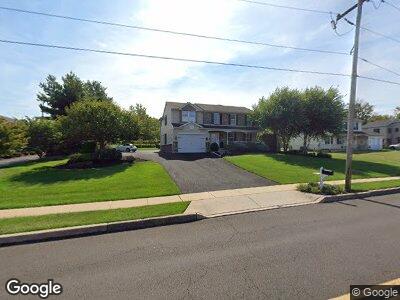
1753 Walnut St Lansdale, PA 19446
Hatfield NeighborhoodEstimated Value: $752,225 - $938,000
4
Beds
2
Baths
4,433
Sq Ft
$190/Sq Ft
Est. Value
About This Home
This home is located at 1753 Walnut St, Lansdale, PA 19446 and is currently estimated at $843,806, approximately $190 per square foot. 1753 Walnut St is a home located in Montgomery County with nearby schools including Oak Park El School, Penndale Middle School, and North Penn Senior High School.
Ownership History
Date
Name
Owned For
Owner Type
Purchase Details
Closed on
May 22, 1998
Sold by
Moscariello Salvatore
Bought by
Moscariello Salvatore and Moscariello Kimberly
Current Estimated Value
Create a Home Valuation Report for This Property
The Home Valuation Report is an in-depth analysis detailing your home's value as well as a comparison with similar homes in the area
Home Values in the Area
Average Home Value in this Area
Purchase History
| Date | Buyer | Sale Price | Title Company |
|---|---|---|---|
| Moscariello Salvatore | -- | -- |
Source: Public Records
Mortgage History
| Date | Status | Borrower | Loan Amount |
|---|---|---|---|
| Closed | Moscariello Salvatore | $417,000 | |
| Closed | Moscariello Kimberly | $351,500 | |
| Closed | Moscariello Salvatore A | $200,000 | |
| Closed | Moscariello Salvatore | $245,000 |
Source: Public Records
Tax History Compared to Growth
Tax History
| Year | Tax Paid | Tax Assessment Tax Assessment Total Assessment is a certain percentage of the fair market value that is determined by local assessors to be the total taxable value of land and additions on the property. | Land | Improvement |
|---|---|---|---|---|
| 2024 | $10,217 | $255,200 | $51,780 | $203,420 |
| 2023 | $9,779 | $255,200 | $51,780 | $203,420 |
| 2022 | $9,460 | $255,200 | $51,780 | $203,420 |
| 2021 | $9,192 | $255,200 | $51,780 | $203,420 |
| 2020 | $8,974 | $255,200 | $51,780 | $203,420 |
| 2019 | $8,825 | $255,200 | $51,780 | $203,420 |
| 2018 | $8,825 | $255,200 | $51,780 | $203,420 |
| 2017 | $8,488 | $255,200 | $51,780 | $203,420 |
| 2016 | $8,388 | $255,200 | $51,780 | $203,420 |
| 2015 | $8,052 | $255,200 | $51,780 | $203,420 |
| 2014 | $8,052 | $255,200 | $51,780 | $203,420 |
Source: Public Records
Map
Nearby Homes
- 1039 Chapman Cir
- 1008 Chapman Cir
- 9 Fortuna Dr
- 8 Fortuna Dr
- 422 Sadie Ave
- 1713 N Line St
- 1612 Moyer Rd
- 1605 N Line St
- 103 Dusty Ln
- 402 Cowpath Rd
- 732 Cowpath Rd
- 2604 W Walnut St
- 0002 Sydney Ln
- 1405 Taylor Rd
- 111 Country Ln
- 1350 Industry Rd
- 876 Andover Rd
- 19 W 9th St
- 2658 Anthony Dr
- 583 Bethlehem Pike
- 1753 Walnut St
- 1749 Walnut St
- 1745 Walnut St
- 1741 Walnut St
- 1744 Walnut St
- 1049 Chapman Cir
- 1051 Chapman Cir Unit 44
- 1053 Chapman Cir
- 1055 Chapman Cir
- 1057 Chapman Cir Unit 47
- 1057 Chapman Cir
- 1059 Chapman Cir
- 0 Walnut St
- 1061 Chapman Cir
- 1063 Chapman Cir
- 1065 Chapman Cir Unit 51
- 1737 Walnut St
- 1067 Chapman Cir Unit 52
- 1736 Walnut St
- 1047 Chapman Cir