Estimated Value: $170,000 - $675,000
4
Beds
1
Bath
1,424
Sq Ft
$291/Sq Ft
Est. Value
About This Home
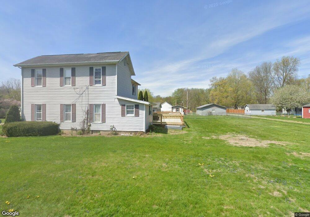
This home is located at 17530 Main Rd, Heath, OH 43056 and is currently estimated at $414,618, approximately $291 per square foot. 17530 Main Rd is a home located in Muskingum County with nearby schools including West Muskingum High School.
Ownership History
Date
Name
Owned For
Owner Type
Purchase Details
Closed on
Aug 27, 1998
Sold by
Hecker Steven L
Bought by
Pitcock Catherine S
Current Estimated Value
Home Financials for this Owner
Home Financials are based on the most recent Mortgage that was taken out on this home.
Original Mortgage
$108,000
Outstanding Balance
$23,331
Interest Rate
7.03%
Mortgage Type
New Conventional
Estimated Equity
$391,287
Purchase Details
Closed on
Apr 27, 1992
Bought by
Hecker Steven L
Create a Home Valuation Report for This Property
The Home Valuation Report is an in-depth analysis detailing your home's value as well as a comparison with similar homes in the area
Purchase History
| Date | Buyer | Sale Price | Title Company |
|---|---|---|---|
| Pitcock Catherine S | $76,900 | -- | |
| Hecker Steven L | -- | -- |
Source: Public Records
Mortgage History
| Date | Status | Borrower | Loan Amount |
|---|---|---|---|
| Open | Pitcock Catherine S | $108,000 |
Source: Public Records
Tax History
| Year | Tax Paid | Tax Assessment Tax Assessment Total Assessment is a certain percentage of the fair market value that is determined by local assessors to be the total taxable value of land and additions on the property. | Land | Improvement |
|---|---|---|---|---|
| 2025 | $3,823 | $54,145 | $6,475 | $47,670 |
| 2024 | $2,080 | $54,145 | $6,475 | $47,670 |
| 2023 | $1,671 | $40,425 | $4,760 | $35,665 |
| 2022 | $1,651 | $40,425 | $4,760 | $35,665 |
| 2021 | $1,634 | $40,425 | $4,760 | $35,665 |
| 2020 | $1,396 | $33,670 | $3,955 | $29,715 |
| 2019 | $1,400 | $33,670 | $3,955 | $29,715 |
| 2018 | $1,338 | $33,670 | $3,955 | $29,715 |
| 2017 | $1,178 | $28,700 | $3,955 | $24,745 |
| 2016 | $1,191 | $28,710 | $3,960 | $24,750 |
| 2015 | $1,224 | $28,710 | $3,960 | $24,750 |
| 2013 | $1,165 | $28,710 | $3,960 | $24,750 |
Source: Public Records
Map
Nearby Homes
- 374 Center St
- 15487 Main Rd SE
- 16726 National Rd SE
- 9898 Poplar Forks Rd SE
- 9273 Mulberry Rd
- 11039 Rankin Rd
- 11631 Rankin Rd
- 0 Mulberry Rd
- 11100 Straker Ln
- 1325 County Line Rd
- 9795 West Pike
- 14687 National Rd SE
- 14687 National Rd
- 14686 National Rd SE
- 16487 Flint Ridge Rd SE
- 16487 Flint Ridge Rd Unit (Lot L Woods Flint R
- 745 N Hopewell Rd
- 0 Mulberry St NE Unit (Lot N Woods Flint R
- 725 Trapp Ln
- 6251 Gratiot Rd SE
- 15861 Main St
- 0 Mt Perry Rd Unit 8904862
- 0 Mt Perry Rd Unit 9926082
- 17533 National Rd SE
- 12335 West Pike
- 12315 W Pike Rd
- 680 Main St
- 653 Main St
- 680 Main St
- 12305 West Pike
- 17519 Main Rd
- 145 Mount Perry Rd
- 348 West Ave
- 650 Main St
- 611 Main St
- 685 Main St
- 653 Main St
- 624 Main St
- 10028 Poplar Forks Rd SE
- 595 Main St
Your Personal Tour Guide
Ask me questions while you tour the home.