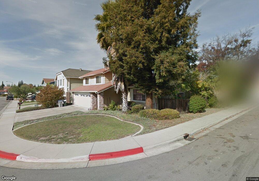
1754 Olivetree Dr San Jose, CA 95131
Brooktree NeighborhoodEstimated Value: $1,562,000 - $2,121,000
4
Beds
3
Baths
2,400
Sq Ft
$811/Sq Ft
Est. Value
About This Home
This home is located at 1754 Olivetree Dr, San Jose, CA 95131 and is currently estimated at $1,945,504, approximately $810 per square foot. 1754 Olivetree Dr is a home located in Santa Clara County with nearby schools including Brooktree Elementary School, Morrill Middle School, and Independence High School.
Ownership History
Date
Name
Owned For
Owner Type
Purchase Details
Closed on
Oct 19, 2016
Sold by
Yuan Jason Lung Ting
Bought by
Yuan Jason Lung Ting
Current Estimated Value
Purchase Details
Closed on
Sep 4, 1993
Sold by
Mcnellis John C and Mcnellis Therese E
Bought by
Yuan Jason Lung Ting
Home Financials for this Owner
Home Financials are based on the most recent Mortgage that was taken out on this home.
Original Mortgage
$237,600
Interest Rate
6.94%
Create a Home Valuation Report for This Property
The Home Valuation Report is an in-depth analysis detailing your home's value as well as a comparison with similar homes in the area
Home Values in the Area
Average Home Value in this Area
Purchase History
| Date | Buyer | Sale Price | Title Company |
|---|---|---|---|
| Yuan Jason Lung Ting | -- | None Available | |
| Yuan Jason Lung Ting | $297,000 | Old Republic Title Company |
Source: Public Records
Mortgage History
| Date | Status | Borrower | Loan Amount |
|---|---|---|---|
| Closed | Yuan Jason Lung Ting | $237,600 |
Source: Public Records
Tax History
| Year | Tax Paid | Tax Assessment Tax Assessment Total Assessment is a certain percentage of the fair market value that is determined by local assessors to be the total taxable value of land and additions on the property. | Land | Improvement |
|---|---|---|---|---|
| 2025 | $7,802 | $504,781 | $220,948 | $283,833 |
| 2024 | $7,802 | $494,884 | $216,616 | $278,268 |
| 2023 | $7,646 | $485,181 | $212,369 | $272,812 |
| 2022 | $7,611 | $475,668 | $208,205 | $267,463 |
| 2021 | $7,351 | $466,342 | $204,123 | $262,219 |
| 2020 | $7,113 | $461,561 | $202,030 | $259,531 |
| 2019 | $6,841 | $452,512 | $198,069 | $254,443 |
| 2018 | $6,738 | $443,640 | $194,186 | $249,454 |
| 2017 | $6,768 | $434,942 | $190,379 | $244,563 |
| 2016 | $6,398 | $426,415 | $186,647 | $239,768 |
| 2015 | $6,319 | $420,011 | $183,844 | $236,167 |
| 2014 | $5,705 | $411,784 | $180,243 | $231,541 |
Source: Public Records
Map
Nearby Homes
- 1976 Tradan Dr Unit 65
- 2280 Zoria Cir
- 2501 Jubilee Ln
- 2559 Alveswood Cir
- 2174 Beech Cir Unit 1102
- 2158 Capitol Park Ct
- 2088 Mckenzie Place
- 1437 Marcello Dr
- 1788 Camino Leonor
- Leona Plan at Parkside West
- Evie Plan at Parkside West
- Kenai Plan at Parkside West
- Asra Plan at Parkside West
- Odin Plan at Parkside West
- Della Plan at Parkside West
- 2059 Joshua Tree Cir
- 2415 Stearman Ct Unit 7
- 1825 Passage St
- 1357 Old Rose Place
- 1823 Passage St
- 1760 Olivetree Dr
- 1748 Olivetree Dr
- 1766 Olivetree Dr
- 2344 Hamlet Ct
- 1774 Olivetree Dr
- 1742 Olivetree Dr
- 2352 Hamlet Ct
- 2357 Hamlet Ct
- 2358 Hamlet Ct
- 1763 Ridgetree Way
- 1781 Rocktree Ct
- 1778 Olivetree Dr
- 2345 Shade Tree Ln
- 1736 Olivetree Dr
- 1785 Rocktree Ct
- 2349 Shade Tree Ln
- 1780 Rocktree Ct
- 1784 Olivetree Dr
- 1747 Ridgetree Way
- 1741 Ridgetree Way
Your Personal Tour Guide
Ask me questions while you tour the home.