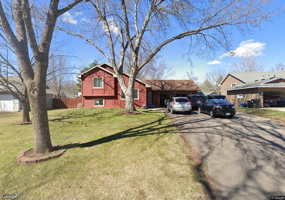
1755 131st Ln NW Coon Rapids, MN 55448
Estimated Value: $385,308 - $409,000
4
Beds
2
Baths
1,214
Sq Ft
$325/Sq Ft
Est. Value
About This Home
This home is located at 1755 131st Ln NW, Coon Rapids, MN 55448 and is currently estimated at $394,577, approximately $325 per square foot. 1755 131st Ln NW is a home located in Anoka County with nearby schools including Morris Bye Elementary School, Coon Rapids Middle School, and Coon Rapids Senior High School.
Create a Home Valuation Report for This Property
The Home Valuation Report is an in-depth analysis detailing your home's value as well as a comparison with similar homes in the area
Home Values in the Area
Average Home Value in this Area
Tax History Compared to Growth
Tax History
| Year | Tax Paid | Tax Assessment Tax Assessment Total Assessment is a certain percentage of the fair market value that is determined by local assessors to be the total taxable value of land and additions on the property. | Land | Improvement |
|---|---|---|---|---|
| 2025 | $3,560 | $344,700 | $90,000 | $254,700 |
| 2024 | $3,560 | $340,700 | $87,000 | $253,700 |
| 2023 | $3,352 | $331,000 | $72,000 | $259,000 |
| 2022 | $2,977 | $342,400 | $72,000 | $270,400 |
| 2021 | $2,930 | $273,800 | $56,000 | $217,800 |
| 2020 | $2,910 | $263,800 | $56,000 | $207,800 |
| 2019 | $2,774 | $252,000 | $56,000 | $196,000 |
| 2018 | $2,628 | $234,500 | $0 | $0 |
| 2017 | $2,242 | $217,000 | $0 | $0 |
| 2016 | $2,298 | $186,200 | $0 | $0 |
| 2015 | $2,241 | $186,200 | $50,000 | $136,200 |
| 2014 | -- | $155,100 | $35,400 | $119,700 |
Source: Public Records
Map
Nearby Homes
- 1687 131st Ln NW
- 1776 133rd Ave NW
- 1520 129th Ave NW
- 1930 127th Cir NW
- 12796 Bluebird St NW
- 12554 Grouse St NW
- 1593 126th Ln NW
- 13519 Partridge Cir NW
- 13416 Swallow St NW
- 1450 126th Ln NW
- 12760 Raven St NW
- 1234 128th Cir NW
- 2147 125th Ln NW
- 12365 Jay St NW
- 1625 124th Ave NW
- 12463 Drake St NW
- 2068 124th Ln NW
- 2270 137th Ln NW
- 13182 Zion St NW
- 2201 139th Ave NW
- 1745 131st Ln NW
- 1752 132nd Ave NW
- 1735 131st Ln NW
- 1775 131st Ln NW
- 1762 132nd Ave NW
- 1742 132nd Ave NW
- 1750 131st Ln NW
- 1740 131st Ln NW
- 1760 131st Ln NW
- 1772 132nd Ave NW
- 1732 132nd Ave NW
- 1770 131st Ln NW
- 1785 131st Ln NW
- 13144 Ibis St NW
- 1782 132nd Ave NW
- 1780 131st Ln NW
- 1747 132nd Ave NW
- 1757 132nd Ave NW
- 1731 131st Ave NW
- 1719 131st Ln NW