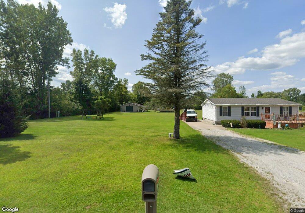
1755 Omar Rd Kimball, MI 48074
Estimated Value: $187,000 - $268,000
2
Beds
2
Baths
1,692
Sq Ft
$139/Sq Ft
Est. Value
About This Home
This home is located at 1755 Omar Rd, Kimball, MI 48074 and is currently estimated at $235,363, approximately $139 per square foot. 1755 Omar Rd is a home located in St. Clair County with nearby schools including Kimball Elementary School, Central Middle School, and Port Huron High School.
Create a Home Valuation Report for This Property
The Home Valuation Report is an in-depth analysis detailing your home's value as well as a comparison with similar homes in the area
Home Values in the Area
Average Home Value in this Area
Tax History Compared to Growth
Tax History
| Year | Tax Paid | Tax Assessment Tax Assessment Total Assessment is a certain percentage of the fair market value that is determined by local assessors to be the total taxable value of land and additions on the property. | Land | Improvement |
|---|---|---|---|---|
| 2025 | $2,117 | $130,600 | $0 | $0 |
| 2024 | $1,140 | $121,600 | $0 | $0 |
| 2023 | $1,044 | $117,700 | $0 | $0 |
| 2022 | $1,782 | $96,300 | $0 | $0 |
| 2021 | $1,660 | $91,500 | $0 | $0 |
| 2020 | $1,660 | $85,600 | $85,600 | $0 |
| 2019 | $1,634 | $71,800 | $0 | $0 |
| 2018 | $1,560 | $63,900 | $0 | $0 |
| 2017 | $1,530 | $70,500 | $0 | $0 |
| 2016 | $798 | $70,500 | $0 | $0 |
| 2015 | -- | $69,100 | $69,100 | $0 |
| 2014 | -- | $67,900 | $67,900 | $0 |
| 2013 | -- | $62,900 | $0 | $0 |
Source: Public Records
Map
Nearby Homes
- V/L Allen
- 1701 Allen Rd
- 1830 Leland Rd
- 1604 Allen Rd
- 1979 Allen Rd
- 4632 Cloverdale Ln
- 4595 Griswold Rd
- 1405 Range Rd
- 00 Range Rd
- 00 Howard Rd
- 0000 Range Rd
- 0 Allen Rd Unit 20250008597
- 0 Allen Rd Unit 20250008612
- 5510 Griswold Rd
- 1091 Allen Rd
- 1876 Morningstar Ave
- 0 Wall Rd Unit 50185999
- 0 Ravenswood Rd Unit 20251017048
- 0000 Ravenswood Rd
- 0 Lapeer Rd Unit 50137357