1756 Cherokee Meadows Rd Livermore, CO 80536
Estimated Value: $836,000 - $963,000
4
Beds
3
Baths
2,288
Sq Ft
$392/Sq Ft
Est. Value
About This Home
This home is located at 1756 Cherokee Meadows Rd, Livermore, CO 80536 and is currently estimated at $897,440, approximately $392 per square foot. 1756 Cherokee Meadows Rd is a home located in Larimer County with nearby schools including Livermore Elementary School, Cache La Poudre Middle School, and Poudre High School.
Ownership History
Date
Name
Owned For
Owner Type
Purchase Details
Closed on
Jul 6, 2004
Sold by
Barnhart Harold M and Barnhart Mary E
Bought by
Desbien Vernon L and Desbien Marcia A
Current Estimated Value
Purchase Details
Closed on
May 1, 1994
Sold by
Beardsley Linda J
Bought by
Barnhart Mary E
Create a Home Valuation Report for This Property
The Home Valuation Report is an in-depth analysis detailing your home's value as well as a comparison with similar homes in the area
Home Values in the Area
Average Home Value in this Area
Purchase History
| Date | Buyer | Sale Price | Title Company |
|---|---|---|---|
| Desbien Vernon L | $150,000 | Chicago Title Co | |
| Barnhart Mary E | $39,500 | -- |
Source: Public Records
Mortgage History
| Date | Status | Borrower | Loan Amount |
|---|---|---|---|
| Open | Desbien Vernon L | $75,000 | |
| Open | Desbien Vernon L | $350,000 | |
| Closed | Desbien Vernon L | $611,000 |
Source: Public Records
Tax History Compared to Growth
Tax History
| Year | Tax Paid | Tax Assessment Tax Assessment Total Assessment is a certain percentage of the fair market value that is determined by local assessors to be the total taxable value of land and additions on the property. | Land | Improvement |
|---|---|---|---|---|
| 2025 | $4,280 | $54,505 | $7,129 | $47,376 |
| 2024 | $4,075 | $54,505 | $7,129 | $47,376 |
| 2022 | $3,373 | $42,276 | $3,731 | $38,545 |
| 2021 | $3,212 | $43,510 | $3,856 | $39,654 |
| 2020 | $2,743 | $37,915 | $628 | $37,287 |
| 2019 | $2,755 | $37,915 | $628 | $37,287 |
| 2018 | $2,834 | $39,875 | $273 | $39,602 |
| 2017 | $2,823 | $39,875 | $273 | $39,602 |
| 2016 | $1,800 | $28,680 | $255 | $28,425 |
| 2015 | $2,475 | $28,690 | $260 | $28,430 |
| 2014 | $1,930 | $22,230 | $230 | $22,000 |
Source: Public Records
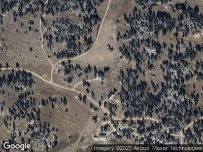
Map
Nearby Homes
- 950 Meadow Creek Rd
- 801 W County Road 82e
- 0 County Road 82 E
- 0 Tbd County Rd 82 E
- 14 Calliope Ln
- 0 White Eagle Way
- 0 Tbd Unit 11195158
- 6215 Mill Creek Rd
- 0 N Highway 287 Unit RECIR1001170
- 120 Joy Rd
- 0 Shoshana Ranch Rd
- 142 Springmeadow Way
- 91 Eagle Rising Place
- 16420 W County Road 74e
- 241 Deadhorse Mountain Ct
- 119 Turtle Rock Ct
- 1001 Iron Mountain Dr
- 181 Deadhorse Mountain Ct
- 17931 W County Road 74e
- 837 Mount Champion Dr
- 1756 Cherokee Meadows Rd
- 1900 County Road 82e
- 1549 Cherokee Meadows Rd
- 2007 Cherokee Meadows Rd
- 585 Rocky Meadow Way
- 1818 Cherokee Meadows Rd
- 1806 Cherokee Meadows Rd
- 0 Rocky Meadow Way Unit 764175
- 508 Haystack Gulch Way
- 10307 W County Road 80c
- 2318 Cherokee Meadows Rd
- 10511 W County Road 80c
- 0 Gun Slinger Rd Unit 740902
- 2628 Cherokee Meadows Rd
- 748 Cherokee Meadows Rd
- 10301 W County Road 80c
- 118 Running Deer Rd
- 2440 W County Road 82e
- 2750 Cherokee Meadows Rd
- 9425 W County Road 80c